- Korsholm
-
Korsholm
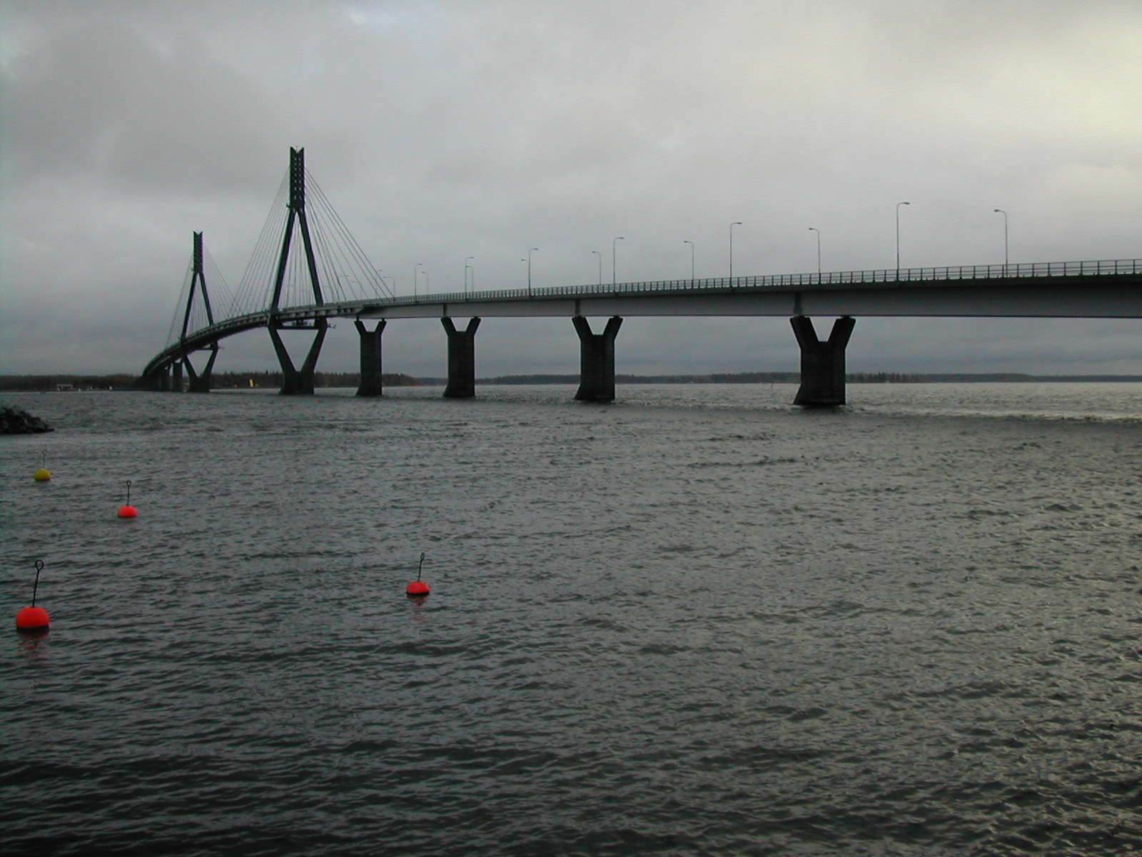
Korsholm – Mustasaari— Municipality — Korsholms kommun – Mustasaaren kunta The Replot Bridge on a grey autumn day
Coat of armsLocation of Korsholm in Finland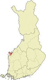
Coordinates: 63°06′45″N 021°40′40″E / 63.1125°N 21.67778°ECoordinates: 63°06′45″N 021°40′40″E / 63.1125°N 21.67778°E Country Finland Region Ostrobothnia Sub-region Vaasa sub-region Charter 1348 Government - Municipal manager Rurik Ahlberg Area(2011-01-01)[1] - Total 3,178.63 km2 (1,227.3 sq mi) - Land 848.14 km2 (327.5 sq mi) - Water 2,330.49 km2 (899.8 sq mi) Area rank 18th largest in Finland Population (2011-01-31)[2] - Total 18,680 - Rank 61st largest in Finland - Density 22.02/km2 (57/sq mi) Population by native language[3] - Swedish 70.2% (official) - Finnish 28.7% (official) - Others 1% Population by age[4] - 0 to 14 19.4% - 15 to 64 63.9% - 65 or older 16.7% Time zone EET (UTC+2) - Summer (DST) EEST (UTC+3) Municipal tax rate[5] 19.75% Website www.korsholm.fi Korsholm (Finnish: Mustasaari) is a municipality of Finland. The town of Vaasa was founded in Korsholm parish in 1606 and today the municipality completely surrounds the city. It is a coastal, mostly rural municipality, consisting of a rural landscape and a large, fractured archipelago. The administrative center is Smedsby (Finnish: Sepänkylä), situated 3 km from Vaasa center along Finnish national road 8.
It is located in the province of Western Finland and is part of the Ostrobothnia region. The municipality has a population of 18,680 (31 January 2011)[2] and covers an area of 3,178.63 square kilometres (1,227.28 sq mi) of which 2,330.49 km2 (899.81 sq mi) is water.[1] The population density is 22.02 inhabitants per square kilometre (57.0 /sq mi). The municipality consists of the central areas, the southern plain, and the extensive archipelago. Parts of the archipelago belong to the UNESCO World Heritage Site of Kvarken (Finnish: Merenkurkku). One of Korsholm's more notable landmarks is that it holds Finland's longest bridge, the Replot Bridge (Finnish: Raippaluodon silta). The bridge connects the island of Replot (Finnish: Raippaluoto) to the mainland. Finland's second oldest stone bridge that is still in use, can also be found in Korsholm, in the village of Toby (Finnish: Tuovila).
The municipality is bilingual, with a majority (70%) being Swedish and a minority (29%) Finnish speakers.[3] The Finnish speakers are concentrated near the enclosed city Vaasa, particularly in Smedsby (Finnish: Sepänkylä), and in the villages of Toby ((Finnish: Tuovila)) and Kvevlax (Finnish: Koivulahti) in the southern plain, while the rest of the municipality is Swedish-speaking.
Korsholm has a history that can be dated back to 1348. In that year Korsholm was mentioned for the first time in writing in a royal letter concerning freedom of commerce. Therefore the municipality celebrated its 650th anniversary in 1998. In the mid 14th century Saint Mary's Church was built in Korsholm island. The municipality got its Swedish name in the year 1927 from the Korsholm Castle (Chrysseborg) from which the whole of Ostrobothnia was governed for hundreds of years. The ruins of Saint Mary's Church and Korsholm Castle are now in the old town of Vaasa (Finnish: Vanha Vaasa; Swedish: Gamla Vasa). The Swedish name Korsholm has the literal meaning "Cross Island", while the Finnish name Mustasaari is different, meaning "Black Island". The area is no longer an island because of rising of the land, the names being relics of the medieval geography.
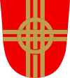
Today's Korsholm municipality consists of five smaller municipalities that were merged in 1973: Korsholm in the center, Replot ((Finnish: Raippaluoto)) and Björköby in the far archipelago, Solf (Finnish: Sulva) in the southern plain and Kvevlax (Finnish: Koivulahti) in the eastern plain. To reflect the new, larger municipality the motif in the Korsholm coat of arms is five intertwined golden threads on a red background.
References
- ^ a b "Area by municipality as of 1 January 2011" (in Finnish and Swedish) (PDF). Land Survey of Finland. http://www.maanmittauslaitos.fi/sites/default/files/pinta-alat_2011_kunnannimenmukaan.xls. Retrieved 9 March 2011.
- ^ a b "Population by municipality as of 31 January 2011" (in Finnish and Swedish). Population Information System. Population Register Center of Finland. http://vrk.fi/default.aspx?docid=4258&site=3&id=0. Retrieved 18 February 2011.
- ^ a b "Population according to language and the number of foreigners and land area km2 by area as of 31 December 2008". Statistics Finland's PX-Web databases. Statistics Finland. http://pxweb2.stat.fi/Dialog/varval.asp?ma=060_vaerak_tau_107_fi&ti=V%E4est%F6+kielen+mukaan+sek%E4+ulkomaan+kansalaisten+m%E4%E4r%E4+ja+maa%2Dpinta%2Dala+alueittain++1980+%2D+2008&path=../Database/StatFin/vrm/vaerak/&lang=3&multilang=fi. Retrieved 29 March 2009.
- ^ "Population according to age and gender by area as of 31 December 2008". Statistics Finland's PX-Web databases. Statistics Finland. http://pxweb2.stat.fi/Dialog/varval.asp?ma=050_vaerak_tau_104_fi&ti=V%E4est%F6+i%E4n+%281%2Dv%2E%29+ja+sukupuolen+mukaan+alueittain+1980+%2D+2008&path=../Database/StatFin/vrm/vaerak/&lang=3&multilang=fi. Retrieved 28 April 2009.
- ^ "List of municipal and parish tax rates in 2011". Tax Administration of Finland. 29 November 2010. http://www.vero.fi/nc/doc/download.asp?id=7996;193801. Retrieved 13 March 2011.
External links
 Media related to Korsholm at Wikimedia Commons
Municipalities of Ostrobothnia Municipalities 
Former municipalities Ostrobothnia · Finland Categories:- Korsholm
- Municipalities of Ostrobothnia Region
- Populated places established in the 1340s


Wikimedia Foundation. 2010.