- Gornal, West Midlands
-
Coordinates: 52°31′23″N 2°07′26″W / 52.523°N 2.124°W
Gornal 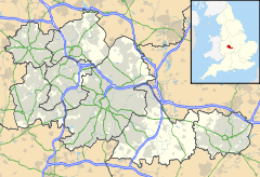
 Gornal
Gornal shown within the West MidlandsOS grid reference SO915917 Metropolitan borough Dudley Metropolitan county West Midlands Region West Midlands Country England Sovereign state United Kingdom Police West Midlands Fire West Midlands Ambulance West Midlands EU Parliament West Midlands UK Parliament Dudley North List of places: UK • England • West Midlands Gornal is an area of the Metropolitan Borough of Dudley, in the West Midlands of England. Gornal encompasses three areas: Upper Gornal, Lower Gornal and Gornalwood; and is located to the northwest of Dudley. It was part of the ancient manor of Sedgley and the Sedgley Urban District until 1966, when it was merged into the County Borough of Dudley.
Since 1974, it has been part of the Metropolitan Borough of Dudley, in the West Midlands county.
Gornal stone, a variety of limestone, originates in Gornal.[1]
Contents
Areas
Upper Gornal
Upper Gornal is situated south of Sedgley town centre on the main A459 road towards Dudley. Many older buildings are still standing in the area, though hundreds of private and council houses have been added since 1920. The locally famous Pig on the Wall public house - previously the Bricklayer's Arms - was controversially demolished in 2002 to make way for a McDonald's drive-thru restaurant. The pub was called the Pig on the Wall after a Black Country urban legend regarding a postcard with a picture of a pig peering over a wall and the phrase Who put the pig on the wall at Gornal to see the band go by. Was it Billy the Boy, Jimmy the Go, Clockweight, Billy on Tho'b, The Pokey Mon or Jacko, Tasso, Cogger, Blossom, Jackery? The postcard was the source of a long running 'mystery' in the magazine The Black Country Bugle in the latter part of the 20th Century, in which the phrase had the additional words No, it was Johhny Longstomach. added at the bottom.
A tram depot was erected on Tudor Road (just off Dudley Road) in about 1930, just after the immediate area had been developed for council housing, but the nearby tram route was closed in 1939 and the depot converted into an industrial unit. This building was demolished in 2001 and redeveloped for private housing.
Next to the tram depot stands the former Jack Darby Picture House, which opened in 1911 in the a building occupied by a former public amenity known as the "Drill Hall". It was one of the first cinemas in the area and underwent a major facelift in 1936, before finally closing in 1960 after almost 50 years in use. The building has since been used as a hardware store.[2]
Upper Gornal was served by a primary school from the late 19th century, which later became Tudor County Primary School - serving pupils aged 5–11 and from 1972 it also provided education for 12 year olds. It closed in July 1986 after nearly 100 years in use and became an adult education centre, finally being demolished in 1996 to be replaced by a development of private bungalows called Board School Gardens.
Along with the bulk of Sedgley, Coseley and Brierley Hill urban district councils, the Upper Gornal area was absorbed into an expanded Dudley borough in 1966. With the introduction of post code districts at this time, most of Upper Gornal became part of the Sedgley DY3 postal district. However, a significant portion of the village - including the land occupied by Burton Road Hospital (which had started life as a workhouse in 1859 and later converted to a hospital, remaining open until 1993 and since redeveloped for housing) - became part of the Dudley DY1 postal district.[3]
Lower Gornal
Lower Gornal is situated to the southwest of Upper Gornal, around the Five Ways traffic island. The local area takes in Roberts Street Primary School, Redhall Primary School and Ellowes Hall Secondary School, the last of which was built in 1964 and named after a nearby stately home that was demolished in the same year. It is surrounded by isolated woodland which though once picturesque is now in need of upkeep.
The biggest development around Lower Gornal is the Stickley Estate, built before the Second World War and partly expanded in the 1950s and 1960s. Ellowes Hall School is situated on the estate.
There are two primary schools in the village - Roberts Primary School and Redhall Primary School. Roberts Primary began life in 1894 as Robert Street infant and junior schools, before becoming Roberts first and middle schools in 1972 and merging to become a primary school in 1984. The original building was demolished in 2000 following the completion of a new £6million building in the old school's grounds. Redhall was formed around 1900 as infant, junior and secondary schools, though the secondary school closed in 1964 when Ellowes Hall opened. The infant and junior schools, which stand on each side of Abbey Street, became first and middle schools in 1972 under a reorganisation of age ranges in the local area, only to revert to infant and junior schools in 1990. The infant and junior schools merged to form a primary school in 1997.
Gornal Athletic F.C., a football team currently in the Premier Division of the West Midlands (Regional) League, are based in Lower Gornal.
Gornal Wood
Situated west of and below Lower Gornal, with a busy village centre providing the local area with a wide range of shops and a library. It is within walking distance of Himley Hall stately home; the former residence of the Earl of Dudley now country park and golf course. Himley Hall grounds are used as a show ground for local events.
Another Georgian building in Gornal Wood was the 'Straits House', a former mansion which became a public house serving the postwar private housing estate that occupies the surrounding land. Within recent years the building began development for a block of apartments, and is almost finished in construction. The private housing estate was built in the late 1950s and early 1960s, and Straits Primary School was added in 1968, also incorporating a library.
The Glynne Arms Public House is known locally as the Crooked House. The pub subsided into a mine shaft running beneath it, and had to have supporting walls erected. This has left the building listing at quite a severe angle. One trick, performed on request in the pub, is an optical illusion where a ball bearing is seen to roll uphill along the back of a bench. The pub used to employ 'guard geese', although these have now gone. When leaving the Glynne Arms, on the opposite side of the Himley Road on the corner of Brick Kiln Lane, can be seen the Old Toll House, that used to charge travellers for the use of the road west.
At the far end of Gornal Wood, near the border with Brierley Hill, stood Jerushas's "titled cottage" - so named because of its similar appearance to the Glynne Arms. It was built around 1840 and remained at this location until 1987, when it was transferred to the Black Country Museum and remodelled inside to resemble the home of wealthy colliery clerk Joseph Bradley, who lived in the house during the early years of the 20th century. Several similar buildings, though none as titled as Jerushah's Cottage, survive at the Cooper's Bank location to this day, nearly 200 years after they were built.[4]
Notable Events
2002 Earthquake
The epicentre of the 2002 Dudley earthquake was located in Gornalwood[5]. It measured 4.8 on the Richter scale and could be felt as far away as North Yorkshire.[6]
Notable residents
Former BBC newsreader Sue Lawley was born in Dudley in 1946 and grew up in Lower Gornal.[7]
See also
- Gornal Athletic F.C.
- Areas of Dudley
References
- ^ "Gornal Stone - Encyclopedia". http://www.encyclo.co.uk/define/Gornal%20stone. Retrieved 10 October 2011.
- ^ http://www.yampy.co.uk/gornal/news/history/jackdarbys.htm
- ^ [1]
- ^ http://www.bclm.co.uk/map10.htm
- ^ "Dudley epicentre left unshaken". BBC News. http://news.bbc.co.uk/1/hi/england/2276610.stm. Retrieved 10 October 2011.
- ^ "Earthquake hits UK". BBC News. http://news.bbc.co.uk/1/hi/uk/2275158.stm. Retrieved 10 October 2011.
- ^ "The Guardian Profile: Sue Lawley". The Guardian. http://www.guardian.co.uk/media/2006/aug/25/broadcasting.bbc. Retrieved 10 October 2011.
External links
Ceremonial county of West Midlands Metropolitan districts Major settlements Aldridge · Bilston · Birmingham · Blackheath · Bloxwich · Brierley Hill · Brownhills · Coseley · Coventry · Cradley Heath · Darlaston · Dudley · Fordbridge · Halesowen · Oldbury · Rowley Regis · Smethwick · Solihull · Stourbridge · Sutton Coldfield · Tipton · Walsall · Wednesbury · Wednesfield · West Bromwich · Willenhall · Wolverhampton
See also: West MidlandsRivers River Blythe · River Cole · River Penk · River Rea · Smestow Brook · River Sherbourne · River Sow · River Sowe · River Stour · River TameCanals Topics Black Country · Centro · Conservation areas · Coventry/Bedworth Urban Area · History of West Midlands County · Museums · West Midlands conurbationCategories:- Towns in the West Midlands (county)
- Areas of Dudley

Wikimedia Foundation. 2010.