- Dry Rocks (reef)
-
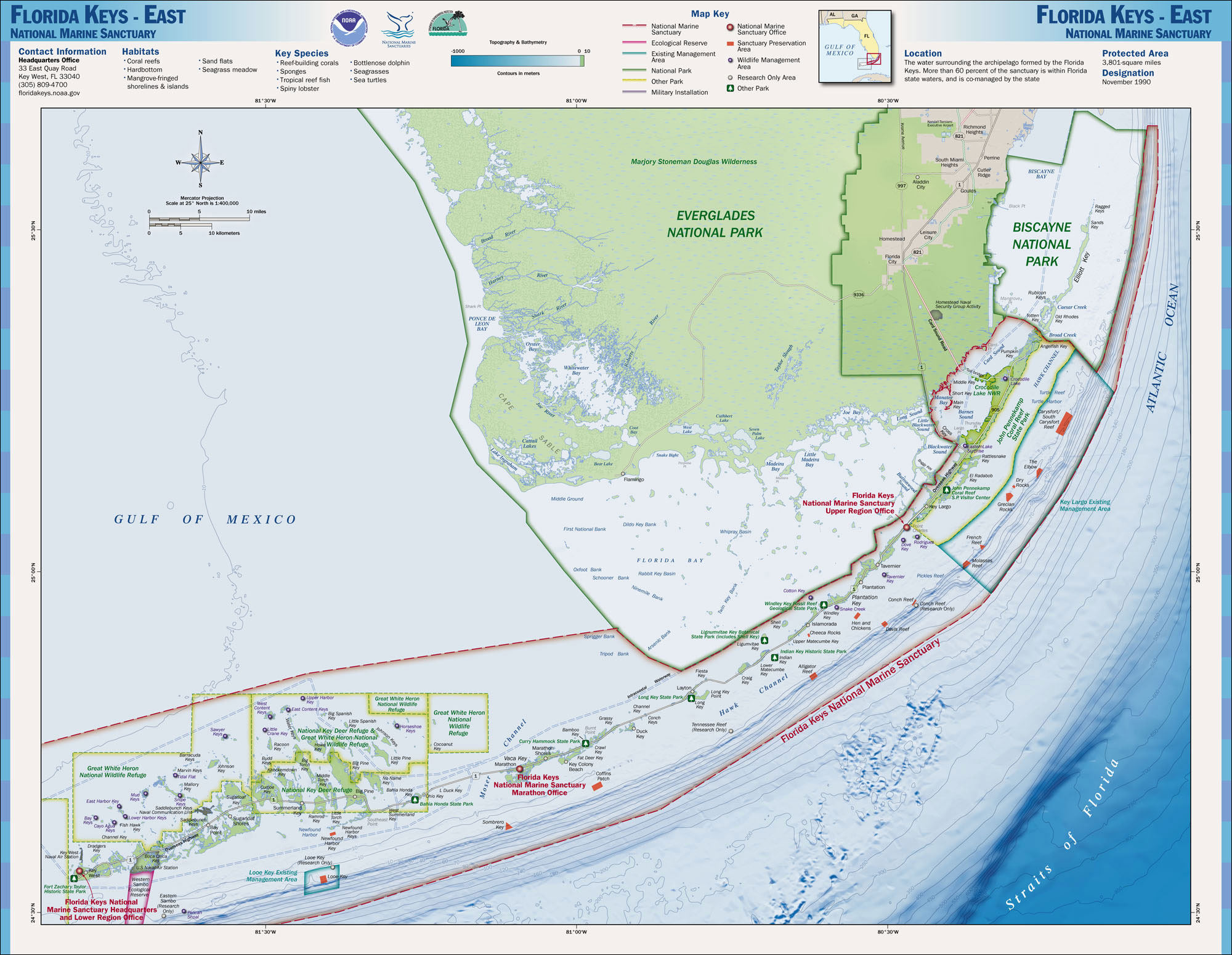
Dry Rocks (or Key Largo Dry Rocks) is a coral reef located within the Florida Keys National Marine Sanctuary. It lies to the east of Key Largo, within the Key Largo Existing Management Area, which is immediately to the east of John Pennekamp Coral Reef State Park. The reef lies within a Sanctuary Preservation Area (SPA). It is close to Grecian Rocks and The Elbow.
A copy of the famous Christ of the Abyss statue is located at this reef.
This reef is distinct from White Banks Dry Rocks, which is landward of Molasses Reef and French Reef.
Approximate coordinates: 25°07′20″N 80°18′00″W / 25.12222°N 80.3°WCoordinates: 25°07′20″N 80°18′00″W / 25.12222°N 80.3°W
References
External Links
Corals and coral reefs Stony corals 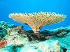
Soft corals - Alcyonacea
- Black coral
- Bamboo coral
- Organ pipe coral
- Sea fans
- Sea pens
Coral reefs - Atoll reef
- Cay
- Fringing reef
- Microatoll
- Coral reef fish
- Census of Coral Reefs
- The Structure and Distribution of Coral Reefs
Coral regions Coral diseases - Coral bleaching
- Black band disease
- Skeletal eroding band
- White band disease
- White pox disease
Protection - Coral reef protection
- Project AWARE
- Reef Check
- Reef Ball
- Coral Reef Alliance
- International Society for Reef Studies
Other - Artificial reef
- Coral aquaculture
- Coral dermatitis
- Coral (precious)
- Coral rag
- Coral sand
- Coralline algae
- Human impact
- Fire coral
- Rugosa (extinct)
- Tabulate (extinct)
- Zooxanthella
Categories:- Marine biology
- Reefs of the Atlantic Ocean

Wikimedia Foundation. 2010.