- Hato International Airport
-
Hato International Airport
Curaçao International Airport
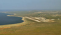
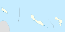
IATA: CUR – ICAO: TNCC Summary Airport type Public Owner Curaçao Airport Holding Operator Curaçao Airport Partners Serves Curacao Location Willemstad, Curaçao Hub for Elevation AMSL 29 ft / 9 m Coordinates 12°11′20″N 068°57′35″W / 12.18889°N 68.95972°WCoordinates: 12°11′20″N 068°57′35″W / 12.18889°N 68.95972°W Website Map Location in Curaçao Runways Direction Length Surface m ft 11/29 3,410 11,188 Asphalt Source: DAFIF[1] Hato International Airport or Curaçao International Airport (originally named Dr. Albert Plesman International Airport) (IATA: CUR, ICAO: TNCC) is the airport of Willemstad, Curaçao. It has services to the Caribbean region, South America, North America and Europe. Hato Airport is a fairly large facility, with the third longest commercial runway in the Caribbean region (after Rafael Hernández Airport and Pointe-à-Pitre International Airport). The airport was the hub of Air ALM and its successor Dutch Caribbean Airlines, the flag carriers of the former Netherlands Antilles until the latter ceased operations in 2004. The airport is now the home base of Dutch Antilles Express and Insel Air.
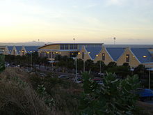
A new terminal was officially opened in 2006 and it accommodates a maximum of 1.6 million passengers per year.[2]
Contents
Airlines and destinations
Airlines Destinations Air Berlin Seasonal: Düsseldorf Air Canada Seasonal: Toronto-Pearson [begins 24 December] American Airlines Miami Arkefly Amsterdam Aserca Airlines operated by PAWA Dominicana Caracas, Santo Domingo Avianca Bogotá Avior Airlines Caracas, Valencia
Seasonal: BarquisimetoBlue Panorama Seasonal: Milan-Malpensa Continental Airlines Newark Divi Divi Air Bonaire Dutch Antilles Express Aruba, Bogotá, Bonaire, Caracas, Cartagena de Indias, Panama City, St Maarten, Santo Domingo, Valencia E-Liner Airways Aruba, Bonaire EZAir Bonaire Gol Transportes Aéreos operated by Varig Brasília Insel Air Aruba, Barquisimeto, Bogotá [begins 1 December], Bonaire, Caracas, Charlotte, Curacao, Kingston, Las Piedras, Medellín, Miami, Paramaribo, Port-au-Prince, St Maarten, San Juan, Santo Domingo, Valencia. KLM Amsterdam LIAT Port of Spain Surinam Airways Paramaribo, Port of Spain Thomas Cook Canada
operated by Jazz AirSeasonal: Toronto-Pearson Tiara Air Aruba Winair operated by Insel Air St.Maarten, Saba, St.Eustatuis Charter & seasonal airlines and destinations
Airlines Destinations Blue Panorama Milan-Malpensa Canjet Halifax, Toronto-Pearson Divi Divi Air Valencia Enerjet Toronto-Pearson Icaro Air Guayaquil RUTACA Airlines Caracas TAME Quito World War II
During World War II, the airport was used by the United States Army Air Force Sixth Air Force conducting antisubmarine patrols. Flying units using the airfield were:
- 59th Bombardment Squadron (VI Bomber Command) 10 March 1942-13 July 1943 (A-20 Havoc)
- 32d Fighter Squadron (36th Fighter Group, Antilles Air Command, XXVI Fighter Command) 9 March 1943-13 March 1944, (P-40 Warhawk)
- Detachment operated from: Dakota Field, Aruba, 9 March 1943-9 March 1944
- Detachment operated from: Losey Army Airfield, Puerto Rico, 9 March-4 June 1944
- 25th Bombardment Group (VI Bomber Command), 1 August-5 October 1943
Coastguard Air Station HATO
Located at the west side of Hato Airport there is a small hangar for the 2 Dash-8 patrol aircraft of the Coast Guard Netherlands Antilles & Aruba. This was until 2007 a naval airbase of the Royal Netherlands Navy who operated the base for 55 years. With a wide variety of aircraft in the past years Fireflies, Avengers, Trackers, Neptunes, Fokker F-27's, PC-3 Orions, Fokker F-60's and several helicopters. After the political decision to sell all Orions the airbase wasn't needed anymore.
And west of the air station the US Air force operate a Forward Operating Base (FOB) mostly operate AWAC's and transport aircraft. Until 1999 the US Air force operated a small amount of F-16's from the FOB.
References
 This article incorporates public domain material from websites or documents of the Air Force Historical Research Agency.
- ^ Airport information for TNCC at World Aero Data. Data current as of October 2006.Source: DAFIF.
- ^ Curaçao International Airport (official website)
- Mauer, Mauer (1969), Combat Squadrons of the Air Force, World War II, Air Force Historical Studies Office, Maxwell AFB, Alabama. ISBN 0-89201-097-5
External links
- Airport information for TNCC at Great Circle Mapper. Source: DAFIF (effective Oct. 2006).
- Accident history for CUR at Aviation Safety Network
 USAAF Sixth Air Force in World War II
Previously: Panama Canal Air Force (1940-1941); Caribbean Air Force (1941-1942) Airfields Caribbean Coolidge (Antigua) · Dakota (Aruba) · Batista (Cuba) · Camaguey (Cuba) · Hato (Curacao) · Vernam (Jamaica) · Arecibo (Puerto Rico) · Borinquen (Puerto Rico) · Losey (Puerto Rico) · Benedict (Saint Croix) · Beane (Saint Lucia) · St. Thomas Airport (Saint Thomas) · Carlsen (Trinidad) · Piarco Airport (Trinidad) · Waller (Trinidad)Canal Zone Panama Aguadulce · Anton · Calzada Larga · Chame · David · La Chorrera · Madden · Patilla Point · Pocri · Rio HatoCentral and South
America
Units Commands VI Bomber Command · VI Fighter Command · XXVI Fighter Command · XXXVI Fighter Command · VI Air Force Service · Antilles Air CommandGroups Fighter Bomber Reconnaissance Squadrons United States Army Air Forces
First · Second · Third · Fourth · Fifth · Sixth · Seventh · Eighth · Ninth · Tenth · Eleventh · Twelfth · Thirteenth · Fourteenth · Fifteenth · TwentiethCategories:- Airports in Curaçao
- Airfields of the United States Army Air Forces
Wikimedia Foundation. 2010.


