- Donington le Heath
-
Coordinates: 52°42′32″N 1°22′47″W / 52.7089°N 1.3797°W
Donington-le-Heath 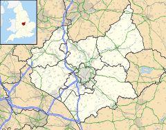
 Donington-le-Heath
Donington-le-Heath shown within LeicestershireParish Coalville District North West Leicestershire Shire county Leicestershire Region East Midlands Country England Sovereign state United Kingdom Post town COALVILLE Postcode district LE67 Dialling code 01530 Police Leicestershire Fire Leicestershire Ambulance East Midlands EU Parliament East Midlands UK Parliament North West Leicestershire List of places: UK • England • Leicestershire 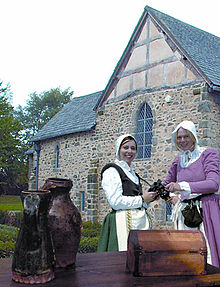 Tudor education sessions at Donington
Donington-le-Heath is a historic settlement lying just over a mile away from the centre of Coalville in North West Leicestershire and merges with the adjacent village of Hugglescote (until 1936 Hugglescote and Donington formed one parish).
As early as 1220[citation needed], Donington-le-Heath and Hugglescote both had small chapelries, which came under the jurisdiction of the church at Ibstock. By the eighteenth century however, these buildings were practically in ruins and Saint Peter's Donington was demolished circa 1770 and was never replaced.
The land in the township was enclosed in 1774[1] and in 1945 this estate was sold by Brig. C. L. O. Tayleur.[2]
Donington-le-Heath Manor House, built around 1280, is one of the oldest surviving houses in England. It has also been established that the building sits on Anglo Saxon foundations, suggesting that an even earlier structure occupied the site: it has a hall facing south and two wings on the north side and a moat. There are some alterations made in the 17th century, including some of the windows and the ground floor entrance.[3][4] The building has been renovated by Leicestershire County Council and is now a museum open to the public.
Donington-le-Heath has one public house, The Corner Pin, located on The Green.
References
- ^ Parliament (1774) An Act for Inclosing ... Hucklescote ...
- ^ Warner, Sheppard & Wade (1945) Particulars of the Hugglescote and Donington estate (with map). Leicester
- ^ Pevsner, N. (1984) Leicestershire and Rutland, 2nd ed. Penguin Books ISBN 0300096186; p. 146
- ^ The Official Guide to North West Leicestershire, undated publication
External links
 Media related to Donington le Heath at Wikimedia CommonsCategories:
- Villages in Leicestershire
- Leicestershire geography stubs


Wikimedia Foundation. 2010.