- Dickey River
-
Dickey River Country United States State Washington County Clallam Source Confluence of West and East Forks - location Olympic Mountains - coordinates 47°59′6″N 124°32′59″W / 47.985°N 124.54972°W [1] Mouth Quillayute River - elevation 4 ft (1 m) [1] - coordinates 47°55′16″N 124°37′24″W / 47.92111°N 124.62333°W [1] 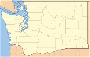
 Location of the mouth of the Dickey River in Washington
The Dickey River is a stream on the Olympic Peninsula in the U.S. state of Washington. It has three main forks, the East Fork, West Fork, and Middle Fork Dickey Rivers. The main stem is formed by the confluence of the East and West Forks. The river and its forks rise in the northwestern part of the Olympic Peninsula and flow generally south and west to join the Quillayute River near its mouth on the Pacific Ocean.[2]
The river's name is a corruption of the Quileute term dichoh dock-teacer or de tho date t doh, pronounced "dā tȯ dȯtch't dōh". This term was applied to the river and a branch of the tribe living along the river. It meant "people who live on the first branch of the Quillayute River" or "people who live on the dark water".[3]
Contents
East Fork
The East Fork Dickey River is approximately 16 miles (26 km) long and originates at 48°7′4″N 124°24′40″W / 48.11778°N 124.41111°W,[4] in the northwestern Olympic Peninsula. It flows generally south collecting tributaries such as Skunk Creek and Thunder Creek before joining the West Fork to form the main stem Dickey River.[2]
West Fork
The West Fork Dickey River is just over 20 miles (32 km) long and originates at 48°5′57″N 124°30′27″W / 48.09917°N 124.5075°W,[5] as the outflow of Dickey Lake. The lake is fed by a number of streams such as Stampedge Creek, Ponds Creek, and Sands Creek. The West Fork Dickey River exits the south end of Dickey Lake and soon collects the Middle Fork Dickey River. Shortly below the joining of the tributary include Squaw Creek the West Fork joins the East Fork to form the main stem Dickey River.[2]
Middle Fork
The Middle Fork Dickey River originates at 48°7′17″N 124°26′3″W / 48.12139°N 124.43417°W,[6] slightly east of Dickey Lake. It flows generally south to join the West Fork Dickey River.[2]
Main stem
The main stem Dickey River originates at the confluence of the East and West Forks and flows generally south for approximately 7 miles (11 km). Along the way it collects tributaries including Larger Creek, Cotby Creek, and Coat Creek. It flows by the Quillayute State Airport. The Dickey River empties into the Quillayute River about a mile north of La Push and the mouth of the Quillayute River. The confluence of the Dickey and Quillayute Rivers occurs within the narrow coastal strip of Olympic National Park.[2]
See also
References
- ^ a b c U.S. Geological Survey Geographic Names Information System: Dickey River
- ^ a b c d e General course info from USGS topographic maps accessed via the "GNIS in Google Map" feature of the USGS Geographic Names Information System website.
- ^ Parratt, Smitty (1984). Gods & goblins: A Field Guide to Place Names of Olympic National Park. CP Publications. p. 36. ISBN 0-914195-00-X.
- ^ U.S. Geological Survey Geographic Names Information System: East Fork Dickey River
- ^ U.S. Geological Survey Geographic Names Information System: West Fork Dickey River
- ^ U.S. Geological Survey Geographic Names Information System: Middle Fork Dickey River
Categories:- Rivers of Washington (state)
- Landforms of Clallam County, Washington

Wikimedia Foundation. 2010.