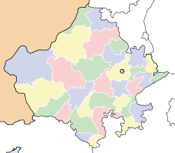
Devli — Original name in latin Devli Name in other language Deoli, Devli, Dioli State code IN Continent/City Asia/Kolkata longitude 25.76042 latitude 75.38093 altitude 339 Population 21298 Date 2012 10 06 … Cities with a population over 1000 database
Devli Jaberr — Union council and town Country Pakistan Region Khyber Pakhtunkhwa District Mansehra District Tehsil … Wikipedia
Gomantak Maratha Samaj — Gomantak Maratha Samaj, गोमंतक मराठा समाज Total population 100,000 (approx) Regions with significant populations Primary populations in: Goa … Wikipedia
Mansehra District — District Location of Mansehra District (highlighted in yellow) within the Khyber Pakhtunkhwa Province. Countr … Wikipedia
devilish — dev|il|ish1 [ devlıʃ ] adjective 1. ) evil or intended for an evil purpose: a devilish plot 2. ) intended to cause trouble, but not in a serious way: a devilish grin 3. ) INFORMAL used for emphasizing how difficult or unpleasant something is… … Usage of the words and phrases in modern English
List of Indian Princely States — Hundreds of princely states in British India existed prior to the independence of India and Pakistan (including the present Bangladesh) in 1947, ruled by semi independent potentates. Only four of the largest of these states were still directed by … Wikipedia
Mansehra — مانسہرہ Town and Union council … Wikipedia
Malvan — (मालवण) city … Wikipedia
Dhodial — Union council and town Country Pakistan Region Khyber Pakhtunkhwa District Mansehra District Tehsil … Wikipedia
Jhajhar — Infobox Indian Jurisdiction native name = Jhajhar | type = city | latd = 27.86 | longd = 75.28 locator position = right | state name = Rajasthan district = Jhunjhunu leader title = leader name = altitude = 379 population as of = 2001 population… … Wikipedia


