- Wabasca, Alberta
-
For other uses, see Wabasca (disambiguation).
Hamlet of Wabasca — Hamlet — Location of Wabasca in Alberta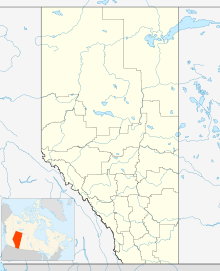

Coordinates: 55°58′N 113°51′W / 55.967°N 113.85°W Country  Canada
Province  Alberta
Region Northern Alberta Municipal district M.D. of Opportunity No. 17 Government – Municipal District M.D. of Opportunity No. 17 Elevation 550 m (1,804 ft) Population (2007)[1] – Total 1,410 Time zone MST (UTC−7) – Summer (DST) MDT (UTC−6) Area code(s) +1-780 Highways Highway 813
Highway 754Waterways Wabasca Lakes Website M.D. of Opportunity No. 17 Wabasca, also known as Wabasca-Desmarais, is a hamlet in northern Alberta, Canada, within the Municipal District (M.D.) of Opportunity No. 17.[2] It is located between and along the South and North Wabasca Lakes, at the intersection of Highway 813 and Highway 754. It is approximately 123 kilometres (76 mi) northeast of Slave Lake.
Wabasca, which is the municipal seat of the M.D of Opportunity No. 17, consists of two communities – Wabasca and Desmarais. The hamlet has a population of 1,410,[1] which is largely Native Canadian. Over 2,000 additional residents live on six Bigstone Cree Nation reserves in the immediate surrounding area. These reserves include Wabasca 166, 166A, 166B, 166C and 166D and are the seat of the Bigstone Cree Nation, a Woodland Cree First Nation.[3]
The name Wabasca originates from the Cree word wapuskau, meaning "white rapid" the name for the Wabasca River. Desmarais was named after Father Alphonse Desmarais, the first missionary in this area.[4]
Contents
Demographics
The population of the Hamlet of Wabasca is 1,410 according to a municipal census conducted by the M.D. of Opportunity No. 17 in 2007.[1]
The following are the populations of the reserves surrounding Wabasca from the 2006 federal census.[5]
- Wabasca 166 - 78
- Wabasca 166A - 648
- Wabasca 166B - 216
- Wabasca 166C - 173
- Wabasca 166D - 863
Transportation
The Hamlet of Wabasca is served by Highway 813 and Highway 754. The Wabasca Airport is located within the hamlet.[1]
Amenities
The community is home to the Wabasca General Hospital, the Wabasca Public Library, and a recreation centre that includes a pool.[1] Wabasca also has two exercise centres, an ice arena, outdoor rodeo grounds, baseball diamonds, a skateboard park, and winter outdoor ice rinks.[citation needed]
Wabasca has four churches including St. Charles Catholic Church, St. John's Anglican Church, St. Martins Catholic Church, and the Wabasca Revival Centre.[1]
Schools
The Northland School Division operates two schools in the community – St. Theresa School for students in kindergarten through grade 5 and Mistassiniy School for students in grades 6 through 12.[1]
The Bigstone Cree First Nation Education Authority operates the Bigstone Community School (Oski Pasikoniwew Kamik).[6]
A campus of Northern Lakes College is located in Wabasca.[1] The college provides part-time and full-time programming for adult upgrading, apprenticeships, university studies, workforce development, and other careers.[7]
Activities
Fishing, ice fishing, hunting, trapping, quadding, and snowmobiling are traditional and recreational activities in the area. Other activities includes cross-country skiing, skating, skateboarding, and swimming.
A paved walking trail links Desmarais and Wabasca with an approximate distance of 20 km (12 mi).
Located along the shores of the North and South Wabasca Lakes, the community has a boat launch, a swimming dock, and a fishing bridge between the two lakes.
Industry
Located west of the Wabasca Oil Field, oil and gas exploration and extraction is Wabasca's primary industry. Forestry also plays a role in the local economy with Alberta Pacific Forest Industries operating an office out of the community.[1]
Climate
Wabasca has a subarctic climate (Köppen climate classification Dfc).
Climate data for Wabasca Month Jan Feb Mar Apr May Jun Jul Aug Sep Oct Nov Dec Year Record high °C (°F) 14.5
(58.1)14
(57)17.2
(63.0)28.5
(83.3)32
(90)32.2
(90.0)32
(90)32.5
(90.5)29.5
(85.1)25.5
(77.9)13.3
(55.9)10
(50)32.5
(90.5)Average high °C (°F) −10.8
(12.6)−5.5
(22.1)0.9
(33.6)9.7
(49.5)15.4
(59.7)20.2
(68.4)22
(72)21.4
(70.5)15
(59)8.5
(47.3)−2.3
(27.9)−8.2
(17.2)7.2 Daily mean °C (°F) −16.7
(1.9)−12.6
(9.3)−6.1
(21.0)3.2
(37.8)9.2
(48.6)14.5
(58.1)16.5
(61.7)15.5
(59.9)9.5
(49.1)3.6
(38.5)−7.2
(19.0)−13.7
(7.3)1.3 Average low °C (°F) −22.5
(−8.5)−19.7
(−3.5)−13.1
(8.4)−3.3
(26.1)3
(37)8.8
(47.8)11
(52)9.6
(49.3)4
(39)−1.4
(29.5)−12.1
(10.2)−19.1
(−2.4)−4.6 Record low °C (°F) −51
(−60)−49
(−56)−42.2
(−44.0)−35
(−31)−18.9
(−2.0)−1.1
(30.0)−1.1
(30.0)−4.5
(23.9)−13.3
(8.1)−26
(−15)−36.5
(−33.7)−43.5
(−46.3)−51
(−60)Precipitation mm (inches) 22.5
(0.886)17.2
(0.677)15.8
(0.622)20.2
(0.795)47.5
(1.87)79.2
(3.118)96.9
(3.815)58.8
(2.315)48.4
(1.906)25.9
(1.02)19.2
(0.756)23.4
(0.921)474.9
(18.697)Source: Environment Canada[8] Community events
Wabasca hosts numerous events on an annual basis including the Royal Canadian Mounted Police (RCMP) Fish Derby, the Wabasca Road Race, and the Lions Club Ski-Doo Rally among others.[1]
See also
- List of communities in Alberta
- List of hamlets in Alberta
References
- ^ a b c d e f g h i j "M.D. of Opportunity No. 17 Profile". Prairie Wind Consulting Inc.. November 2009. http://opportunityno17.civicweb.net/contentengine/launch.asp?ID=548. Retrieved 2011-04-28.
- ^ Alberta Municipal Affairs (2010-04-01). "Specialized and Rural Municipalities and Their Communities". http://municipalaffairs.gov.ab.ca/documents/msb/2010-ruralmun.pdf. Retrieved 2010-07-03.
- ^ Bigstone Cree Nation webpage[dead link]
- ^ M.D. of Opportunity No. 17 - History[dead link]
- ^ "Population and dwelling counts, for Canada, provinces and territories, and census subdivisions (municipalities), 2006 and 2001 censuses - 100% data (Alberta)". Statistics Canada. 2010-01-06. http://www12.statcan.gc.ca/census-recensement/2006/dp-pd/hlt/97-550/Index.cfm?TPL=P1C&Page=RETR&LANG=Eng&T=302&SR=1&S=1&O=A&RPP=9999&PR=48&CMA=0. Retrieved 2011-04-28.
- ^ "Oski Pasikoniwew Kamik (BCN School)". Bigstone Cree Nation. http://www.bigstone.ca/index.php?option=com_content&task=view&id=28&Itemid=93. Retrieved 2011-04-28.
- ^ "Programs". Northern Lakes College. http://www.northernlakescollege.ca/programs.aspx. Retrieved 2011-04-28.
- ^ "Canadian Climate Normals 1971-2000". Environment Canada. 2010-09-28. http://www.climate.weatheroffice.gc.ca/climate_normals/results_e.html?Province=ALTA&StationName=&SearchType=&LocateBy=Province&Proximity=25&ProximityFrom=City&StationNumber=&IDType=MSC&CityName=&ParkName=&LatitudeDegrees=&LatitudeMinutes=&LongitudeDegrees=&LongitudeMinutes=&NormalsClass=A&SelNormals=&StnId=2813&. Retrieved 2011-04-28.
External links

Red Earth Creek Chipewyan Lake Fort McMurray Atikameg 
Janvier South  Wabasca

Slave Lake Athabasca Lac La Biche  Subdivisions of Alberta
Subdivisions Regions · Census divisions · Municipal districts (counties) · Specialized municipalities · School districts · Regional health authoritiesCommunities Cities · Towns · Villages · Summer villages · Hamlets · Indian reserves · Métis settlements · Ghost towns · Designated placesCities and Urban
Service AreasAirdrie · Brooks · Calgary · Camrose · Cold Lake · Edmonton (capital) · Fort McMurray · Fort Saskatchewan · Grande Prairie · Lacombe · Leduc · Lethbridge · Lloydminster · Medicine Hat · Red Deer · Sherwood Park · Spruce Grove · St. Albert · WetaskiwinCategories:- Municipal seats in Alberta
- Opportunity No. 17, Alberta
- First Nations in Alberta
- Designated places in Alberta

Wikimedia Foundation. 2010.