- Glacial landform
-
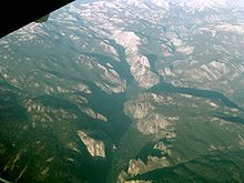
Glacial landforms are those created by the action of glaciers. Most of today's glacial landforms were created by the movement of large ice sheets during the Quaternary glaciations. Some areas, like Fennoscandia and the southern Andes, have extensive occurrences of glacial landforms; other areas, such as the Sahara, display very old fossil glacial landforms.
Contents
Erosional landforms
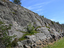
As the glaciers expanded, due to their accumulating weight of snow and ice , they crushed and scoured surface rocks and bedrock. The resulting erosional landforms include striations, cirques, glacial horns, arêtes, trim lines, U-shaped valleys, roches moutonnées, overdeepenings and hanging valleys.
- Cirque: Starting location for mountain glaciers
- U-shaped valley: U-shaped valleys are created by mountain glaciers, called fjord when filled with ocean water, creating an inlet
Depositional landforms
Later, when the glaciers retreated leaving behind their freight of crushed rock and sand (glacial drift), they created characteristic depositional landforms. Examples include glacial moraines, eskers, and kames. Drumlins and ribbed moraines are also landforms left behind by retreating glaciers. The stone walls of New England contain many glacial erratics, rocks that were dragged by a glacier many miles from their bedrock origin.
- Esker: Built up bed of a sub-glacial stream.
- Kame: Irregularly shaped mound.
- Moraine: Feature can be terminal (at the end of a glacier) or lateral (along the sides of a glacier).
- Outwash fan: Braided stream flowing from the front end of a glacier.
Glacial lakes and ponds
Lakes and ponds may also be caused by glacial movement. Kettle lakes form when a retreating glacier leaves behind an underground or surface chunk of ice that later melts to form a depression containing water. Moraine-dammed lakes occur when a stream (or snow runoff) is dammed by glacial debris. Jackson Lake and Jenny Lake in Grand Teton National Park are examples of moraine-dammed lakes, although Jackson Lake is also enhanced by a man-made dam.
- Kettle lake: Depression, formed by a block of ice separated from the main glacier, in which the lake forms.
- Glacial Lake: A lake that formed between the front of a glacier and the last terminal moraine. Usually it is no longer in existence.
Ice Features
Apart from the landforms left behind by glaciers, glaciers themselves may be striking features of the terrain, particularly in the polar regions of the earth. Notable examples include valley glaciers where glacial flow is restricted by the valley walls, crevasses in the upper section of glacial ice, and icefalls, the ice equivalent of waterfalls.
External links
- Illustrated glossary of alpine glacial landforms
- Landforms of glaciation
- Diagram illustrating mechanisms of glacial landforms in The Ice Melts: Deposition on page 6 of "Pennsylvania and the Ice Age" published 1999 by PA DCNR Bureau of Topographic and Geologic Survey
Glaciers Types of glaciers - Cirque glacier
- Ice cap
- Ice field
- Ice sheet
- Ice shelf
- Ice stream
- Outlet glaciers
- Rock glaciers
- Valley glaciers
- Ledoyom (Ice body)
Anatomy Processes Measurements Glaciovolcanic relations Glacial landforms Erosional- Arête
- Cirque
- Crag and tail
- Fjord
- Glacial horn
- Glacial striae
- Hanging valley
- Ribbon lake
- Roche moutonnée
- Tunnel valley
- U-valley
Depositional- Drumlin
- Drumlin field
- Erratic block
- Moraine
- Pulju moraine
- Rogen moraine
- Terminal moraine
- Till plain
- Veiki moraine
Glacifluvial- Esker
- Kame
- Kame delta
- Kettle hole
- Outwash fan
- Sandur
- Giant current ripples
- Diluvium
- Glaciology
- Category:Glaciers
Categories:
Wikimedia Foundation. 2010.


