- Cotai
-
Coordinates: 22°08′27″N 113°33′47″E / 22.14082°N 113.56310°E
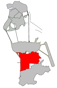
Cotai Landfill Zone Chinese name Traditional Chinese 路氹城海區 Simplified Chinese 路凼城海区 Cantonese Jyutping Lou6 Tam5 Sing4 Hoi2 Koe1 Hanyu Pinyin Lùdàngchéng Hǎiqū Transcriptions Mandarin - Hanyu Pinyin Lùdàngchéng Hǎiqū - IPA [lŷtɑ̂ŋtʂʰɤ̌ŋ xàɪtɕʰý] Cantonese (Yue) - Jyutping Lou6 Tam5 Sing4 Hoi2 Koe1 - IPA [lòu tʰɐ̬m sɪ̭n hɔ̌ːi kʰœ́ː] - Yale Romanization Lùhdàhngchén Hǎichyū Portuguese name Portuguese Zona do Aterro de Cotai Cotai (Chinese: 路氹城) is a 5.2 km2 piece of newly reclaimed land between Taipa and Coloane islands in Macau,[1] that has not yet been assigned to any of the freguesias. The Chinese and Portuguese names are a portmanteau of the two islands, Coloane and Taipa.
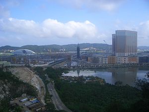
Cotai was created to provide Macau with a new gambling and tourism area since Macau is so densely populated and land is scarce. The Cotai Strip is the name used more commonly for this area in Cotai where the casinos and hotels are currently being built.
Galaxy entertainment's Grand Waldo Hotel was the first casino to commence operations in Cotai, opening its doors in May, 2006. The construction of many other casino and hotel projects is currently underway. The most notable of which is Las Vegas Sands' Venetian Macao, which opened its doors on August 28, 2007.[2]
In 2006, a new hospital was founded in the Cotai area, the MUST Hospital, which is associated with the Macau University of Science and Technology.
Footnotes
Municipalities and Parishes of Macau Note: The following Parishes are purely symbolic there are no political administrative sub-divisions in Macau after the formation of Instituto para os Assuntos Cívicos e Municipais in 2002. Cotai was never a parish. Municipality of Macau 
Municipality of the Islands Categories:- Populated coastal places in Macau
- Concelho das Ilhas
- Macau geography stubs
Wikimedia Foundation. 2010.


