- Nanur Airport
-
Nanur Airport IATA: none – ICAO: none Summary Airport type Civil Operator Government Location Libya Elevation AMSL 185 ft / 56 m Coordinates 31°42′18.54″N 014°54′41.83″E / 31.70515°N 14.9116194°ECoordinates: 31°42′18.54″N 014°54′41.83″E / 31.70515°N 14.9116194°E Runways Direction Length Surface m ft 13/31 3,898 12,790 Composite 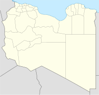
 Nanur AirportLocation of Nanur, Libya
Nanur Airport is an airport in the Wadi Maymun Darraj region of Libya, located approximately 200 km south-southeast of Tripoli in the Libyan desert. Although listed as a civil airport, it appears to function as a reserve Libyan Air Force airfield. It consists of a very large runway, capable of strategic bomber use, with a taxiway and a parking ramp. There are no permanent structures visible, nor are there any production oilfields in the area.
World War II
During World War II the airfield, then known as Darragh Airfield was used as a military airfield by the United States Army Air Force Ninth Air Force 57th Fighter Group during the North African Campaign against Axis forces. The 57th flew P-40 Warhawks from the airfield between 19 January-3 March 1943 before moving forward with the British Eighth Army. [1]
The current airfield appears to be overlaid on its World War II predecessor facility.
References
- ^
 This article incorporates public domain material from websites or documents of the Air Force Historical Research Agency.
- Maurer, Maurer. Air Force Combat Units of World War II. Maxwell AFB, Alabama: Office of Air Force History, 1983. ISBN 0-89201-092-4.
- Mauer, Mauer (1969), Combat Squadrons of the Air Force, World War II, Air Force Historical Studies Office, Maxwell AFB, Alabama. ISBN 0-89201-097-5
External links
Links to related articles Stations 
Units Commands 9th Air Division (was IX Bomber Command) · IX Air Defense · IX Fighter · IX Tactical Air · IX Troop Carrier · XIX Tactical Air · XXIX Tactical AirWings Bombardment 97th Bombardment · 98th Bombardment · 99th BombardmentFighter 8th Fighter · 9th Fighter · 70th Fighter · 71st Fighter · 84th Fighter · 100th Fighter · 303d FighterTroop Carrier 50th Troop Carrier · 52d Troop Carrier · 53d Troop CarrierGroups Bombardment 12th Bombardment · 98th Bombardment · 322d Bombardment · 323d Bombardment · 340th Bombardment · 344th Bombardment · 376th Bombardment · 386th Bombardment · 387th Bombardment · 391st Bombardment · 394th Bombardment · 397th Bombardment · 409th Bombardment · 410th Bombardment · 416th BombardmentFighter 36th Fighter · 48th Fighter · 50th Fighter · 57th Fighter · 79th Fighter · 324th Fighter · 354th Fighter · 358th Fighter · 365th Fighter · 362d Fighter · 363d Fighter · 366th Fighter · 367th Fighter · 368th Fighter · 370th Fighter · 371st Fighter · 373d Fighter · 404th Fighter · 405th Fighter · 406th Fighter · 474th FighterTroop Carrier 61st Troop Carrier · 313th Troop Carrier · 314th Troop Carrier · 315th Troop Carrier · 316th Troop Carrier · 349th Troop Carrier · 434th Troop Carrier · 435th Troop Carrier · 436th Troop Carrier · 437th Troop Carrier · 438th Troop Carrier · 439th Troop Carrier · 440th Troop Carrier · 441st Troop Carrier · 442d Troop Carrier · IX Troop Carrier Pathfinder (Provisional)Reconnaissance Squadrons Liaison 14th Liaison · 47th LiaisonNight Fighter 422d Night Fighter · 425th Night FighterCategories:- North African airport stubs
- Airports in Libya
- Libya geography stubs
- Airfields of the United States Army Air Forces in Libya
- World War II Desert Airfields
- ^


Wikimedia Foundation. 2010.