- Martuba Air Base
-
Martuba Air Base 
IATA: none – ICAO: none Summary Airport type Military Operator Libyan Air Force Location Libya Elevation AMSL 1,014 ft / 309 m Coordinates 32°32′32.15″N 022°44′43.29″E / 32.5422639°N 22.7453583°ECoordinates: 32°32′32.15″N 022°44′43.29″E / 32.5422639°N 22.7453583°E Runways Direction Length Surface m ft 14/32 3,591 11,781 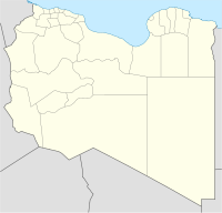
 Martuba Air BaseLocation of Martuba Air Base, Libya
Martuba Air Base is a Libyan Air Force (Arabic: القوات الجوية الليبية, Berber: Adwas Alibyan Ujnna) base in the Derna District of Libya, located approximately 27 kilometres (17 mi) south-southeast of Derna, 268 kilometres (167 mi) east-northeast of Benghazi. Its primary use is by the Libyan Air Force. The hangars contain Mi-2 and Mi-8 helicopters. A G.222 is stored on the ramp. It appears to be a reserve facility, as it primarily consists of a runway and a parking ramp. No support structures are visible.
World War II
During World War II the airfield, then known as Martuba Airfield was used as a military airfield by the United States Army Air Force 57th Fighter Group during the North African Campaign against Axis forces. The 57th flew P-40 Warhawks from the airfield 16 November-3 December 1942.
References
- ^
 This article incorporates public domain material from websites or documents of the Air Force Historical Research Agency.
- Maurer, Maurer. Air Force Combat Units of World War II. Maxwell AFB, Alabama: Office of Air Force History, 1983. ISBN 0-89201-092-4.
- Mauer, Mauer (1969), Combat Squadrons of the Air Force, World War II, Air Force Historical Studies Office, Maxwell AFB, Alabama. ISBN 0-89201-097-5
External links
Links to related articles Stations 
Units Commands 9th Air Division (was IX Bomber Command) · IX Air Defense · IX Fighter · IX Tactical Air · IX Troop Carrier · XIX Tactical Air · XXIX Tactical AirWings Bombardment 97th Bombardment · 98th Bombardment · 99th BombardmentFighter 8th Fighter · 9th Fighter · 70th Fighter · 71st Fighter · 84th Fighter · 100th Fighter · 303d FighterTroop Carrier 50th Troop Carrier · 52d Troop Carrier · 53d Troop CarrierGroups Bombardment 12th Bombardment · 98th Bombardment · 322d Bombardment · 323d Bombardment · 340th Bombardment · 344th Bombardment · 376th Bombardment · 386th Bombardment · 387th Bombardment · 391st Bombardment · 394th Bombardment · 397th Bombardment · 409th Bombardment · 410th Bombardment · 416th BombardmentFighter 36th Fighter · 48th Fighter · 50th Fighter · 57th Fighter · 79th Fighter · 324th Fighter · 354th Fighter · 358th Fighter · 365th Fighter · 362d Fighter · 363d Fighter · 366th Fighter · 367th Fighter · 368th Fighter · 370th Fighter · 371st Fighter · 373d Fighter · 404th Fighter · 405th Fighter · 406th Fighter · 474th FighterTroop Carrier 61st Troop Carrier · 313th Troop Carrier · 314th Troop Carrier · 315th Troop Carrier · 316th Troop Carrier · 349th Troop Carrier · 434th Troop Carrier · 435th Troop Carrier · 436th Troop Carrier · 437th Troop Carrier · 438th Troop Carrier · 439th Troop Carrier · 440th Troop Carrier · 441st Troop Carrier · 442d Troop Carrier · IX Troop Carrier Pathfinder (Provisional)Reconnaissance Squadrons Liaison 14th Liaison · 47th LiaisonNight Fighter 422d Night Fighter · 425th Night FighterUnited States Army Air Forces
First · Second · Third · Fourth · Fifth · Sixth · Seventh · Eighth · Ninth · Tenth · Eleventh · Twelfth · Thirteenth · Fourteenth · Fifteenth · TwentiethCategories:- North African airport stubs
- Airports in Libya
- Libya geography stubs
- Airfields of the United States Army Air Forces in Libya
- World War II Desert Airfields
- Military installations of Libya
- ^


Wikimedia Foundation. 2010.