- Dalton, Richmondshire
-
This article is about the village near Richmond. For the village near Darlington, see Dalton-on-Tees. For other uses, see Dalton.
Coordinates: 54°28′16″N 1°49′28″W / 54.471018°N 1.824374°W
Dalton 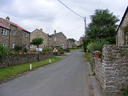
Looking through Dalton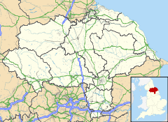
 Dalton
Dalton shown within North YorkshirePopulation 147 (2001) OS grid reference NZ114084 District Richmondshire Shire county North Yorkshire Region Yorkshire and the Humber Country England Sovereign state United Kingdom Post town RICHMOND Postcode district DL11 Dialling code 01833 Police North Yorkshire Fire North Yorkshire Ambulance Yorkshire EU Parliament Yorkshire and the Humber List of places: UK • England • Yorkshire Dalton is a village and civil parish in North Yorkshire in England, about six miles northwest of Richmond and about five miles southeast of Barnard Castle within the council district of Richmondshire and close to the A66 transpennine trunk road. It was listed in the Domesday book. The Dalton parish boundary includes the village itself as well the houses at Dalton Heights (off the road to Newsham) plus numerous surrounding farms. The population of the parish was 147 according to the 2001 census.
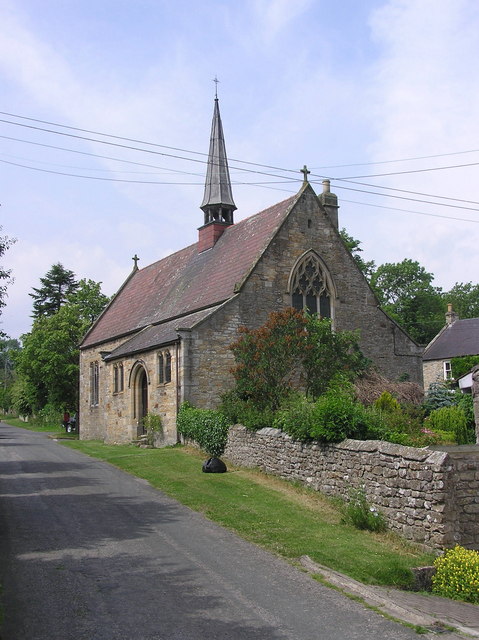
 The Church of St James, built in 1897, architect W.S. Hicks
Dalton is founded on a farming community, both arable and stock, and nestles on a stream or beck which is a tributary of the River Swale. The Dalton & Gayles Village Hall, which is shared with the neighbouring village of Gayles, is located in Dalton; there is also a Church of England church, St James's, built in 1897.
External links
 Media related to Dalton, Richmondshire at Wikimedia Commons
This Richmondshire location article is a stub. You can help Wikipedia by expanding it.