- Crossford, Fife
-
Coordinates: 56°03′42″N 3°30′06″W / 56.06167°N 3.50167°W
Crossford 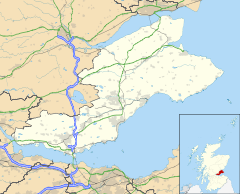
 Crossford
Crossford shown within FifePopulation 2,830 OS grid reference NT068866 Council area Fife Country Scotland Sovereign state United Kingdom Police Fife Fire Fife Ambulance Scottish EU Parliament Scotland UK Parliament Dunfermline and West Fife Scottish Parliament Dunfermline West List of places: UK • Scotland • Crossford is a small village in west Fife, Scotland (population in 1991 was 2830).[1]
It is situated one mile (1.6 km) west of Dunfermline, east of Cairneyhill, astride the A994 (Main Street), at 56°03′51″N 03°29′47″W / 56.06417°N 3.49639°W. It is just over twelve miles (19 km) from Edinburgh. The village has mixed housing with a large housing estate on the southwest end (referred to locally as the 'Wimpey Estate'). Most residents work either locally or commute to Edinburgh or Glasgow, the village sits on the main bus route from Fife to Central Glasgows' Buchanan Bus Station.
Contents
Local facilities
 Crossford Main Street looking West on a cold morning in March 2006
School and community
Crossford Primary School was built in 1973 replacing the old school that was located on the North side of the A994 half way between Cairneyhill and Crossford.[2] The school has ten teaching areas in a semi-open plan arrangement, plus a separate nursery class. There is a grass playing field for football and other sports. There is also a village hall, and a Scout hall (with Scouts and Girl Guides held weekly).
The highlight of the social year in Crossford is probably the annual Children's Gala event every summer. Held for over 60 years this event is organised by the local community council and Galla commity involving children from the village school and a day of events.
Businesses and employment
Businesses in the village include the local Post Office, The Crossford Masterchef Chip Shop, a hairdresser (Scissors), a small supermarket (David Sands) and two hotels. The Pitfirrane Arms Hotel is in the centre of the village and is one of the few original Coaching Inns left in Scotland.[3] The Keavil House Hotel stands in 12 acres (49,000 m2) of grounds to the west of Crossford[4] and its meeting facilities, restaurant and health club with swimming pool are an amenity for the village and surrounding area.
Sport
Crossford boasts the King George V Memorial Park playing fields, opened in 1950 by the Countess of Elgin. The land was gifted by the Halkett family of the Pitfirrane Estate. The community itself paid for the establishing of the facilities together with a Major Fiddes of the National Playing Fields Association. New sports facilities in King George V Memorial Park were unveiled on 8 May 2005.[5] The floodlit, all-weather multi court was proposed by Crossford Recreation and the Environment, and will be used by schools and the community for five-a-side football, tennis, basketball, hockey and netball.
To the southeast of Crossford the Dunfermline Golf Club[6] has an 18-hole golf course. The Halkett family owned the Pitfirrane Estate until 1951, living in the Pitfirrane Castle which has become the clubhouse.[1]
History
Crossford can trace it's history back into the distant past with Bronze Age discoveries having been made on Craigs Farm indicating agricultiural activity into antiquity.[7] Crossford is said to take its name from the ford crossed by monks on their way between the abbeys of Dunfermline and Culross.[1] and together with the early agricultural activity this seems to form the main part of the activity in the village. In the 16th century the village found a new life as Coal and Iron Stone were mined from the lands of Pitfirrane under a charter granted to the Lairds of Pitfirrane (The Halkett family) by Queen Mary. The produce of this activity was then transported down the Waggon Road to Limekilns for shipping via the port there. The Halketts enjoyed a privilege to ship free of duty to all foreign lands until 1788, when the government purchased the right for £40'000. The uppermost 4 inches and lowermost 2 inches of ironstone were said to be of such high quality as to be suitable for the making of Canon, and the produce was shipped to the Carron Company Ironworks for that purpose.[7]
The introduction of the Turnpike Act in 1796 brought about the installation of a Tollbar on the Waggon Road. The building housing this still exists on the crossroads in the centre of the village.
At the beginning of the 19th century it is recorded that some 50 handloom were in use in the village with a population of 380 persons. This follows a pattern in the area for such weaving communities, another example being Gowkhall a few miles North.
An 1856 map[8][9] shows a brewery at the west end of the village, and Whinstone Quarry to the north of the main road.
During World War I the modern day Keavil House Hotel was used by the Admiralty as a location to base high ranking officers, the navalbase at Rosyth (Rosyth Dockyard) being of much greater size and importance at the time. During 1917 the First Sea Lord, Prince Louis of Battenburg and his son (Earl Mountbatten of Burma) were in residence when their names were officially changed to Mountbatten in order to reduce the Germanic image. This was very common in the UK at the time given the situation of total war being persecuted against Germany. Prince Louis wrote in the visitors book at Keavil "July 9th: arrived Prince Hyde. July19th: departed Lord Jekyll."
Crossford also boasts the Pitfirrane Castle, a 16th century 4 storey Towerhouse. In modern times this has become home to the Dunfermline Golf Club. The building has been modified and extended in recent years, but still maintains some impressive stained glass and much of its original stature.
Nature
Crossford lies on low ground which to the south of the village was actually a loch in antiquity, stretching as far as Crombie. The land is fertile and sought after for agriculture.
A local plant of note is Giant Hogweed, a potentailly dangerous skin burning plant widespread to the south of the village in boggy areas. Whilst not a notifiable plant under DEFRA it is listed in the Wildlife and Countryside Act 1981.
Useful Information
- Telephone area code: 01383 (Dunfermline)
- Post Code: KY12 area (Dunfermline)
External links
References
- ^ a b c "Crossford". Gazetteer for Scotland. 1995-2007. http://www.scottish-places.info/towns/townfirst30.html. Retrieved 2007-03-10.
- ^ "Building". Crossford Primary School, 2010–11. Fife Council Education Service. p. 6. http://www.fifedirect.org.uk/uploadfiles/Publications/c64_CrossfordPrimarySchoolBooklet.pdf. Retrieved 9 July 2010.
- ^ "The Pitfirrane Hotel". http://www.pitfirranehotel.com/main.html. Retrieved 2007-03-10.
- ^ "hotels in Dunfermline, Fife : Keavil House hotel with health club". Best Western. 2007. http://www.keavilhouse.co.uk/. Retrieved 2007-03-10.
- ^ "New Pars boss to launch sports facilities for Crossford". Sport Scotland. 2005. http://www.sportscotland.org.uk/ChannelNavigation/News/TopicNavigation/Press+Releases/Articles/New+Pars+boss+to+launch+sports+facilities+for+Crossford.htm. Retrieved 2007-03-10.
- ^ "Dunfermline Golf Club". 2007. http://www.dunfermlinegolfclub.com/. Retrieved 2007-03-10.
- ^ a b Pitcairn, Sheila (2000). A History of The old "Fitpaths" and streets of Dunfermline then, and now. Kelso Graphics. ISBN 0952126420.
- ^ "Old Maps". old-maps.co.uk. 1856. http://www.old-maps.co.uk/oldmaps/index_external.jsp?easting=306800&northing=686700. Retrieved 2007-03-10.[dead link]
- ^ "1856 map of Crossford". old-maps.co.uk. 1856. http://www.old-maps.co.uk/oldmaps/servlet/RawImageServlet?application=oldmaps&command=omStartup.sh&operation=display&save=OFF&imageList=/datar/raid6/66fife1/ep1/66035001.TIF&projParams=33%2032767%202%209%206377563.3959999997%200.0066705398%201.0000000000%200.0000000000%20-3.2954397202%2056.2455482483%200.0000000000%200.0000000000%200.0000000000%200.0000000000%200.0000000000%200.0000000000%200.0000000000%200.0000000000%200.0000000000&westTM=306461.0&eastTM=307139.0&southTM=686519.2&northTM=686880.8&zoomLevel=1&winWidth=1024&winHeight=768. Retrieved 2007-03-10.[dead link]
Categories:- Villages in Fife
- Fife


Wikimedia Foundation. 2010.