- Croes-goch
-
Coordinates: 51°55′N 5°10′W / 51.92°N 5.17°W
Croesgoch 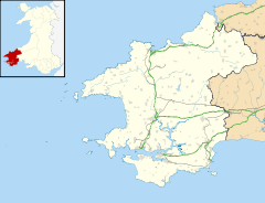
 Croesgoch
Croesgoch shown within PembrokeshirePopulation 400 OS grid reference SM8230 Principal area Pembrokeshire Region Country Wales Sovereign state United Kingdom Postcode district SA62 Dialling code 01348 Police Dyfed-Powys Fire Mid and West Wales Ambulance Welsh EU Parliament Wales UK Parliament Preseli-Pembrokeshire List of places: UK • Wales • Pembrokeshire Croes-goch is a village in North Pembrokeshire, West Wales. It is situated on the A487 between Fishguard and St David's. It lies some 5 miles north east of St Davids on the junction of the A487 St Davids to Fishguard road with the B4330 Llanrhian to Haverfordwest. The village, which has a population of about 155, lies within Llanrhian Community Council area and lies 2 miles to the south of the Pembrokeshire Coast National Park.
Contents
History
There are a number of ancient burial mounds in the general vicinity and a previous site of a windmill. An old private tollgate still stands and is now used as a holiday cottage. Croesgoch lies on one of the pilgrimage routes to St Davids. The special carved stone, Mesur y Dorth, indicates a spot where people shared their bread before the last stage of their journey.
The name of the village is thought to originate from a battle which occurred near the village and resulted in a slaughter and a mythical river of blood that formed a cross - Croes-Goch. The oldest archaeological remains that have been found in the village is a cist burial tomb carbon dated c 500 AD unearthed during building work.
The Baptist Chapel, which is situated near the village centre, was built in 1858 and played a crucial role in village life. Local churches include Llanrhian and Llanhywel.
On an 1842 Tithe Map is shown only a small group of three or so cottages with a building designated as a Chapel. Similarly the 1841 census shows only a small group of 3 cottages.
Over the years the village has grown with building mainly taking place on the Llanrhian,Abereidy and Trefeigan roads.
The Modern Village
The village now has various amenities. There is a bilingual primary school involved in many cultural activities. The Chapel is still functioning with services on a fortnightly basis. There are two art galleries run by well-known artists (one being John Knapp-Fisher). There is a modern inn providing good food and meeting facilities. There is a garage (Forge Garage) for vehicle maintenance and MOTs and a large farm store (Croesgoch Farm Stores). The local pub, The Artramont Arms, offers takeway meals as well as a friendly drinking environment. The post office is temporarily closed, but with regular collections. There is a village general carpenter, metal worker and undertaker. Village people are employed in these activities and many travel further afield for their employment and others are employed in holiday and service industries in the locality. A construction company (Carreg Construction) is based in the village and building work is carried out in the village also employing some local people.
Culture
The Croesgoch Garden Show committee organises the annual show which takes place at the school. This has been running for 65 years. Other events include fireworks (which is organised by the pub in the field next to Felinwynt), carol singing, the nearby church fete in Llanrhian which takes place in August and Llanhywel Church Strawberry Fair and the school summer fete in July, and women come together to recite poetry. Every year in the month of June a vintage tractor run is held in Croesgoch and it attracts much local interest.
References
Categories:- Villages in Pembrokeshire

Wikimedia Foundation. 2010.