- Craven Fault
-
The Craven Fault is the name applied by geologists to the group of crustal faults in the Pennines that form the south edge of the Askrigg Block. It is evident at the surface in the contrast of limestone with millstone grit. It is coincident with the south edge of the Yorkshire Dales National Park and the north edge of the Bowland Fells. It is the formative event of the Craven Basin and also of the upper part of the Aire Gap.
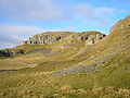
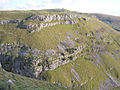
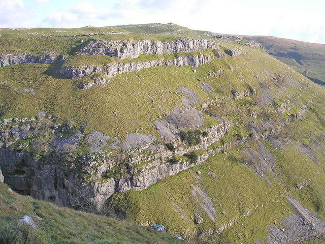
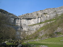 Malham Cove reveals the Middle Craven Fault
Contents
Location
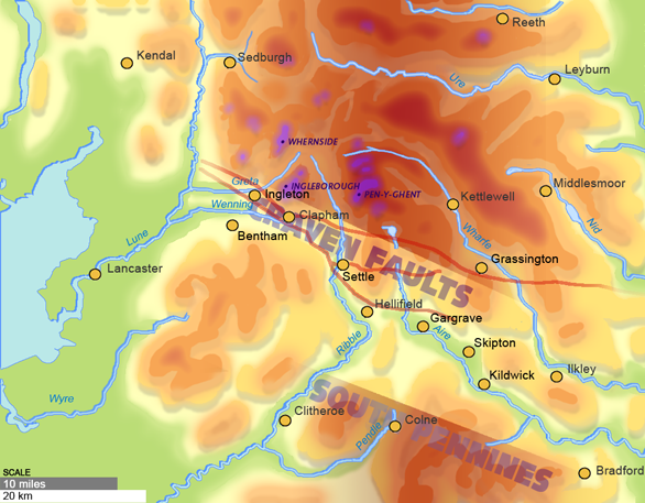
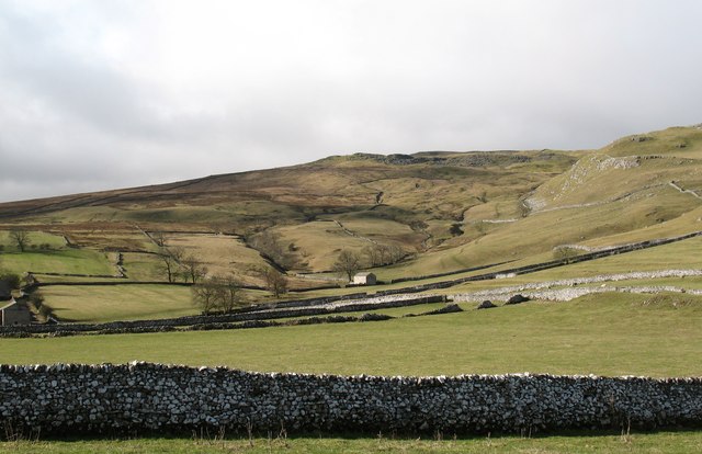
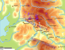 The Craven Faults define the North edge of the Craven Basin and the Aire Gap
The Craven Faults are major cracks across the Pennines that reformed the North of England dramatically. These faults constitute a zone crossing the backbone of England from west to east commencing near Leck, Lancashire at 54°11′26″N 2°31′38″W / 54.190507°N 2.527339°W then branching three ways:
- The North Craven Fault extends about 50 kilometres (30 mi) to 54°04′26″N 1°48′00″W / 54.074°N 1.800°W.
- The Mid Craven Fault extends about 36 kilometres (20 mi) to 54°04′12″N 2°04′30″W / 54.070°N 2.075°W.
- The South Craven Fault extends about 39 kilometres (20 mi) to 54°03′58″N 2°02′31″W / 54.066°N 2.042°W.[1][2]
Craven Basin
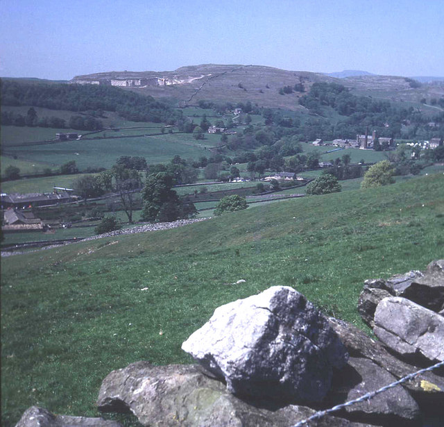
The Craven Faults form a low-altitude pass, also called the Aire Gap, through inhospitable highlands. This broad trough separates the limestone Yorkshire Dales from the Bowland Fells and the Millstone Grit plateaux of the South Pennines.[3] The Craven Basin coincides with most of the civic District of Craven.
Geological age
The Fault group comprises the North Craven Fault, Middle Craven Fault and South Craven Fault. The Middle Craven Fault moved mainly during Carboniferous times and marks the southern limit of the Askrigg Block. However the North and South Faults continued to be active into post-Triassic times.[2]:16 The Great Scar Limestone is exposed along the Middle Craven Fault at Malham Cove, Gordale Scar[3] and along the South Craven Fault at Giggleswick Scar.
Erosion
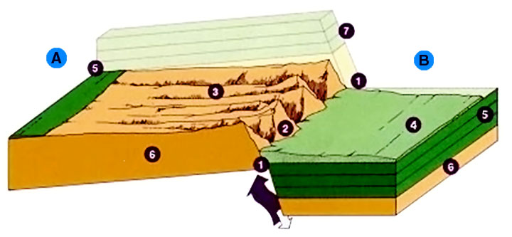
 A. Upthrown Fault Block; B. Downthrown Fault Block; 1. Fault Zone; 2. Steep face; 3. Gentle slope; 4. Valley filled with eroded surface runoff; 5. Sedimentary rock layers; 6. Bedrock; 7. Sedimentary rock layers worn away; these matched layers 5.
 The only evidence of the fault line here is that the central hill is of sandstone whereas that on the right is of Limestone.
The Great Scar Limestone is over 200 metres thick and the overlying Yoredale Series was over 300 metres thick before weathering.[4]:12
The vertical throw of the fault zone is up to 1,800 m (5,906 ft).
Charles Darwin used the Craven Fault to illustrate how nature can so well conceal dramatic events: "The Craven Fault, for instance, extends for upwards of 30 miles, and along this line the vertical displacement of strata has varied from 600 to 3000 feet"[5] but due to erosion of surface features comparatively little of that height-difference remains evident.
Gallery
-
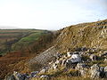
Giggleswick Scar
-

View NW across Ribble to Giggleswick Scar
-
Warrendale Knotts
-
Cross Field Knotts
References
- ^ [1] British Geological Survey, Geology of England and IOM, DiGMapGB625, data NERC 2008
- ^ a b Wilson, Alfred (1992). Geology of the Yorkshire Dales National Park. Grassington: Yorkshire Dales National Park Committee. ISBN 0905455347.:2
- ^ a b Donkin, Kevin (2006). Circular Walks Along the Pennine Way. London: Frances Lincoln Ltd. ISBN 978-0-7112-2665-4.
- ^ Kelsall, Dennis; Jan Kelsall (2008). The Yorkshire Dales: South and West. Milnthorpe: Cicerone. ISBN 978-1-85284-45-1.
- ^ Darwin, Charles. "On the Imperfection of the Geological Record [XIV]". On the Origin of Species.
External links
- "The Craven Fault". www.yorkshire-dales.com. http://www.yorkshire-dales.com/craven-fault.html. Retrieved 2009-09-14.
- Map of Wharfedale section of the fault area
Categories:- Geography of North Yorkshire
- North Yorkshire geography stubs


Wikimedia Foundation. 2010.