- Malham Cove
-
Coordinates: 54°04′15″N 2°09′31″W / 54.070833°N 2.158611°W
Malham Cove 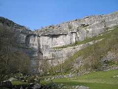
 Malham Cove
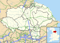
 Malham Cove shown within North Yorkshire
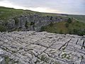
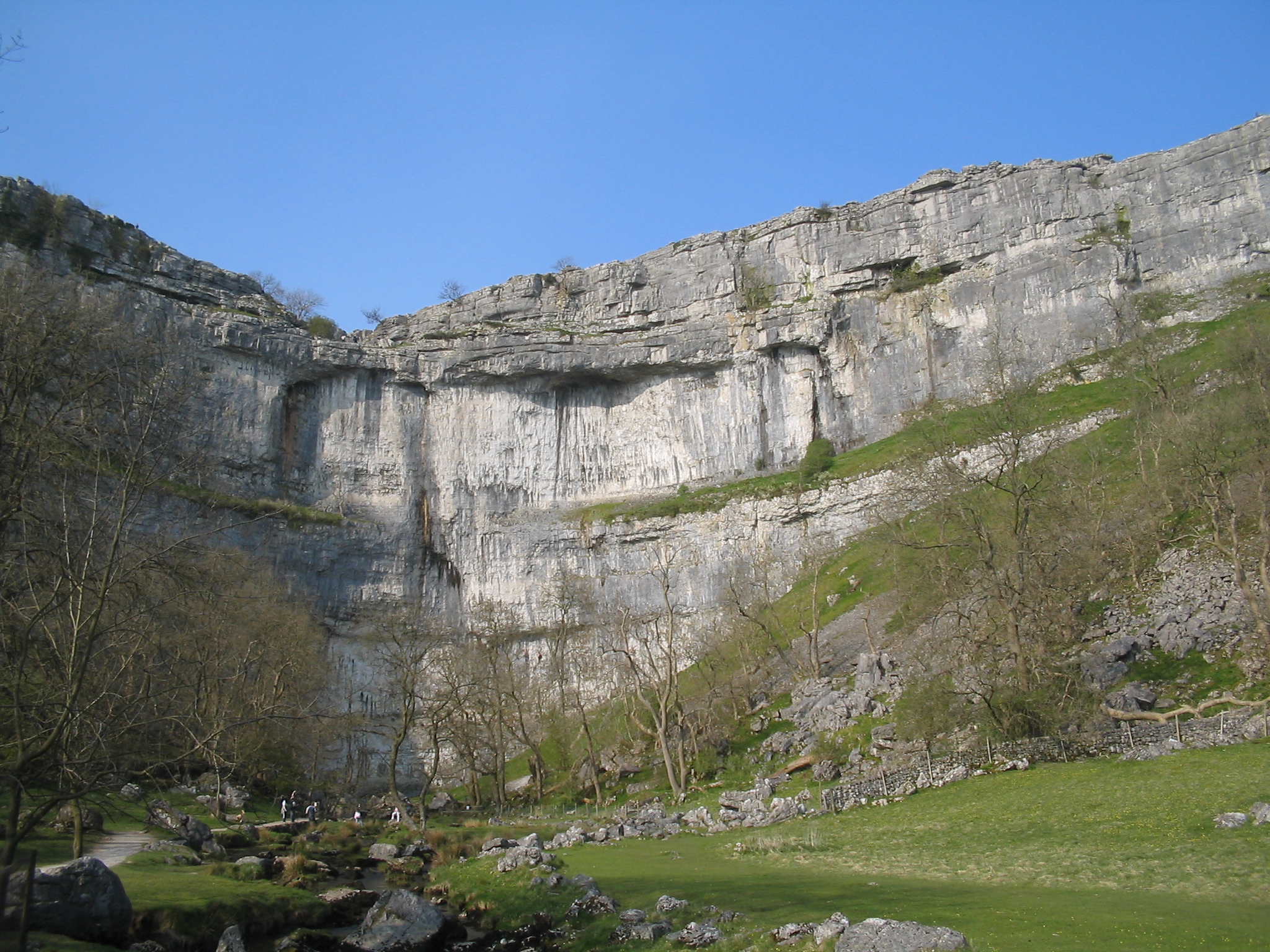
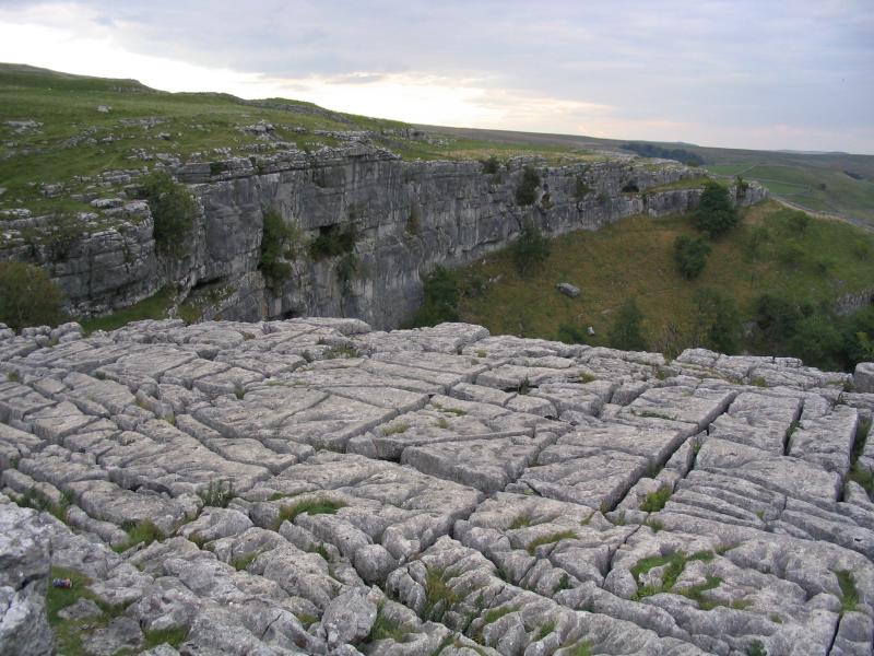
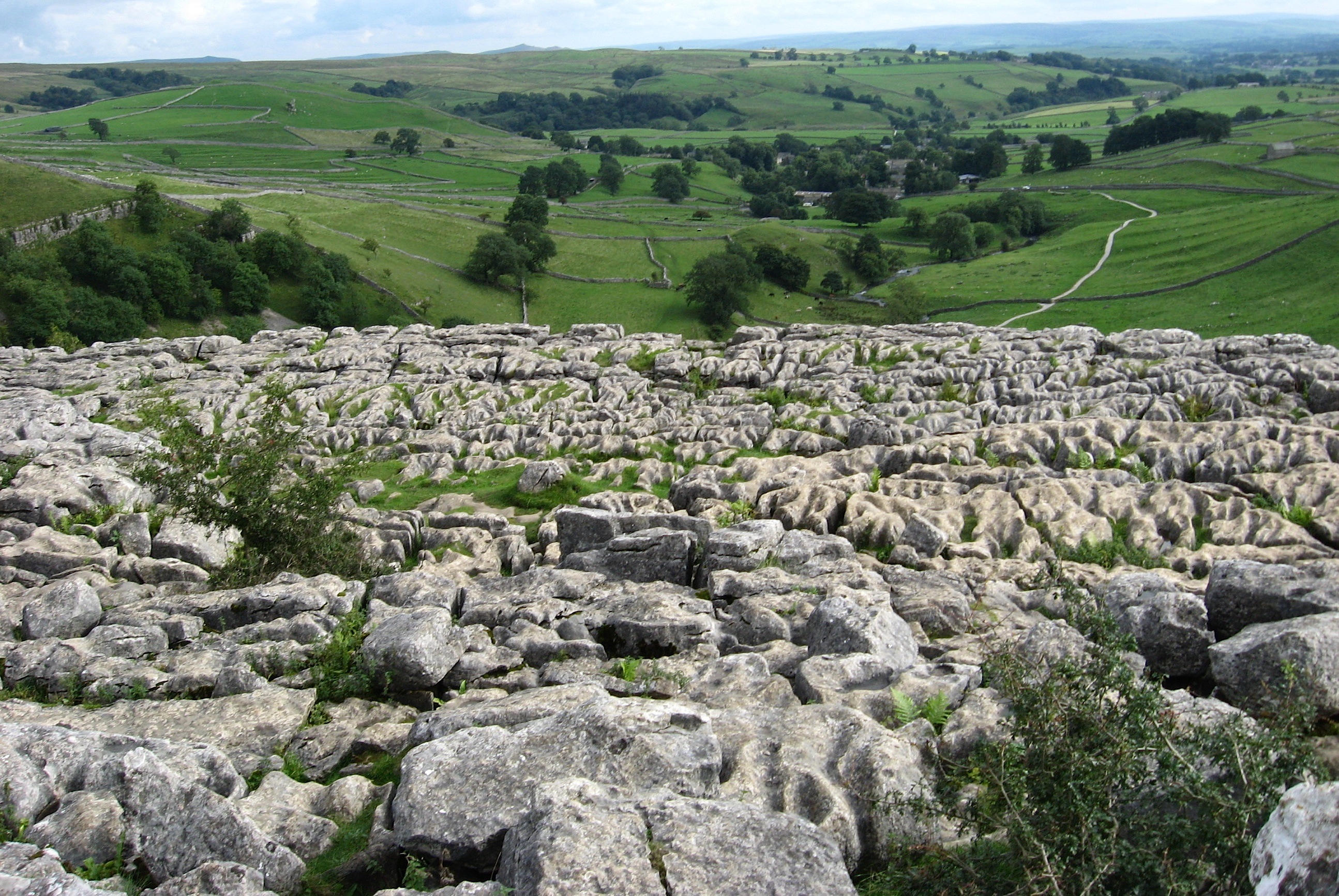
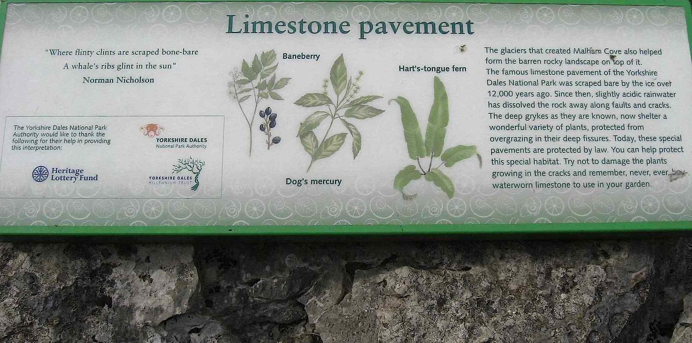
OS grid reference SD896639 List of places: UK • England • North Yorkshire Malham Cove is a natural limestone formation 1 km north of the village of Malham, North Yorkshire, England. A well-known beauty spot, it is a large, curved limestone cliff at the head of a valley, with a fine area of limestone pavement at the top.
Describing the cove in 1779, Adam Walker said, "This beautiful rock is like the age-tinted wall of a prodigious castle; the stone is very white, and from the ledges hang various shrubs and vegetables, which with the tints given it by the bog water. & c. gives it a variety that I never before saw so pleasing in a plain rock."[citation needed]
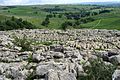
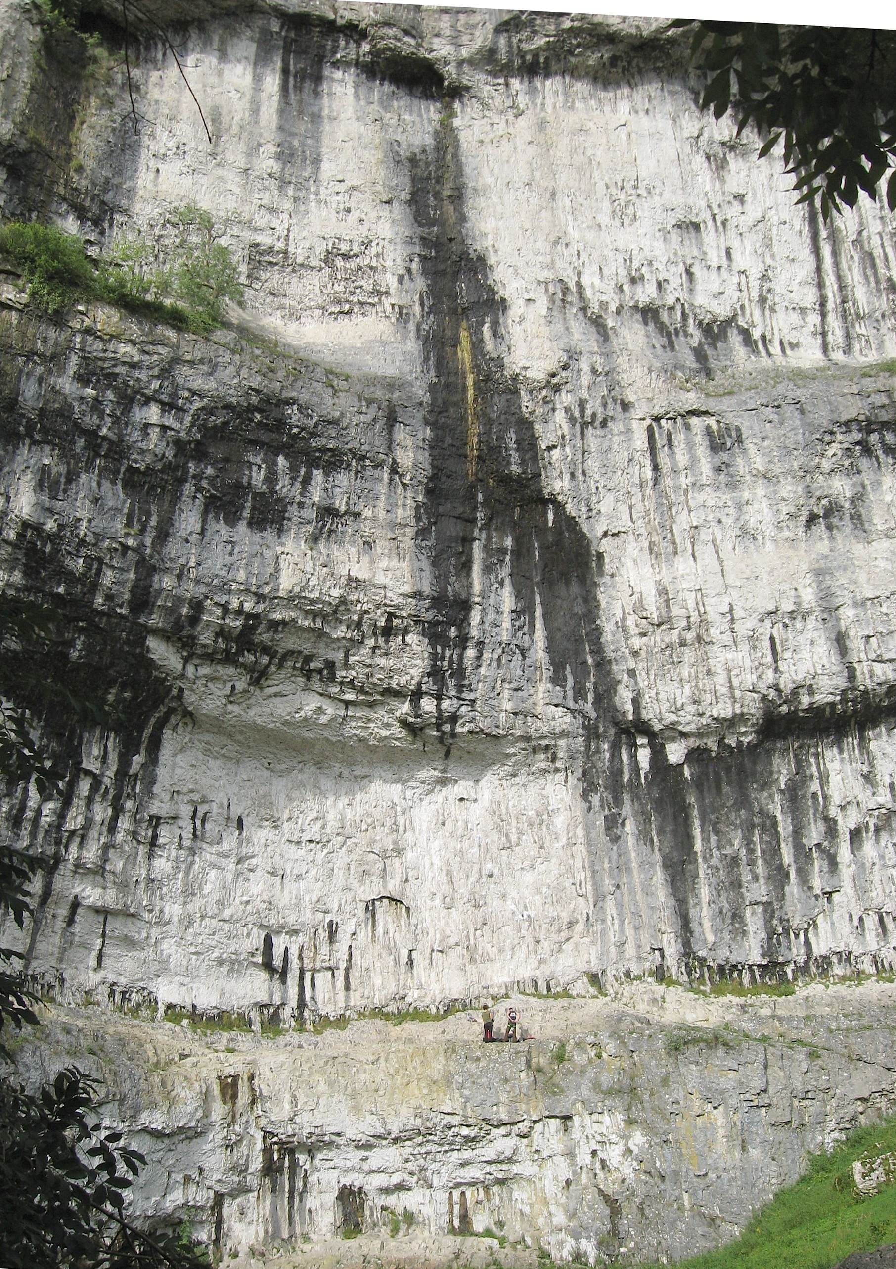
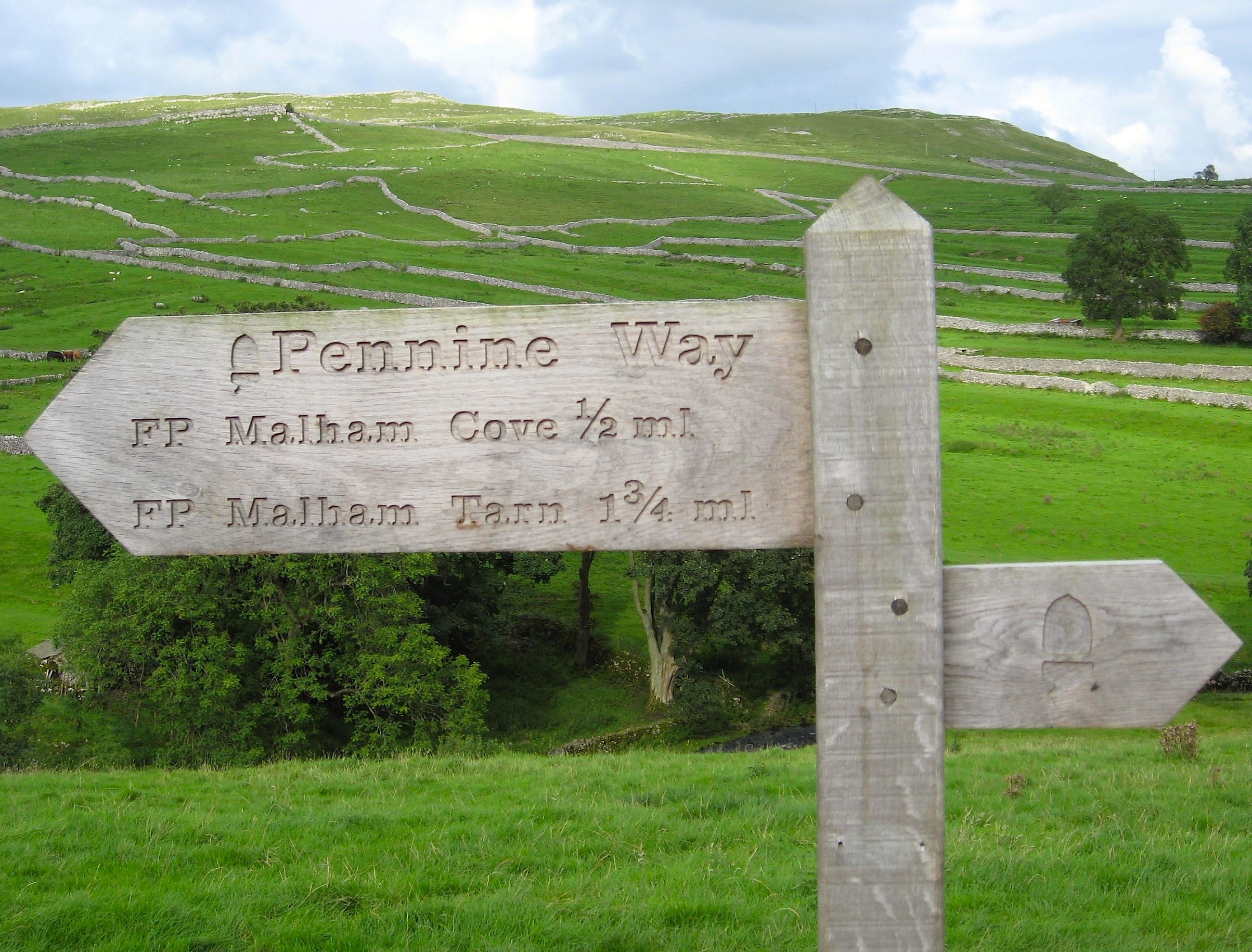
On the west side of the 80 metre (260 foot) high cliff face are about 400 irregular stone steps: these form part of the route of the Pennine Way and lead to an uneven limestone pavement at the top.
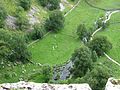
Originally, a large waterfall flowed over the cove as a glacier melted above it. The remnant of a stream which once fell over the cliff now flows out of the lake of Malham Tarn, on the moors 2 km north of the cove. That stream now disappears underground at the aptly named 'Water Sinks', 1.5 kilometres (one mile) before its valley reaches the top of the cove. A stream of a similar size (Malham Beck) emerges from a cave at the bottom of the cove. It used to be assumed that the two streams were one and the same. However, experiments with dyes have now shown that two separate streams go underground at different locations, cross paths without mixing behind the cliff, and re-emerge a couple of kilometres apart. This shows the complexity of the system of caves behind the cliff, which is thought to be around 50,000 years old. Divers have so far explored over 1.6 km [1] of cave passage entered from the base of the cove.
The lip of the cove has been more heavily eroded than the sides, creating a curved shape. A colossal amount of water used to flow over this waterfall, which measures 80 m (260 ft) high and over 300 m (1000 ft) wide. Nowadays the underlying cave systems have a large enough capacity to swallow any flood waters before it reaches the fall. The last record of water flowing over the fall in any kind of volume dates back to a period of heavy rain in the early 19th century.
The valley was formed at the end of the last ice age when the ground was frozen. The frozen ground meant that meltwater from the melting ice sheet formed a large river flowing over the surface, eroding the valley that we see today. The water from this river flowed over Malham Cove to form a huge waterfall. When the climate warmed around 12,000 years ago the ground thawed and the river in the valley disappeared underground leaving the valley dry as we see it today.
The cove, along with nearby Gordale Scar, was featured in an episode of the BBC TV series Seven Natural Wonders as one of the natural wonders of Yorkshire.
The cove was also featured in the film Harry Potter and the Deathly Hallows (Part 1) as one of the places Hermione and Harry travel to. The scenes were filmed in November 2009.[2]
The limestone pavement and general location of Malham featured in an episode of The Trip starring Steve Coogan and Rob Brydon which aired on BBC2 on 29 November 2010.
-
Limestone pavement at the top of the cove
-
View over cliff edge to Malham Beck below
-
View S over Airedale
-
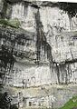
Full cliff face, with climbers for scale
-

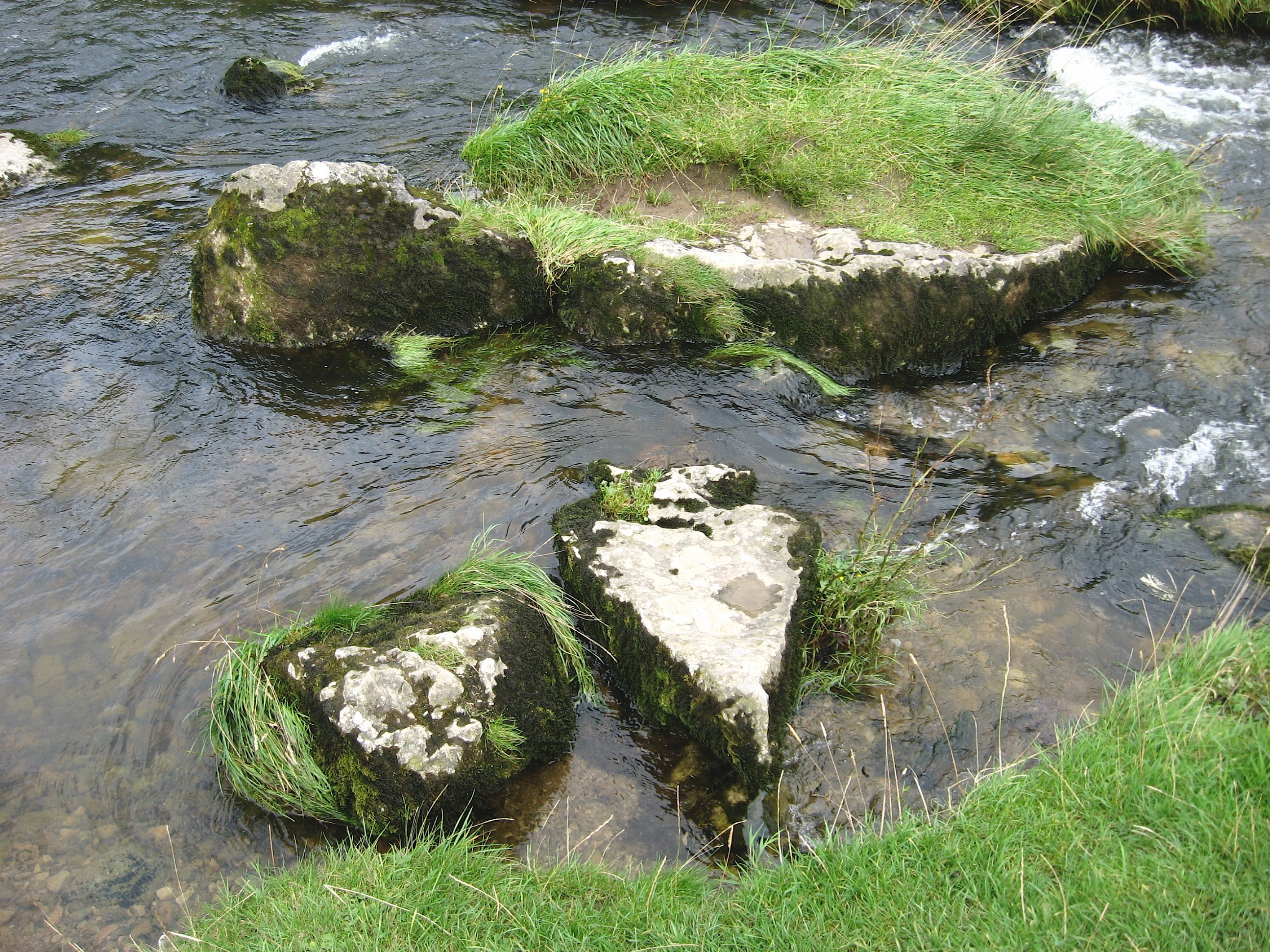
Stones in Malham Beck
-
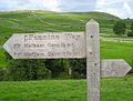
Pennine Way sign
-
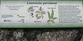
Sign at top of Malham Cove
References
Categories:- Geography of North Yorkshire
- Craven (district)
- Rock formations in England
-


Wikimedia Foundation. 2010.