Yanda County

Yanda County
Yanda
New South Wales
Yanda NSW.PNG
Location in New South Wales
Lands administrative divisions around Yanda
Landsborough Gunderbooka Cowper
Killara Yanda Cowper
Rankin Booroondarra Robinson

Yanda County is one of the 141 Cadastral divisions of New South Wales. The Darling River is the north-western boundary.

The name Yanda is believed to be derived from a local Aboriginal word.[1]

Parishes within this county

A full list of parishes found within this county; their current LGA and mapping coordinates to the approximate centre of each location is as follows:

Parish LGA Coordinates
Bimbera Bourke Shire 30°40′02″S 145°41′39″E / 30.66722°S 145.69417°E / -30.66722; 145.69417 (Bimbera Parish)
Bonita Cobar Shire 30°46′32″S 145°23′35″E / 30.77556°S 145.39306°E / -30.77556; 145.39306 (Bonita Parish)
Booroondara Cobar Shire 31°04′55″S 145°22′13″E / 31.08194°S 145.37028°E / -31.08194; 145.37028 (Booroondara Parish)
Bright Cobar Shire 31°00′35″S 145°02′49″E / 31.00972°S 145.04694°E / -31.00972; 145.04694 (Bright Parish)
Brookong Cobar Shire 31°02′19″S 145°37′19″E / 31.03861°S 145.62194°E / -31.03861; 145.62194 (Brookong Parish)
Buckwaroon Cobar Shire 31°13′41″S 145°17′21″E / 31.22806°S 145.28917°E / -31.22806; 145.28917 (Buckwaroon Parish)
Bundaline Cobar Shire 31°03′46″S 145°14′50″E / 31.06278°S 145.24722°E / -31.06278; 145.24722 (Bundaline Parish)
Canpadore Bourke Shire 30°53′06″S 144°51′15″E / 30.885°S 144.85417°E / -30.885; 144.85417 (Canpadore Parish)
Cookadini Cobar Shire 31°12′21″S 145°27′41″E / 31.20583°S 145.46139°E / -31.20583; 145.46139 (Cookadini Parish)
Cumbedore Bourke Shire 30°46′53″S 144°49′26″E / 30.78139°S 144.82389°E / -30.78139; 144.82389 (Cumbedore Parish)
Darling Bourke Shire 30°42′22″S 144°55′32″E / 30.70611°S 144.92556°E / -30.70611; 144.92556 (Darling Parish)
Derrina Cobar Shire 30°48′51″S 145°09′45″E / 30.81417°S 145.1625°E / -30.81417; 145.1625 (Derrina Parish)
Dootheboy Cobar Shire 30°56′56″S 144°57′15″E / 30.94889°S 144.95417°E / -30.94889; 144.95417 (Dootheboy Parish)
Dunlop Bourke Shire unknown
Elutha Cobar Shire 31°09′58″S 145°33′28″E / 31.16611°S 145.55778°E / -31.16611; 145.55778 (Elutha Parish)
Emu Cobar Shire 31°00′19″S 145°11′41″E / 31.00528°S 145.19472°E / -31.00528; 145.19472 (Emu Parish)
Gellabudda Bourke Shire 30°42′17″S 145°17′21″E / 30.70472°S 145.28917°E / -30.70472; 145.28917 (Gellabudda Parish)
Ginnewandinia Bourke Shire 30°38′20″S 145°29′39″E / 30.63889°S 145.49417°E / -30.63889; 145.49417 (Ginnewandinia Parish)
Gonella Bourke Shire 30°47′03″S 145°40′38″E / 30.78417°S 145.67722°E / -30.78417; 145.67722 (Gonella Parish)
Goonie Bourke Shire 30°40′36″S 145°25′28″E / 30.67667°S 145.42444°E / -30.67667; 145.42444 (Goonie Parish)
Gumhall Cobar Shire 30°51′55″S 145°44′44″E / 30.86528°S 145.74556°E / -30.86528; 145.74556 (Gumhall Parish)
Gundabooka Bourke Shire 30°48′57″S 145°48′36″E / 30.81583°S 145.81°E / -30.81583; 145.81 (Gundabooka Parish)
Keirangunyah Cobar Shire 30°57′47″S 145°19′14″E / 30.96306°S 145.32056°E / -30.96306; 145.32056 (Keirangunyah Parish)
Kenindee Cobar Shire 31°05′41″S 145°03′42″E / 31.09472°S 145.06167°E / -31.09472; 145.06167 (Kenindee Parish)
Kerie Bourke Shire 30°32′47″S 145°14′47″E / 30.54639°S 145.24639°E / -30.54639; 145.24639 (Kerie Parish)
Lenakka Cobar Shire 30°56′56″S 145°36′45″E / 30.94889°S 145.6125°E / -30.94889; 145.6125 (Lenakka Parish)
Maranoa Cobar Shire 31°02′18″S 145°28′23″E / 31.03833°S 145.47306°E / -31.03833; 145.47306 (Maranoa Parish)
Merrere Cobar Shire 30°57′59″S 145°47′59″E / 30.96639°S 145.79972°E / -30.96639; 145.79972 (Merrere Parish)
Meutherra Cobar Shire 31°03′14″S 145°34′14″E / 31.05389°S 145.57056°E / -31.05389; 145.57056 (Meutherra Parish)
Mitchell Bourke Shire 30°35′27″S 145°33′31″E / 30.59083°S 145.55861°E / -30.59083; 145.55861 (Mitchell Parish)
Momble Cobar Shire 31°09′08″S 145°06′52″E / 31.15222°S 145.11444°E / -31.15222; 145.11444 (Momble Parish)
Mookalimbirria Cobar Shire 31°01′44″S 145°50′30″E / 31.02889°S 145.84167°E / -31.02889; 145.84167 (Mookalimbirria Parish)
Mulga Cobar Shire 30°51′02″S 145°21′06″E / 30.85056°S 145.35167°E / -30.85056; 145.35167 (Mulga Parish)
Mulya Cobar Shire 30°53′42″S 145°12′46″E / 30.895°S 145.21278°E / -30.895; 145.21278 (Mulya Parish)
Narwarre Cobar Shire 30°53′21″S 145°25′07″E / 30.88917°S 145.41861°E / -30.88917; 145.41861 (Narwarre Parish)
Pangunya Cobar Shire 31°15′29″S 145°08′16″E / 31.25806°S 145.13778°E / -31.25806; 145.13778 (Pangunya Parish)
Penilui Bourke Shire 30°48′24″S 145°36′14″E / 30.80667°S 145.60389°E / -30.80667; 145.60389 (Penilui Parish)
Pulpulla Cobar Shire 31°10′14″S 145°14′16″E / 31.17056°S 145.23778°E / -31.17056; 145.23778 (Pulpulla Parish)
Ramsay Cobar Shire 30°58′31″S 145°56′54″E / 30.97528°S 145.94833°E / -30.97528; 145.94833 (Ramsay Parish)
Runker Cobar Shire 30°55′55″S 145°52′13″E / 30.93194°S 145.87028°E / -30.93194; 145.87028 (Runker Parish)
Salisbury Bourke Shire 30°47′02″S 145°00′09″E / 30.78389°S 145.0025°E / -30.78389; 145.0025 (Salisbury Parish)
Tatiara Bourke Shire 30°28′41″S 145°20′46″E / 30.47806°S 145.34611°E / -30.47806; 145.34611 (Tatiara Parish)
Tigeralba Bourke Shire 30°34′13″S 145°23′42″E / 30.57028°S 145.395°E / -30.57028; 145.395 (Tigeralba Parish)
Tinderra Cobar Shire 31°02′08″S 145°56′28″E / 31.03556°S 145.94111°E / -31.03556; 145.94111 (Tinderra Parish)
Toburra Cobar Shire 30°53′36″S 145°37′59″E / 30.89333°S 145.63306°E / -30.89333; 145.63306 (Toburra Parish)
Trethella Bourke Shire 30°50′41″S 145°31′40″E / 30.84472°S 145.52778°E / -30.84472; 145.52778 (Trethella Parish)
Tyngin Cobar Shire 30°55′39″S 145°29′11″E / 30.9275°S 145.48639°E / -30.9275; 145.48639 (Tyngin Parish)
Warrego Bourke Shire 30°29′40″S 145°31′09″E / 30.49444°S 145.51917°E / -30.49444; 145.51917 (Warrego Parish)
Winbar Bourke Shire unknown
Winderra Bourke Shire 30°39′04″S 145°18′52″E / 30.65111°S 145.31444°E / -30.65111; 145.31444 (Winderra Parish)
Wittagoona Cobar Shire 31°08′35″S 145°25′04″E / 31.14306°S 145.41778°E / -31.14306; 145.41778 (Wittagoona Parish)
Woodhouse Cobar Shire 31°06′04″S 145°51′42″E / 31.10111°S 145.86167°E / -31.10111; 145.86167 (Woodhouse Parish)
Woolla Bourke Shire 30°25′00″S 145°28′51″E / 30.4166667°S 145.48083°E / -30.4166667; 145.48083 (Woolla Parish)
Yanda Bourke Shire 30°31′17″S 145°36′29″E / 30.52139°S 145.60806°E / -30.52139; 145.60806 (Yanda Parish)
Yandagulla Bourke Shire 30°30′55″S 145°11′12″E / 30.51528°S 145.18667°E / -30.51528; 145.18667 (Yandagulla Parish)

References

  1. ^ Geographical Names Board of NSW

Wikimedia Foundation. 2010.

Игры ⚽ Нужно сделать НИР?

Look at other dictionaries:

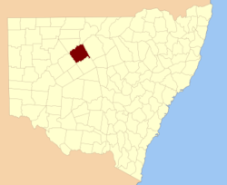
  • Yanda County, New South Wales — Infobox Australian cadastral name = Yanda state = New South Wales caption = Location in New South Wales near nw = Landsborough near n = Gunderbooka near ne = Cowper near e = Cowper near se = Robinson near s = Booroondarra near sw = Rankin near w …   Wikipedia

  • Robinson County — Map of all coordinates from Google Map of all coordinates from Bing Export all coordinates as KML …   Wikipedia

  • Deng Yanda — (simplified Chinese: 邓演达; traditional Chinese: 鄧演達; Mandarin Pinyin: Dèng Yǎndá; Jyutping: dang6 jin2daat6, 1 March 1895 29 November 1931) was a military officer in the Chinese Nationalist Party. He broke with party leaders in 1927, denouncing… …   Wikipedia

  • Robinson County, New South Wales — Infobox Australian cadastral name = Robinson state = New South Wales caption = Location in New South Wales near nw = Yanda near n = Yanda near ne = Cowper near e = Canbelego near se = Flinders near s = Mouramba near sw = Booroondarra near w =… …   Wikipedia

  • Clyde County — Map of all coordinates from Google Map of all coordinates from Bing Export all coordinates as KML …   Wikipedia

  • Cowper County, New South Wales — Infobox Australian cadastral name = Cowper state = New South Wales caption = Location in New South Wales near nw = Gunderbooka near n = Gunderbooka near ne = Clyde near e = Clyde near se = Canbelego near s = Robinson near sw = Yanda near w =… …   Wikipedia

  • Killara County, New South Wales — Infobox Australian cadastral name = Killara state = New South Wales caption = Location in New South Wales near nw = Fitzgerald near n = Fitzgerald near ne = Landsborough near e = Yanda near se = Rankin near s = Werunda near sw = Young near w =… …   Wikipedia

  • Landsborough County, New South Wales — Infobox Australian cadastral name = Landsborough state = New South Wales caption = Location in New South Wales near nw = Ularara near n = Barrona near ne = Gunderbooka near e = Gunderbooka near se = Yanda near s = Rankin near sw = Killara near w …   Wikipedia

  • Rankin County, New South Wales — Infobox Australian cadastral name = Rankin state = New South Wales caption = Location in New South Wales near nw = Killara near n = Landsborough near ne = Yanda near e = Robinson near se = Booroondarra near s = Woore near sw = Werunda near w =… …   Wikipedia

  • Cowper County — Cowper New South Wales Location in New South Wales Lands administrative divisions around Cowper …   Wikipedia

Share the article and excerpts

Direct link
Do a right-click on the link above
and select “Copy Link”