Yantara County

Yantara County
Yantara
New South Wales
Yantara NSW.PNG
Location in New South Wales
Lands administrative divisions around Yantara
Tongowoko Tongowoko Delalah
Evelyn Yantara Ularara
Mootwingee Yungnulgra Fitzgerald

Yantara County is one of the 141 Cadastral divisions of New South Wales.

The name Yantara is believed to be derived from a local Aboriginal word and is also the name of the local Yantara Station.[1]

Parishes within this county

A full list of parishes found within this county; their current LGA and mapping coordinates to the approximate centre of each location is as follows:

Parish LGA Coordinates
Albert Unincorporated 30°06′33″S 142°21′33″E / 30.10917°S 142.35917°E / -30.10917; 142.35917 (Albert)
Algie Unincorporated 29°51′27″S 142°56′13″E / 29.8575°S 142.93694°E / -29.8575; 142.93694 (Algie)
Banjah Unincorporated 30°10′17″S 142°45′49″E / 30.17139°S 142.76361°E / -30.17139; 142.76361 (Banjah)
Booligurra Unincorporated 29°39′36″S 142°43′55″E / 29.66°S 142.73194°E / -29.66; 142.73194 (Booligurra)
Buona Unincorporated 29°56′19″S 142°35′27″E / 29.93861°S 142.59083°E / -29.93861; 142.59083 (Buona)
Butra Unincorporated 29°55′56″S 142°57′22″E / 29.93222°S 142.95611°E / -29.93222; 142.95611 (Butra)
Clifton Unincorporated 29°45′11″S 142°36′09″E / 29.75306°S 142.6025°E / -29.75306; 142.6025 (Clifton)
Coallie Unincorporated 29°54′48″S 142°06′40″E / 29.91333°S 142.11111°E / -29.91333; 142.11111 (Coallie)
Cobham Unincorporated 30°20′36″S 142°11′53″E / 30.34333°S 142.19806°E / -30.34333; 142.19806 (Cobham)
Cockulby Unincorporated 30°02′05″S 142°18′36″E / 30.03472°S 142.31°E / -30.03472; 142.31 (Cockulby)
Gilgwapla Unincorporated 29°57′17″S 142°18′36″E / 29.95472°S 142.31°E / -29.95472; 142.31 (Gilgwapla)
Herbert Unincorporated 29°46′17″S 142°53′54″E / 29.77139°S 142.89833°E / -29.77139; 142.89833 (Herbert)
Kilpara Unincorporated 29°45′18″S 142°11′14″E / 29.755°S 142.18722°E / -29.755; 142.18722 (Kilpara)
Kooltoo Unincorporated 30°03′11″S 142°29′38″E / 30.05306°S 142.49389°E / -30.05306; 142.49389 (Kooltoo)
Kootooloomondoo Unincorporated 30°04′43″S 142°57′22″E / 30.07861°S 142.95611°E / -30.07861; 142.95611 (Kootooloomondoo)
Menderie Unincorporated 30°14′00″S 142°40′58″E / 30.2333333°S 142.68278°E / -30.2333333; 142.68278 (Menderie)
Narnumpy Unincorporated 30°05′25″S 142°35′08″E / 30.09028°S 142.58556°E / -30.09028; 142.58556 (Narnumpy)
Paldrumata Unincorporated 30°11′50″S 142°21′33″E / 30.19722°S 142.35917°E / -30.19722; 142.35917 (Paldrumata)
Pessima Unincorporated 29°53′55″S 142°45′44″E / 29.89861°S 142.76222°E / -29.89861; 142.76222 (Pessima)
Salt Lake Unincorporated 30°06′50″S 142°08′04″E / 30.11389°S 142.13444°E / -30.11389; 142.13444 (Salt Lake)
Takeiwa Unincorporated 29°51′55″S 142°44′04″E / 29.86528°S 142.73444°E / -29.86528; 142.73444 (Takeiwa)
Tarrawonda Unincorporated 29°35′46″S 142°11′25″E / 29.59611°S 142.19028°E / -29.59611; 142.19028 (Tarrawonda)
Teperago Unincorporated 30°11′09″S 142°09′16″E / 30.18583°S 142.15444°E / -30.18583; 142.15444 (Teperago)
Terrawinda Unincorporated 29°40′48″S 142°19′11″E / 29.68°S 142.31972°E / -29.68; 142.31972 (Terrawinda)
Tiltabrinna Unincorporated 29°35′17″S 142°53′50″E / 29.58806°S 142.89722°E / -29.58806; 142.89722 (Tiltabrinna)
Torowoto Unincorporated 29°54′20″S 142°26′04″E / 29.90556°S 142.43444°E / -29.90556; 142.43444 (Torowoto)
Uncana Unincorporated 30°20′06″S 142°48′36″E / 30.335°S 142.81°E / -30.335; 142.81 (Uncana)
Weimbutta Unincorporated 30°04′42″S 142°45′50″E / 30.07833°S 142.76389°E / -30.07833; 142.76389 (Weimbutta)
Whyjonta Unincorporated 29°45′11″S 142°29′48″E / 29.75306°S 142.49667°E / -29.75306; 142.49667 (Whyjonta)
Woombup Unincorporated 30°12′49″S 142°32′44″E / 30.21361°S 142.54556°E / -30.21361; 142.54556 (Woombup)
Wunawunty Unincorporated 29°59′37″S 142°06′40″E / 29.99361°S 142.11111°E / -29.99361; 142.11111 (Wunawunty)
Yandenberry Unincorporated 30°19′15″S 142°26′32″E / 30.32083°S 142.44222°E / -30.32083; 142.44222 (Yandenberry)
Yantara Unincorporated 29°49′31″S 142°16′40″E / 29.82528°S 142.27778°E / -29.82528; 142.27778 (Yantara)

References

  1. ^ Geographical Names Board of NSW

Wikimedia Foundation. 2010.

Игры ⚽ Поможем написать курсовую

Look at other dictionaries:

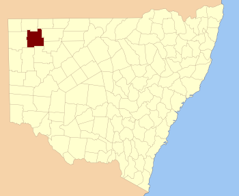
  • Yantara County, New South Wales — Infobox Australian cadastral name = Yantara state = New South Wales caption = Location in New South Wales near nw = Tongowoko near n = Tongowoko near ne = Delalah near e = Ularara near se = Fitzgerald near s = Yungnulgra near sw = Mootwingee near …   Wikipedia

  • Mootwingee County, New South Wales — Infobox Australian cadastral name = Mootwingee state = New South Wales caption = Location in New South Wales near nw = Evelyn near n = Yantara near ne = Yantara near e = Yungnulgra near se = Young near s = Tandora near sw = Yancowinna near w =… …   Wikipedia

  • Tongowoko County, New South Wales — Infobox Australian cadastral name = Tongowoko state = New South Wales caption = Location in New South Wales near nw = Queensland near n = Queensland near ne = Queensland near e = Delalah near se = Yantara near s = Yantara near sw = Evelyn near w …   Wikipedia

  • Ularara County, New South Wales — Infobox Australian cadastral name = Ularara state = New South Wales caption = Location in New South Wales near nw = Delalah near n = Thoulcanna near ne = Irrara near e = Barrona near se = Landsborough near s = Fitzgerald near sw = Yantara near w …   Wikipedia

  • Yungnulgra County, New South Wales — Infobox Australian cadastral name = Yungnulgra state = New South Wales caption = Location in New South Wales near nw = Yantara near n = Yantara near ne = Fitzgerald near e = Killara near se = Killara near s = Young near sw = Mootwingee near w =… …   Wikipedia

  • Mootwingee County — Map of all coordinates from Google Map of all coordinates from Bing Export all coordinates as KML …   Wikipedia

  • Tongowoko County — Map of all coordinates from Google Map of all coordinates from Bing Export all coordinates as KML …   Wikipedia

  • Ularara County — Map of all coordinates from Google Map of all coordinates from Bing Export all coordinates as KML …   Wikipedia

  • Yungnulgra County — Map of all coordinates from Google Map of all coordinates from Bing Export all coordinates as KML …   Wikipedia

  • Delalah County, New South Wales — Infobox Australian cadastral name = Delalah state = New South Wales caption = Location in New South Wales near nw = Queensland near n = Queensland near ne = Queensland near e = Thoulcanna near se = Ularara near s = Ularara near sw = Yantara near… …   Wikipedia

Share the article and excerpts

Direct link
Do a right-click on the link above
and select “Copy Link”