Parry County

Parry County
Parry
New South Wales
Parry NSW.PNG
Location in New South Wales
Lands administrative divisions around Parry
Nandewar Inglis Vernon
Buckland Parry Vernon
Buckland Brisbane Hawes

Parry County is one of the 141 Cadastral divisions of New South Wales. It is bounded by the Peel River and Cockburn River on the north, near Tamworth. The Moonbi Range is on the eastern boundary, and the Peel Range on the western boundary. The Great Dividing Range is the boundary to the south-east. It includes the towns of Dungowan, Woolomin, Piallamore and Nundle.

Parry County was named in honour of Sir William Edward Parry, Commissioner for the Australian Agricultural Company, who selected the area within the county which was granted to what was then called the Peel River Company.[1]

Parishes within this county

A full list of parishes found within this county; their current LGA and mapping coordinates to the approximate centre of each location is as follows:

Parish LGA Coordinates
Ainsley Tamworth Regional Council 31°10′54″S 151°20′04″E / 31.18167°S 151.33444°E / -31.18167; 151.33444 (Ainsley)
Anna Tamworth Regional Council 31°06′54″S 151°15′04″E / 31.115°S 151.25111°E / -31.115; 151.25111 (Anna)
Bective Tamworth Regional Council 30°59′54″S 150°45′04″E / 30.99833°S 150.75111°E / -30.99833; 150.75111 (Bective)
Bullimball Tamworth Regional Council 31°05′54″S 151°12′04″E / 31.09833°S 151.20111°E / -31.09833; 151.20111 (Bullimball)
Calala Tamworth Regional Council 31°08′54″S 150°56′04″E / 31.14833°S 150.93444°E / -31.14833; 150.93444 (Calala)
Callaghan Tamworth Regional Council 31°20′54″S 151°24′04″E / 31.34833°S 151.40111°E / -31.34833; 151.40111 (Callaghan)
Crawney Tamworth Regional Council 31°32′54″S 151°00′04″E / 31.54833°S 151.00111°E / -31.54833; 151.00111 (Crawney)
Dungowan Tamworth Regional Council 31°25′54″S 151°10′04″E / 31.43167°S 151.16778°E / -31.43167; 151.16778 (Dungowan)
Garoo Tamworth Regional Council 31°21′54″S 150°58′04″E / 31.365°S 150.96778°E / -31.365; 150.96778 (Garoo)
Gill Tamworth Regional Council 31°07′50″S 151°05′35″E / 31.13056°S 151.09306°E / -31.13056; 151.09306 (Gill)
Goonoo Goonoo Tamworth Regional Council 31°19′54″S 150°50′04″E / 31.33167°S 150.83444°E / -31.33167; 150.83444 (Goonoo Goonoo)
Loftus Tamworth Regional Council 31°14′54″S 151°20′04″E / 31.24833°S 151.33444°E / -31.24833; 151.33444 (Loftus)
Loomberah Tamworth Regional Council 31°14′54″S 150°59′04″E / 31.24833°S 150.98444°E / -31.24833; 150.98444 (Loomberah)
Moolunmoola Tamworth Regional Council 31°03′54″S 150°40′04″E / 31.065°S 150.66778°E / -31.065; 150.66778 (Moolunmoola)
Moorowara Gunnedah Shire Council 30°56′54″S 150°31′04″E / 30.94833°S 150.51778°E / -30.94833; 150.51778 (Moorowara)
Mulla Tamworth Regional Council 31°07′24″S 151°08′04″E / 31.12333°S 151.13444°E / -31.12333; 151.13444 (Mulla)
Murroon Tamworth Regional Council 31°05′54″S 150°52′04″E / 31.09833°S 150.86778°E / -31.09833; 150.86778 (Murroon)
Nemingha Tamworth Regional Council 31°06′54″S 150°51′04″E / 31.115°S 150.85111°E / -31.115; 150.85111 (Nemingha)
Nundle Tamworth Regional Council 31°29′54″S 151°08′04″E / 31.49833°S 151.13444°E / -31.49833; 151.13444 (Nundle)
Ogunbil Tamworth Regional Council 31°18′24″S 151°16′54″E / 31.30667°S 151.28167°E / -31.30667; 151.28167 (Ogunbil)
Piallamore Tamworth Regional Council 31°11′48″S 151°10′28″E / 31.19667°S 151.17444°E / -31.19667; 151.17444 (Piallamore)
Royinn Tamworth Regional Council 31°21′54″S 151°15′04″E / 31.365°S 151.25111°E / -31.365; 151.25111 (Royinn)
Scott Tamworth Regional Council 31°24′54″S 151°21′04″E / 31.415°S 151.35111°E / -31.415; 151.35111 (Scott)
Somerton Tamworth Regional Council 31°01′08″S 150°37′31″E / 31.01889°S 150.62528°E / -31.01889; 150.62528 (Somerton)
Tamarang Tamworth Regional Council 31°20′54″S 150°53′04″E / 31.34833°S 150.88444°E / -31.34833; 150.88444 (Tamarang)
Tangaratta Tamworth Regional Council 30°58′54″S 150°49′04″E / 30.98167°S 150.81778°E / -30.98167; 150.81778 (Tangaratta)
Timbumburi Tamworth Regional Council 31°15′54″S 150°56′04″E / 31.265°S 150.93444°E / -31.265; 150.93444 (Timbumburi)
Turi Tamworth Regional Council 31°16′54″S 150°51′04″E / 31.28167°S 150.85111°E / -31.28167; 150.85111 (Turi)
Vernon Walcha Council 31°07′54″S 151°20′04″E / 31.13167°S 151.33444°E / -31.13167; 151.33444 (Vernon)
Walcha Tamworth Regional Council 31°15′54″S 151°21′04″E / 31.265°S 151.35111°E / -31.265; 151.35111 (Walcha)
Warral Tamworth Regional Council 31°09′54″S 150°46′04″E / 31.165°S 150.76778°E / -31.165; 150.76778 (Warral)
Winton Tamworth Regional Council 31°06′54″S 150°43′04″E / 31.115°S 150.71778°E / -31.115; 150.71778 (Winton)
Wombramurra Tamworth Regional Council 31°34′43″S 151°06′03″E / 31.57861°S 151.10083°E / -31.57861; 151.10083 (Wombramurra)
Woolomin Tamworth Regional Council 31°16′50″S 151°10′47″E / 31.28056°S 151.17972°E / -31.28056; 151.17972 (Woolomin)
Yeerowin Tamworth Regional Council 31°25′54″S 151°18′04″E / 31.43167°S 151.30111°E / -31.43167; 151.30111 (Yeerowin)

References

  1. ^ Geographical Names Board of NSW

Wikimedia Foundation. 2010.

Игры ⚽ Нужно решить контрольную?

Look at other dictionaries:

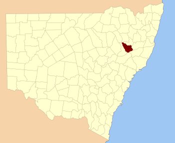
  • Parry County, New South Wales — Infobox Australian cadastral name = Parry state = New South Wales caption = Location in New South Wales near nw = Nandewar near n = Inglis near ne = Vernon near e = Vernon near se = Hawes near s = Brisbane near sw = Buckland near w =… …   Wikipedia

  • Parry — may refer to * Parry County, New South Wales * A parry, a manoeuvre in fencing. * PARRY, a simulation program in artificial intelligence. * The manufacturer of Parry People Movers. * Parry (automobile company), an American manufacturer, based in… …   Wikipedia

  • Parry Sound District —   District   Location of Parry Sound District in Ontario …   Wikipedia

  • Parry —   [ pærɪ],    1) Sir (seit 1898) Charles Hubert Hastings, seit 1903 Baronet, britischer Komponist, * Bournemouth 27. 2. 1848, ✝ Rustington (County West Sussex) 7. 10. 1918; verdient um die Pflege der Werke J. S. Bachs; komponierte Orchesterwerke… …   Universal-Lexikon

  • Parry Wayne Humphreys — (1778 ndash; February 12, 1839), was an American politician who represented Tennessee in the United States House of Representatives. He was born in Staunton, Virginia, but moved with his family to Kentucky in 1789, and later settled in Tennessee …   Wikipedia

  • Parry Sound—Muskoka — Infobox Canada electoral district province = Ontario caption = Parry Sound Muskoka in relation to other Ontario electoral districts fed status = active fed district number = 35069 fed created = 1947 fed abolished = fed election first = 1949 fed… …   Wikipedia

  • Parry Sound District, Ontario — Infobox Settlement official name = Parry Sound District other name = native name = nickname = settlement type = District motto = imagesize = image caption = flag size = image seal size = image shield = shield size = city logo = citylogo size =… …   Wikipedia

  • Parry Sound—Muskoka (provincial electoral district) — Infobox Canada electoral district name = Parry Sound Muskoka province = Ontario caption = prov status = active prov created = 1999 prov abolished = prov election first = 1999 prov election last = 2007 prov rep = Norm Miller prov rep link = prov… …   Wikipedia

  • Parry McCluer High School — Infobox School name= Parry McCluer High School streetaddress= 100 Bradford Drive city= Buena Vista state= Virginia zipcode= 24416 district= Buena Vista City Public Schools principal= Haywood Hand assistant principal(s)= Grafton Young… …   Wikipedia

  • County of Brant — For the defunct provincial electoral district known as Brant County , see Brant (provincial electoral district). County of Brant   Single tier city   Par …   Wikipedia

Share the article and excerpts

Direct link
Do a right-click on the link above
and select “Copy Link”