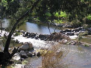
- Cockburn River
-
The Cockburn River (pronounced /ˈkoʊbɚn/) is a river in New South Wales, Australia.
The Cockburn River rises near Woolbrook, New South Wales in the southern New England tablelands. It drains the western side of the Great Dividing Range. It flows generally to the south-west, eventually joining the Peel River at Nemingha, about three kilometres east of the city of Tamworth.
Runoff from the southern side of the Moonbi Range mostly flows to the Cockburn River. There are small areas of irrigated cropping along the banks of the river and the surrounding hills are mostly used for grazing.
The river was first encountered by European explorers on 4 September 1818 during an expedition led by the Surveyor-General of New South Wales, John Oxley, who named the river after Admiral Sir George Cockburn.[1]
The localities of Kootingal, Tintinhull, Moonbi and Limbri are located near the Cockburn River.
A section of the Main North railway line runs along the valley of the Cockburn River.
The Cockburn is also one of the fastest flowing rivers in the southern hemisphere. It is home to fish species such as Catfish,Yellow Belly and unfortunately Carp which have decimated the native fish stocks to the point that they are getting harder to find.
Coordinates: 31°08′S 151°00′E / 31.133°S 151°E
- ^ Oxley, John (1820). Journals of Two Expeditions into the Interior of New South Wales, undertaken by order of the British Government in the Years 1817-18. London: John Murray. p. 286.
Categories:- Rivers of New South Wales
- New South Wales geography stubs
Wikimedia Foundation. 2010.

