- Leichardt County
-
Leichardt
New South Wales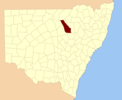
Location in New South WalesLands administrative divisions around Leichardt Narran Finch Baradine Clyde Leichardt Baradine Gregory Ewenmar Gowen Leichardt County is one of the 141 Cadastral divisions of New South Wales. It is located south of the Namoi River and includes land on both sides of the Castlereagh River, including Coonamble.
Leichardt County was named in honour of the Prussian naturalist and explorer Friedrich Wilhelm Ludwig Leichhart (1813-1848).[1]
Parishes within this county
A full list of parishes found within this county; their current LGA and mapping coordinates to the approximate centre of each location is as follows:
References
Categories:- Counties of New South Wales

Wikimedia Foundation. 2010.