Gowen County

Gowen County
Gowen
New South Wales
Gowen NSW.PNG
Location in New South Wales
Lands administrative divisions around Gowen
Leichardt Baradine White
Ewenmar Gowen Napier
Ewenmar Lincoln Napier

Gowen County is one of the 141 Cadastral divisions of New South Wales. It is located to the east of the Castlereagh River in the area to the east of Gilgandra, to Coonabarabran in the north-east. This includes land on both sides of the Newell Highway.

The origin of the name Gowen County is unknown.[1]

Parishes within this county

A full list of parishes found within this county; their current LGA and mapping coordinates to the approximate centre of each location is as follows:

Parish LGA Coordinates
Baby Warrumbungle Shire Council 31°17′54″S 149°30′04″E / 31.29833°S 149.50111°E / -31.29833; 149.50111 (Baby)
Balumbridal Warrumbungle Shire Council 31°20′54″S 149°09′04″E / 31.34833°S 149.15111°E / -31.34833; 149.15111 (Balumbridal)
Bandulla Warrumbungle Shire Council 31°43′54″S 149°08′04″E / 31.73167°S 149.13444°E / -31.73167; 149.13444 (Bandulla)
Bearbong Gilgandra Shire Council 31°38′54″S 148°57′04″E / 31.64833°S 148.95111°E / -31.64833; 148.95111 (Bearbong)
Belar Warrumbungle Shire Council 31°29′54″S 149°15′04″E / 31.49833°S 149.25111°E / -31.49833; 149.25111 (Belar)
Biralbung Gilgandra Shire Council 31°38′54″S 148°48′04″E / 31.64833°S 148.80111°E / -31.64833; 148.80111 (Biralbung)
Bone Bone Warrumbungle Shire Council 31°35′54″S 149°10′04″E / 31.59833°S 149.16778°E / -31.59833; 149.16778 (Bone Bone)
Boyben Gilgandra Shire Council 31°46′54″S 148°52′04″E / 31.78167°S 148.86778°E / -31.78167; 148.86778 (Boyben)
Breelong Gilgandra Shire Council 31°44′54″S 148°48′04″E / 31.74833°S 148.80111°E / -31.74833; 148.80111 (Breelong)
Burrendah Gilgandra Shire Council 31°42′54″S 148°55′04″E / 31.715°S 148.91778°E / -31.715; 148.91778 (Burrendah)
Caigan Warrumbungle Shire Council 31°41′54″S 149°14′04″E / 31.69833°S 149.23444°E / -31.69833; 149.23444 (Caigan)
Callangoan Gilgandra Shire Council 31°29′54″S 148°36′04″E / 31.49833°S 148.60111°E / -31.49833; 148.60111 (Callangoan)
Caraghnan Coonamble Shire Council 31°17′54″S 149°01′04″E / 31.29833°S 149.01778°E / -31.29833; 149.01778 (Caraghnan)
Cobbinbil Coonamble Shire Council 31°18′54″S 148°39′04″E / 31.315°S 148.65111°E / -31.315; 148.65111 (Cobbinbil)
Coonabarabran Warrumbungle Shire Council 31°15′54″S 149°16′04″E / 31.265°S 149.26778°E / -31.265; 149.26778 (Coonabarabran)
Cuttabulloo Warrumbungle Shire Council 31°38′54″S 149°18′04″E / 31.64833°S 149.30111°E / -31.64833; 149.30111 (Cuttabulloo)
Deringulla Warrumbungle Shire Council 31°20′54″S 149°14′04″E / 31.34833°S 149.23444°E / -31.34833; 149.23444 (Deringulla)
Dilly Gilgandra Shire Council 31°31′54″S 148°54′04″E / 31.53167°S 148.90111°E / -31.53167; 148.90111 (Dilly)
Eringanerin Gilgandra Shire Council 31°41′54″S 148°42′04″E / 31.69833°S 148.70111°E / -31.69833; 148.70111 (Eringanerin)
Gowang Warrumbungle Shire Council 31°22′54″S 149°01′04″E / 31.38167°S 149.01778°E / -31.38167; 149.01778 (Gowang)
Greenbah Warrumbungle Shire Council 31°33′54″S 149°19′04″E / 31.565°S 149.31778°E / -31.565; 149.31778 (Greenbah)
Gulargambone Coonamble Shire Council 31°23′54″S 148°14′04″E / 31.39833°S 148.23444°E / -31.39833; 148.23444 (Gulargambone)
Gumin Coonamble Shire Council 31°17′54″S 148°53′04″E / 31.29833°S 148.88444°E / -31.29833; 148.88444 (Gumin)
Gundi Warrumbungle Shire Council 31°17′54″S 149°11′04″E / 31.29833°S 149.18444°E / -31.29833; 149.18444 (Gundi)
Kirban Gilgandra Shire Council 31°31′54″S 149°04′04″E / 31.53167°S 149.06778°E / -31.53167; 149.06778 (Kirban)
Mundar Gilgandra Shire Council 31°31′54″S 148°48′04″E / 31.53167°S 148.80111°E / -31.53167; 148.80111 (Mundar)
Naman Coonamble Shire Council 31°20′54″S 149°00′04″E / 31.34833°S 149.00111°E / -31.34833; 149.00111 (Naman)
Nandi Warrumbungle Shire Council 31°14′54″S 149°13′04″E / 31.24833°S 149.21778°E / -31.24833; 149.21778 (Nandi)
Orandelbinia Warrumbungle Shire Council 31°32′54″S 149°11′04″E / 31.54833°S 149.18444°E / -31.54833; 149.18444 (Orandelbinia)
Piangula Gilgandra Shire Council 31°38′54″S 149°02′04″E / 31.64833°S 149.03444°E / -31.64833; 149.03444 (Piangula)
Pibbon Gilgandra Shire Council 31°34′54″S 149°04′04″E / 31.58167°S 149.06778°E / -31.58167; 149.06778 (Pibbon)
Quandong Coonamble Shire Council 31°18′54″S 148°46′04″E / 31.315°S 148.76778°E / -31.315; 148.76778 (Quandong)
Tannabar Warrumbungle Shire Council 31°23′54″S 149°09′04″E / 31.39833°S 149.15111°E / -31.39833; 149.15111 (Tannabar)
Tarambijal Coonamble Shire Council 31°21′54″S 148°44′04″E / 31.365°S 148.73444°E / -31.365; 148.73444 (Tarambijal)
Terrabile Gilgandra Shire Council 31°31′54″S 148°42′04″E / 31.53167°S 148.70111°E / -31.53167; 148.70111 (Terrabile)
Timor Warrumbungle Shire Council 31°16′54″S 149°07′04″E / 31.28167°S 149.11778°E / -31.28167; 149.11778 (Timor)
Tonderburine Coonamble Shire Council 31°21′54″S 148°52′04″E / 31.365°S 148.86778°E / -31.365; 148.86778 (Tonderburine)
Tooraweenah Gilgandra Shire Council 31°27′54″S 148°54′04″E / 31.465°S 148.90111°E / -31.465; 148.90111 (Tooraweenah)
Uargon Gilgandra Shire Council 31°29′54″S 149°00′04″E / 31.49833°S 149.00111°E / -31.49833; 149.00111 (Uargon)
Ulamambri Warrumbungle Shire Council 31°14′54″S 149°30′04″E / 31.24833°S 149.50111°E / -31.24833; 149.50111 (Ulamambri)
Ulungra Gilgandra Shire Council 31°43′54″S 149°02′04″E / 31.73167°S 149.03444°E / -31.73167; 149.03444 (Ulungra)
Urabrible Warrumbungle Shire Council 31°19′54″S 149°17′04″E / 31.33167°S 149.28444°E / -31.33167; 149.28444 (Urabrible)
Wallumburrawang Gilgandra Shire Council 31°33′54″S 149°00′04″E / 31.565°S 149.00111°E / -31.565; 149.00111 (Wallumburrawang)
Wilber Coonamble Shire Council 31°17′54″S 148°33′04″E / 31.29833°S 148.55111°E / -31.29833; 148.55111 (Wilber)
Windurong Gilgandra Shire Council 31°27′54″S 148°40′04″E / 31.465°S 148.66778°E / -31.465; 148.66778 (Windurong)
Wingabutta Warrumbungle Shire Council 31°29′54″S 149°11′04″E / 31.49833°S 149.18444°E / -31.49833; 149.18444 (Wingabutta)
Woorut Warrumbungle Shire Council 31°18′54″S 149°04′04″E / 31.315°S 149.06778°E / -31.315; 149.06778 (Woorut)
Yalcogrin Gilgandra Shire Council 31°37′54″S 148°41′04″E / 31.63167°S 148.68444°E / -31.63167; 148.68444 (Yalcogrin)
Yarragrin Warrumbungle Shire Council 31°40′54″S 149°08′04″E / 31.68167°S 149.13444°E / -31.68167; 149.13444 (Yarragrin)
Yarrawin Warrumbungle Shire Council 31°24′54″S 149°15′04″E / 31.415°S 149.25111°E / -31.415; 149.25111 (Yarrawin)
Youlbung Gilgandra Shire Council 31°27′54″S 148°51′04″E / 31.465°S 148.85111°E / -31.465; 148.85111 (Youlbung)

References

  1. ^ Geographical Names Board of NSW

Wikimedia Foundation. 2010.

Игры ⚽ Поможем написать реферат

Look at other dictionaries:

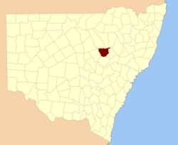
  • Gowen County, New South Wales — Infobox Australian cadastral name = Gowen state = New South Wales caption = Location in New South Wales near nw = Leichardt near n = Baradine near ne = White near e = Napier near se = Napier near s = Lincoln near sw = Ewenmar near w =… …   Wikipedia

  • Gowen — may refer to : * Alan Gowen (1947 1981), a fusion/progressive rock keyboardist * Bradford Gowen (1946 ), first prize in the 1978 Kennedy Center/Rockefeller Foundation International Competition for Excellence in the Performance of American Music * …   Wikipedia

  • Gowen — ist der Name mehrerer Orte in den Vereinigten Staaten: Gowen (Louisiana) Gowen (Michigan) Gowen (Oklahoma) Gowen (Pennsylvania) Gowen City (Pennsylvania) in Australien: Gowen County, Verwaltungseinheit in New South Wales Personen: Clonie Gowen (* …   Deutsch Wikipedia

  • Gowen — Recorded in many forms including: Gow, Gowan, Gowans, Gowanson, Gowen, Gowing, Goan, Goane, Goance, Guan, and Going, as well as dialectals such as Quogan, Quoane, Quonne, this is a British surname. Logic would suggest that this surname should be… …   Surnames reference

  • Franklin B. Gowen — Infobox Person name = Franklin Benjamin Gowen caption = birth date = birth date|1836|2|9|mf=y birth place = Philadelphia, Pennsylvania death date = death date and age|1889|12|13|1836|2|9|mf=y death place = Washington, D.C.Franklin Benjamin Gowen… …   Wikipedia

  • Baradine County, New South Wales — Infobox Australian cadastral name = Baradine state = New South Wales caption = Location in New South Wales near nw = Finch near n = Denham near ne = Jamison near w = Leichardt near e = White near sw = Gowen near s = Gowen near se = Napier… …   Wikipedia

  • Ewenmar County, New South Wales — Infobox Australian cadastral name = Ewenmar state = New South Wales caption = Location in New South Wales near nw = Gregory near n = Leichardt near ne = Gowen near e = Gowen near se = Lincoln near s = Narromine near sw = Narromine near w =… …   Wikipedia

  • Baradine County — Map of all coordinates from Google Map of all coordinates from Bing Export all coordinates as KML …   Wikipedia

  • Ewenmar County — Map of all coordinates from Google Map of all coordinates from Bing Export all coordinates as KML …   Wikipedia

  • Chester County, Pennsylvania — Chester County Courthouse …   Wikipedia

Share the article and excerpts

Direct link
Do a right-click on the link above
and select “Copy Link”