Ewenmar County

Ewenmar County
Ewenmar
New South Wales
Ewenmar NSW.PNG
Location in New South Wales
Lands administrative divisions around Ewenmar
Gregory Leichardt Gowen
Oxley Ewenmar Gowen
Narromine Narromine Lincoln

Ewenmar County is one of the 141 Cadastral divisions of New South Wales. It is located between the Macquarie River on the west, and the Castlereagh River on the east. This is the area between Warren and Gilgandra.

Ewenmar is believed to be derived from a local Aboriginal word.[1]

Parishes within this county

A full list of parishes found within this county; their current LGA and mapping coordinates to the approximate centre of each location is as follows:

Parish LGA Coordinates
Allamurgoola Gilgandra Shire Council 31°25′54″S 148°30′04″E / 31.43167°S 148.50111°E / -31.43167; 148.50111 (Allamurgoola)
Armatree Coonamble Shire Council 31°23′54″S 148°24′04″E / 31.39833°S 148.40111°E / -31.39833; 148.40111 (Armatree)
Balladoran Gilgandra Shire Council 31°47′54″S 148°35′04″E / 31.79833°S 148.58444°E / -31.79833; 148.58444 (Balladoran)
Beemunnel Warren Shire Council 31°41′54″S 148°02′04″E / 31.69833°S 148.03444°E / -31.69833; 148.03444 (Beemunnel)
Berida Gilgandra Shire Council 31°34′54″S 148°28′04″E / 31.58167°S 148.46778°E / -31.58167; 148.46778 (Berida)
Bobarah Gilgandra Shire Council 31°39′54″S 148°37′04″E / 31.665°S 148.61778°E / -31.665; 148.61778 (Bobarah)
Boebung Gilgandra Shire Council 31°27′54″S 148°24′04″E / 31.465°S 148.40111°E / -31.465; 148.40111 (Boebung)
Bourbah Warren Shire Council 31°23′54″S 148°16′04″E / 31.39833°S 148.26778°E / -31.39833; 148.26778 (Bourbah)
Breelong Gilgandra Shire Council 31°47′21″S 148°41′44″E / 31.78917°S 148.69556°E / -31.78917; 148.69556 (Breelong)
Bugabada Narromine Shire Council 31°53′54″S 148°18′04″E / 31.89833°S 148.30111°E / -31.89833; 148.30111 (Bugabada)
Bullagreen Warren Shire Council 31°23′54″S 148°10′04″E / 31.39833°S 148.16778°E / -31.39833; 148.16778 (Bullagreen)
Bundemar Warren Shire Council 31°49′54″S 148°14′04″E / 31.83167°S 148.23444°E / -31.83167; 148.23444 (Bundemar)
Bundijoe Warren Shire Council 31°47′54″S 148°16′04″E / 31.79833°S 148.26778°E / -31.79833; 148.26778 (Bundijoe)
Bundilla Warren Shire Council 31°27′54″S 148°08′04″E / 31.465°S 148.13444°E / -31.465; 148.13444 (Bundilla)
Bundobering Gilgandra Shire Council 31°41′54″S 148°26′04″E / 31.69833°S 148.43444°E / -31.69833; 148.43444 (Bundobering)
Bungey Gilgandra Shire Council 31°43′54″S 148°33′04″E / 31.73167°S 148.55111°E / -31.73167; 148.55111 (Bungey)
Buramilong Gilgandra Shire Council 31°37′54″S 148°31′04″E / 31.63167°S 148.51778°E / -31.63167; 148.51778 (Buramilong)
Burroway Narromine Shire Council 32°01′54″S 148°17′04″E / 32.03167°S 148.28444°E / -32.03167; 148.28444 (Burroway)
Carrigan Narromine Shire Council 31°51′54″S 148°10′04″E / 31.865°S 148.16778°E / -31.865; 148.16778 (Carrigan)
Cobboco Gilgandra Shire Council 31°59′54″S 148°26′04″E / 31.99833°S 148.43444°E / -31.99833; 148.43444 (Cobboco)
Collemburrawang Warren Shire Council 31°27′54″S 147°50′04″E / 31.465°S 147.83444°E / -31.465; 147.83444 (Collemburrawang)
Collie Warren Shire Council 31°15′54″S 148°42′04″E / 31.265°S 148.70111°E / -31.265; 148.70111 (Collie)
Connibong Gilgandra Shire Council 31°27′54″S 148°20′04″E / 31.465°S 148.33444°E / -31.465; 148.33444 (Connibong)
Coolbaggie Narromine Shire Council 32°08′54″S 148°24′04″E / 32.14833°S 148.40111°E / -32.14833; 148.40111 (Coolbaggie)
Coradgerie Warren Shire Council 31°35′54″S 148°14′04″E / 31.59833°S 148.23444°E / -31.59833; 148.23444 (Coradgerie)
Driel Warren Shire Council 31°39′54″S 147°56′04″E / 31.665°S 147.93444°E / -31.665; 147.93444 (Driel)
Drillwarrina Gilgandra Shire Council 31°52′54″S 148°33′04″E / 31.88167°S 148.55111°E / -31.88167; 148.55111 (Drillwarrina)
Eiraban Gilgandra Shire Council 31°47′54″S 148°24′04″E / 31.79833°S 148.40111°E / -31.79833; 148.40111 (Eiraban)
Emogandry Narromine Shire Council 31°57′54″S 148°16′04″E / 31.965°S 148.26778°E / -31.965; 148.26778 (Emogandry)
Emu Gilgandra Shire Council 31°55′54″S 148°40′04″E / 31.93167°S 148.66778°E / -31.93167; 148.66778 (Emu)
Eumungerie Gilgandra Shire Council 31°56′54″S 148°32′04″E / 31.94833°S 148.53444°E / -31.94833; 148.53444 (Eumungerie)
Eura Gilgandra Shire Council 31°49′54″S 148°42′04″E / 31.83167°S 148.70111°E / -31.83167; 148.70111 (Eura)
Eurombedah Narromine Shire Council 32°12′54″S 148°19′04″E / 32.215°S 148.31778°E / -32.215; 148.31778 (Eurombedah)
Gewah Warren Shire Council 31°35′54″S 148°18′04″E / 31.59833°S 148.30111°E / -31.59833; 148.30111 (Gewah)
Gulargambone Coonamble Shire Council 31°19′54″S 148°16′04″E / 31.33167°S 148.26778°E / -31.33167; 148.26778 (Gulargambone)
Healy Warren Shire Council 31°25′54″S 148°22′04″E / 31.43167°S 148.36778°E / -31.43167; 148.36778 (Healy)
Kickabil Gilgandra Shire Council 31°53′54″S 148°22′04″E / 31.89833°S 148.36778°E / -31.89833; 148.36778 (Kickabil)
Killendoon Warren Shire Council 31°45′54″S 147°56′04″E / 31.765°S 147.93444°E / -31.765; 147.93444 (Killendoon)
Merrigal Warren Shire Council 31°27′54″S 148°14′04″E / 31.465°S 148.23444°E / -31.465; 148.23444 (Merrigal)
Meryon Warren Shire Council 31°35′54″S 148°08′04″E / 31.59833°S 148.13444°E / -31.59833; 148.13444 (Meryon)
Milda Gilgandra Shire Council 31°31′54″S 148°31′04″E / 31.53167°S 148.51778°E / -31.53167; 148.51778 (Milda)
Milpulling Gilgandra Shire Council 31°46′54″S 148°30′04″E / 31.78167°S 148.50111°E / -31.78167; 148.50111 (Milpulling)
Moonul City of Dubbo 32°00′54″S 148°28′04″E / 32.015°S 148.46778°E / -32.015; 148.46778 (Moonul)
Narroweema Warren Shire Council 31°43′54″S 148°10′04″E / 31.73167°S 148.16778°E / -31.73167; 148.16778 (Narroweema)
Tacklebang Gilgandra Shire Council 31°41′54″S 148°20′04″E / 31.69833°S 148.33444°E / -31.69833; 148.33444 (Tacklebang)
Tenandra Warren Shire Council 31°27′54″S 147°56′04″E / 31.465°S 147.93444°E / -31.465; 147.93444 (Tenandra)
Umangla Warren Shire Council 31°35′54″S 147°48′04″E / 31.59833°S 147.80111°E / -31.59833; 147.80111 (Umangla)
Urobula Warren Shire Council 31°41′54″S 148°10′04″E / 31.69833°S 148.16778°E / -31.69833; 148.16778 (Urobula)
Wambianna Warren Shire Council 31°51′54″S 148°06′04″E / 31.865°S 148.10111°E / -31.865; 148.10111 (Wambianna)
Warrie Coonamble Shire Council 31°17′54″S 148°22′04″E / 31.29833°S 148.36778°E / -31.29833; 148.36778 (Warrie)
Wemabung Warren Shire Council 30°59′54″S 148°04′04″E / 30.99833°S 148.06778°E / -30.99833; 148.06778 (Wemabung)
Wirrigai Narromine Shire Council 32°06′54″S 148°17′04″E / 32.115°S 148.28444°E / -32.115; 148.28444 (Wirrigai)
Wonbobbie Warren Shire Council 31°33′54″S 147°58′04″E / 31.565°S 147.96778°E / -31.565; 147.96778 (Wonbobbie)

References

  1. ^ Geographical Names Board of NSW

Wikimedia Foundation. 2010.

Игры ⚽ Нужна курсовая?

Look at other dictionaries:

  • Ewenmar County, New South Wales — Infobox Australian cadastral name = Ewenmar state = New South Wales caption = Location in New South Wales near nw = Gregory near n = Leichardt near ne = Gowen near e = Gowen near se = Lincoln near s = Narromine near sw = Narromine near w =… …   Wikipedia

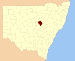
  • Gowen County, New South Wales — Infobox Australian cadastral name = Gowen state = New South Wales caption = Location in New South Wales near nw = Leichardt near n = Baradine near ne = White near e = Napier near se = Napier near s = Lincoln near sw = Ewenmar near w =… …   Wikipedia

  • Gowen County — Map of all coordinates from Google Map of all coordinates from Bing Export all coordinates as KML …   Wikipedia

  • Lincoln County, New South Wales — Infobox Australian cadastral name = Lincoln state = New South Wales caption = Location in New South Wales near nw = Ewenmar near n = Gowen near ne = Napier near e = Bligh near se = Bligh near s = Bligh near sw = Gordon near w = Narromine Lincoln… …   Wikipedia

  • Gregory County, New South Wales — Infobox Australian cadastral name = Gregory state = New South Wales caption = Location in New South Wales near nw = Cowper near n = Clyde near ne = Leichardt near e = Gowen near se = Ewenmar near s = Oxley near sw = Flinders near w =… …   Wikipedia

  • Leichardt County, New South Wales — Infobox Australian cadastral name = Leichardt state = New South Wales caption = Location in New South Wales near nw = Narran near n = Finch near ne = Baradine near e = Baradine near se = Gowen near s = Ewenmar near sw = Gregory near w =… …   Wikipedia

  • Oxley County, New South Wales — Infobox Australian cadastral name = Oxley state = New South Wales caption = Location in New South Wales near nw = Canbelego near n = Gregory near ne = Gregory near e = Ewenmar near se = Narromine near s = Kennedy near sw = Flinders near w =… …   Wikipedia

  • Leichardt County — Map of all coordinates from Google Map of all coordinates from Bing Export all coordinates as KML …   Wikipedia

  • Oxley County — Map of all coordinates from Google Map of all coordinates from Bing Export all coordinates as KML …   Wikipedia

  • Narromine County, New South Wales — Infobox Australian cadastral name = Narromine state = New South Wales caption = Location in New South Wales near nw = Oxley near n = Ewenmar near ne = Lincoln near e = Gordon near se = Gordon near s = Kennedy near sw = Kennedy near w =… …   Wikipedia

Share the article and excerpts

Direct link
Do a right-click on the link above
and select “Copy Link”