Fitzroy County

Fitzroy County
Fitzroy
New South Wales
Fitzroy NSW.PNG
Location in New South Wales
Lands administrative divisions around Fitzroy
Gresham Clarence Pacific Ocean
Gresham Fitzroy Pacific Ocean
Clarke Raleigh Pacific Ocean

Fitzroy County is one of the 141 Cadastral divisions of New South Wales. It lies south of the Orara River, and north of the Bellinger River, and includes Coffs Harbour.

Fitzroy County was named in honour of Governor of New South Wales Sir Charles Augustus Fitzroy.[1]

Parishes within this county

A full list of parishes found within this county; their current LGA and mapping coordinates to the approximate centre of each location is as follows:

Parish LGA Coordinates
Allan Bellingen Shire Council 30°14′54″S 152°45′04″E / 30.24833°S 152.75111°E / -30.24833; 152.75111 (Allan)
Allans Water Clarence Valley Council 30°18′54″S 152°28′04″E / 30.315°S 152.46778°E / -30.315; 152.46778 (Allans Water)
Bagawa Clarence Valley Council 30°09′54″S 152°59′04″E / 30.165°S 152.98444°E / -30.165; 152.98444 (Bagawa)
Bardool Clarence Valley Council 29°59′54″S 152°45′04″E / 29.99833°S 152.75111°E / -29.99833; 152.75111 (Bardool)
Bardsley Clarence Valley Council 29°51′54″S 152°53′04″E / 29.865°S 152.88444°E / -29.865; 152.88444 (Bardsley)
Blaxland Clarence Valley Council 29°51′54″S 152°45′04″E / 29.865°S 152.75111°E / -29.865; 152.75111 (Blaxland)
Blicks Clarence Valley Council 30°10′54″S 152°31′04″E / 30.18167°S 152.51778°E / -30.18167; 152.51778 (Blicks)
Bligh Bellingen Shire Council 30°21′54″S 152°43′04″E / 30.365°S 152.71778°E / -30.365; 152.71778 (Bligh)
Bobo Clarence Valley Council 30°09′54″S 152°44′04″E / 30.165°S 152.73444°E / -30.165; 152.73444 (Bobo)
Bostobrick Bellingen Shire Council 30°16′54″S 152°36′04″E / 30.28167°S 152.60111°E / -30.28167; 152.60111 (Bostobrick)
Chambigne Clarence Valley Council 29°43′54″S 152°43′04″E / 29.73167°S 152.71778°E / -29.73167; 152.71778 (Chambigne)
Coff City of Coffs Harbour 30°19′54″S 153°00′04″E / 30.33167°S 153.00111°E / -30.33167; 153.00111 (Coff)
Comlaroi City of Coffs Harbour 30°14′54″S 153°00′04″E / 30.24833°S 153.00111°E / -30.24833; 153.00111 (Comlaroi)
Cope Clarence Valley Council 30°05′54″S 152°44′04″E / 30.09833°S 152.73444°E / -30.09833; 152.73444 (Cope)
Corindi Clarence Valley Council 30°00′54″S 153°10′04″E / 30.015°S 153.16778°E / -30.015; 153.16778 (Corindi)
Duckan Duckan Clarence Valley Council 29°36′54″S 152°39′04″E / 29.615°S 152.65111°E / -29.615; 152.65111 (Duckan Duckan)
Ermington Clarence Valley Council 29°47′54″S 152°40′04″E / 29.79833°S 152.66778°E / -29.79833; 152.66778 (Ermington)
Fenton Bellingen Shire Council 30°20′54″S 152°36′04″E / 30.34833°S 152.60111°E / -30.34833; 152.60111 (Fenton)
Gundar City of Coffs Harbour 30°10′54″S 152°52′04″E / 30.18167°S 152.86778°E / -30.18167; 152.86778 (Gundar)
Hernani Clarence Valley Council 30°18′54″S 152°24′04″E / 30.315°S 152.40111°E / -30.315; 152.40111 (Hernani)
Hyland Clarence Valley Council 30°15′24″S 152°24′34″E / 30.25667°S 152.40944°E / -30.25667; 152.40944 (Hyland)
Jardine Clarence Valley Council 30°02′54″S 152°42′04″E / 30.04833°S 152.70111°E / -30.04833; 152.70111 (Jardine)
Koukandowie Clarence Valley Council 29°55′54″S 152°51′04″E / 29.93167°S 152.85111°E / -29.93167; 152.85111 (Koukandowie)
Kremnos Clarence Valley Council 29°59′54″S 152°58′04″E / 29.99833°S 152.96778°E / -29.99833; 152.96778 (Kremnos)
Leigh Bellingen Shire Council 30°17′54″S 152°45′04″E / 30.29833°S 152.75111°E / -30.29833; 152.75111 (Leigh)
Martin Clarence Valley Council 29°52′54″S 152°42′04″E / 29.88167°S 152.70111°E / -29.88167; 152.70111 (Martin)
Meldrum Downs Bellingen Shire Council 30°21′54″S 152°30′04″E / 30.365°S 152.50111°E / -30.365; 152.50111 (Meldrum Downs)
Moonee City of Coffs Harbour 30°13′54″S 153°06′04″E / 30.23167°S 153.10111°E / -30.23167; 153.10111 (Moonee)
Moonpar Clarence Valley Council 30°13′54″S 152°37′04″E / 30.23167°S 152.61778°E / -30.23167; 152.61778 (Moonpar)
Nymboida Clarence Valley Council 29°56′54″S 152°45′04″E / 29.94833°S 152.75111°E / -29.94833; 152.75111 (Nymboida)
Orara City of Coffs Harbour 30°06′54″S 153°03′04″E / 30.115°S 153.05111°E / -30.115; 153.05111 (Orara)
Ross Clarence Valley Council 29°42′54″S 152°39′04″E / 29.715°S 152.65111°E / -29.715; 152.65111 (Ross)
Shannon Clarence Valley Council 29°57′54″S 152°41′04″E / 29.965°S 152.68444°E / -29.965; 152.68444 (Shannon)
Shea Clarence Valley Council 30°05′54″S 152°34′04″E / 30.09833°S 152.56778°E / -30.09833; 152.56778 (Shea)
Sherwood Clarence Valley Council 30°00′54″S 153°00′04″E / 30.015°S 153.00111°E / -30.015; 153.00111 (Sherwood)
Sherwood Clarence Valley Council 29°57′54″S 153°03′04″E / 29.965°S 153.05111°E / -29.965; 153.05111 (Sherwood)
Stewart Bellingen Shire Council 30°17′54″S 152°52′04″E / 30.29833°S 152.86778°E / -30.29833; 152.86778 (Stewart)
Tallawudjah Clarence Valley Council 30°02′54″S 152°57′04″E / 30.04833°S 152.95111°E / -30.04833; 152.95111 (Tallawudjah)
Toothill Clarence Valley Council 29°47′54″S 152°48′04″E / 29.79833°S 152.80111°E / -29.79833; 152.80111 (Toothill)
Towallum Clarence Valley Council 30°04′54″S 152°52′04″E / 30.08167°S 152.86778°E / -30.08167; 152.86778 (Towallum)
Turville Clarence Valley Council 29°38′54″S 152°45′04″E / 29.64833°S 152.75111°E / -29.64833; 152.75111 (Turville)
Tyringham Clarence Valley Council 30°14′54″S 152°30′04″E / 30.24833°S 152.50111°E / -30.24833; 152.50111 (Tyringham)
Ucombe Bellingen Shire Council 30°14′54″S 152°54′04″E / 30.24833°S 152.90111°E / -30.24833; 152.90111 (Ucombe)
Waihou Clarence Valley Council 30°02′54″S 153°00′04″E / 30.04833°S 153.00111°E / -30.04833; 153.00111 (Waihou)
Wiriri Clarence Valley Council 30°06′54″S 152°40′04″E / 30.115°S 152.66778°E / -30.115; 152.66778 (Wiriri)
Wongawanga City of Coffs Harbour 30°17′54″S 152°58′04″E / 30.29833°S 152.96778°E / -30.29833; 152.96778 (Wongawanga)
Woolgoolga City of Coffs Harbour 30°06′54″S 153°09′04″E / 30.115°S 153.15111°E / -30.115; 153.15111 (Woolgoolga)

References

  1. ^ Geographical Names Board of NSW

Wikimedia Foundation. 2010.

Игры ⚽ Нужно решить контрольную?

Look at other dictionaries:

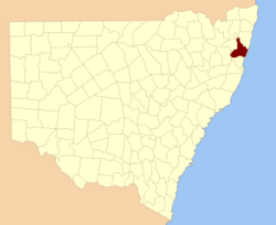
  • Fitzroy County, New South Wales — Infobox Australian cadastral name = Fitzroy state = New South Wales caption = Location in New South Wales near nw = Gresham near n = Clarence near ne = Pacific Ocean near e = Pacific Ocean near se = Pacific Ocean near s = Raleigh near sw = Clarke …   Wikipedia

  • County of Fitzroy, Queensland — Fitzroy Queensland Location within Queensland Lands administrative divisions around Fitzroy …   Wikipedia

  • Fitzroy Township, Ontario — Fitzroy is an historic township originally part of Carleton County in eastern Ontario, Canada.Fitzroy was located in the western part of the county, bordered to the northeast by Torbolton Township, to the southeast by Huntley Township, to the… …   Wikipedia

  • County of Cavendish — Cavendish Queensland Location within Queensland Lands administrative divisions around …   Wikipedia

  • County of Aubigny — Aubigny Queensland Location within Queensland Lands administrative divisions around Aubigny …   Wikipedia

  • County of Canning — Canning Queensland Location within Queensland Lands administrative divisions around Canning …   Wikipedia

  • County of Lennox — Lennox Queensland Location within Queensland Lands administrative divisions around Lennox …   Wikipedia

  • County of Canning, Queensland — Infobox Australian cadastral name = Canning state = Queensland imagesize= 180px caption = Location within Queensland near nw = Fitzroy near n = Lennox near ne = March near e = Pacific Ocean near se = Pacific Ocean near s = Stanley near sw =… …   Wikipedia

  • Augustus FitzRoy, 3. Herzog von Grafton — Dieser Artikel oder Abschnitt ist nicht hinreichend mit Belegen (Literatur, Webseiten oder Einzelnachweisen) versehen. Die fraglichen Angaben werden daher möglicherweise demnächst gelöscht. Hilf Wikipedia, indem du die Angaben recherchierst und… …   Deutsch Wikipedia

  • Augustus Henry FitzRoy, 3. Herzog von Grafton — Dieser Artikel oder Abschnitt ist nicht hinreichend mit Belegen (Literatur, Webseiten oder Einzelnachweisen) versehen. Die fraglichen Angaben werden daher möglicherweise demnächst gelöscht. Hilf Wikipedia, indem du die Angaben recherchierst und… …   Deutsch Wikipedia

Share the article and excerpts

Direct link
Do a right-click on the link above
and select “Copy Link”