County of Cavendish

County of Cavendish
Cavendish
Queensland
Cavendish-county-queensland.png
Location within Queensland
Lands administrative divisions around Cavendish
Fitzroy Fitzroy Canning
Aubigny Cavendish Canning
Aubigny Churchill Stanley

The County of Cavendish is a county in Queensland, Australia. Like all counties in Queensland, it is a non-functional administrative unit, that is used mainly for the purpose of registering land titles. The county includes the northern part of the Toowoomba Region and the western part of the Somerset Region.[1] The county was officially named and bounded by the Governor in Council on 7 March 1901 under the Land Act 1897.[2]

Parishes

Cavendish is divided into parishes, listed as follows:

Parish LGA Coordinates
Anduramba Somerset 27°12′S 152°10′E / 27.2°S 152.167°E / -27.2; 152.167 (Anduramba Parish)
Avoca Somerset 26°37′S 152°12′E / 26.617°S 152.2°E / -26.617; 152.2 (Avoca Parish)
Biarra Somerset 27°06′S 152°19′E / 27.1°S 152.317°E / -27.1; 152.317 (Biarra Parish)
Buaraba Somerset 27°22′S 152°18′E / 27.367°S 152.3°E / -27.367; 152.3 (Buaraba Parish)
Clarendon Lockyer Valley 27°29′S 152°22′E / 27.483°S 152.367°E / -27.483; 152.367 (Clarendon Parish)
Colinton Somerset 26°52′S 152°15′E / 26.867°S 152.25°E / -26.867; 152.25 (Colinton Parish)
Cooyar Toowoomba 26°55′S 151°55′E / 26.917°S 151.917°E / -26.917; 151.917 (Cooyar Parish)
Cressbrook Somerset 27°02′S 152°26′E / 27.033°S 152.433°E / -27.033; 152.433 (Cressbrook Parish)
Crows Nest Toowoomba 27°15′S 152°03′E / 27.25°S 152.05°E / -27.25; 152.05 (Crows Nest Parish)
Deongwar Somerset 27°15′S 152°11′E / 27.25°S 152.183°E / -27.25; 152.183 (Deongwar Parish)
Djuan Toowoomba 27°08′S 151°56′E / 27.133°S 151.933°E / -27.133; 151.933 (Djuan Parish)
Emu Creek Toowoomba 27°00′S 152°02′E / 27°S 152.033°E / -27; 152.033 (Emu Creek Parish)
England Somerset 27°25′S 152°27′E / 27.417°S 152.45°E / -27.417; 152.45 (England Parish)
Esk Somerset 27°14′S 152°25′E / 27.233°S 152.417°E / -27.233; 152.417 (Esk Parish)
Eskdale Toowoomba 27°06′S 152°10′E / 27.1°S 152.167°E / -27.1; 152.167 (Eskdale Parish)
Helidon Lockyer Valley 27°30′S 152°07′E / 27.5°S 152.117°E / -27.5; 152.117 (Helidon Parish)
Lockyer Lockyer Valley 27°30′S 152°14′E / 27.5°S 152.233°E / -27.5; 152.233 (Lockyer Parish)
Murphy Lockyer Valley 27°27′S 152°06′E / 27.45°S 152.1°E / -27.45; 152.1 (Murphy Parish)
Nukinenda Somerset 27°01′S 152°11′E / 27.017°S 152.183°E / -27.017; 152.183 (Nukinenda Parish)
Ravensbourne Toowoomba 27°21′S 152°08′E / 27.35°S 152.133°E / -27.35; 152.133 (Ravensbourne Parish)
Taromeo South Burnett 26°49′S 152°07′E / 26.817°S 152.117°E / -26.817; 152.117 (Taromeo Parish)
Wivenhoe Somerset 27°21′S 152°32′E / 27.35°S 152.533°E / -27.35; 152.533 (Nukinenda Parish)

References

  1. ^ Moreton District, County of Cavendish Maps - A4 Series at Queensland Archives.
  2. ^ Department of Environment and Resource Management. "Place name details — Cavendish". http://www.derm.qld.gov.au/property/placenames/details.php?id=6681. Retrieved 4 June 2011. 


Coordinates: 27°25′S 152°10′E / 27.417°S 152.167°E / -27.417; 152.167


Wikimedia Foundation. 2010.

Игры ⚽ Нужна курсовая?

Look at other dictionaries:

  • Cavendish, Idaho — Cavendish is an unincorporated town in Nez Perce County, Idaho, United States, [gnis|397534] in the mountains between the towns of Orofino and Kendrick. Cavendish contains an elementary school (Cavendish Teakean Elementary School), a cemetery,… …   Wikipedia

  • Cavendish , Margaret — Cavendish , Margaret, Duchess of Newcastle (1623–1673) British natural philosopher The daughter of a wealthy landowner, Margaret was born at St. John s, Colchester, in the eastern English county of Essex and inherited £10,000 on his death. She… …   Scientists

  • Cavendish, Prince Edward Island — Infobox Settlement official name = Cavendish nickname = settlement type = unincorporated rural area motto = imagesize = 250px image caption = Cavendish Beach in Prince Edward Island National Park image mapsize = map caption = pushpin pushpin… …   Wikipedia

  • Cavendish School (Eastbourne) — Infobox UK school name = The Cavendish School size = latitude = 50.78039 longitude = 0.26060 dms = dms motto = motto pl = established = approx = closed = c approx = type = Comprehensive Community school religion = Non denominational president =… …   Wikipedia

  • Cavendish, Vermont — Infobox Settlement official name = Cavendish, Vermont settlement type = Town nickname = motto = imagesize = 250px image caption = The Sister of The Glimmerstone House image mapsize = 250px map caption = Location of Cavendish within Vermont… …   Wikipedia

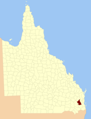
  • County of Fitzroy, Queensland — Fitzroy Queensland Location within Queensland Lands administrative divisions around Fitzroy …   Wikipedia

  • Cavendish School (Hemel Hempstead) — Infobox UK school name = The Cavendish School size = latitude = 51.75761 longitude = 0.48328 dms = dms motto = motto pl = established = approx = closed = c approx = type = religion = president = head label = Headteacher head = Dr Stephen Pam r… …   Wikipedia

  • cavendish — /kav euhn dish/, n. tobacco that has been softened, sweetened, and pressed into cakes. [1830 40; presumably named after maker or handler] * * * (as used in expressions) Bentinck William Henry Cavendish Lord Cavendish Henry Cavendish experiment… …   Universalium

  • Cavendish — /kav euhn dish/, n. 1. Henry, 1731 1810, English chemist and physicist. 2. William, 4th Duke of Devonshire, 1720 64, British statesman: prime minister 1756 57. * * * (as used in expressions) Bentinck William Henry Cavendish Lord Cavendish Henry… …   Universalium

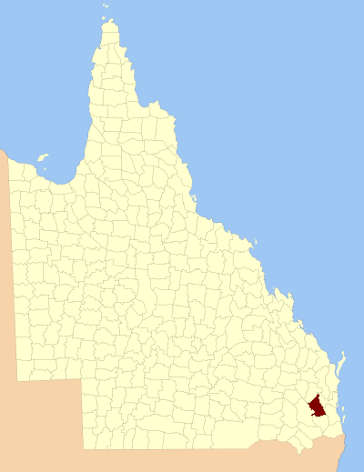
  • County of Canning — Canning Queensland Location within Queensland Lands administrative divisions around Canning …   Wikipedia

Share the article and excerpts

Direct link
Do a right-click on the link above
and select “Copy Link”