- Bellingen Shire Council
Infobox Australian Place | type = lga
name = Bellingen Shire
state = nsw
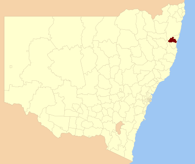
caption = Location inNew South Wales
pop = 12,758
publisher =Australian Bureau of Statistics
title=Regional Population Growth, Australia, 2004-05
accessdate = 2006-12-03
area = 1602
title = Bellingen Shire Council
publisher = Department of Local Government
url = http://www.dlg.nsw.gov.au/dlg/dlghome/dlg_CouncilContactDetails.asp?slacode=600
accessdate = 2006-11-20
est =
seat = Bellingen (Hyde Street}
mayor = Mark Troy
region = Mid North Coast
url = http://www.bellingen.nsw.gov.au/
stategov = Oxley, Coffs Harbour
fedgov = Cowper
near-nw = Guyra
near-n = Clarence Valley
near-ne = Coffs Harbour
near-w = Armidale Dumaresq
near-e =Pacific Ocean
near-sw = Armidale Dumaresq
near-s = Nambucca
near-se =Pacific Ocean Bellingen Shire Council is a Local Government Area on the Mid North Coast of
New South Wales ,Australia . It is on the Pacific Highway,Waterfall Way and the North Coast railway line.Demographics
In the 2006 Census of Population and Housing there were 12,416 usual residents living in Bellingen Shire Council. Of this count, 6,050 (or 49%) were males and 6,366 (or 51%) were females.
By age, 20% of the population was under 15 years old, 62% were between 15 and 65, and 18% were over 65 years old.
Most people living in Bellingen Shire Council were born in Australia (83%). The median age was 44 years.
Economy
According to the 2006 Census of Population and Housing, the median invididual income was $336 per week (equal to approximately $17,520 per year). The median family income in 2006 was $777 per week (equal to approximately $40,515 per year); and, the median household income in 2006 was $622 per week (equal to approximately $32,433 per year).
There were 4,502 people employed in 2006 (to give an employment to working age population ratio of 0.59), and 526 people unemployed. The most common occupations were Professionals (20%); Managers (16%); and, Technicians and Trades Workers (15%). The top 5 industries for employment were School Education (7.2%); Sheep, Beef Cattle and Grain Farming (4.0%); Hospitals (4.0%); Cafes, Restaurants and Takeaway Food Services (3.7%); and, Supermarket and Grocery Stores (2.6%).
Housing
In the 2006 Census of Population and Housing, the median housing loan repayment was $1,015 per month. This equated to marginally under 41% of median household income.
The median rent in 2006 was $165 per week. This equated to just under 27% of median household income.
The average household size was 2.4 persons.
Geography
It includes the towns of Bellingen, Dorrigo (west), Urunga and Mylestom (east) townships. The rural communities of the Thora and Kalang valleys and the pastoral area of Gleniffer are additionally accessed from the Bellinger Valley.
References
Wikimedia Foundation. 2010.