- University Avenue (Minneapolis–Saint Paul)
-
University Avenue in the Minneapolis–St. Paul region of Minnesota begins near the Minnesota State Capitol in Saint Paul and extends westward into neighboring Minneapolis, where it passes the University of Minnesota, and then turns north to pass through several suburbs before ending in Blaine, Minnesota. For many years, the road carried U.S. Highway 12 and U.S. Highway 52 (at least for part of its length), and University Avenue is still a significant thoroughfare in the area. University Avenue's intersection with Snelling Avenue is Minnesota's busiest intersection with 64,000 cars passing through it daily.[1] According to the Minnesota Department of Transportation the “busiest” intersection in Minnesota, as of 2009, was US Highway 169 and Co Rd 81.
University Avenue originally ran along a line several blocks north of its current location, forming a route which once connected the Minneapolis campus of the University of Minnesota to Hamline University in Saint Paul (hence the name).[2] When the construction of the Minnesota Transfer Railway yards blocked that route, the street was moved one-half mile to the south on the Saint Paul side, to what was then called Melrose Avenue.[2] The old University Avenue route was renamed Minnehaha Avenue, which it remains to this day.[2]
Some important neighborhoods the road passes through include Frogtown (officially, the Thomas-Dale neighborhood) and the Midway region, both in Saint Paul. Hubbard Broadcasting and its flagship stations, KSTP-AM-FM-TV, are located just next to the border of Minneapolis and Saint Paul. In fact, the sidewalk at the KSTP studios is right on the city/county line.[1] This was one of the highest points in the area and made an appropriate site for a radio transmitter. An antenna structure still stands there today, though it is used for microwave links rather than broadcasting (KSTP and most other Twin Cities stations use the Telefarm installation in Shoreview, Minnesota or the nearby KMSP Tower).
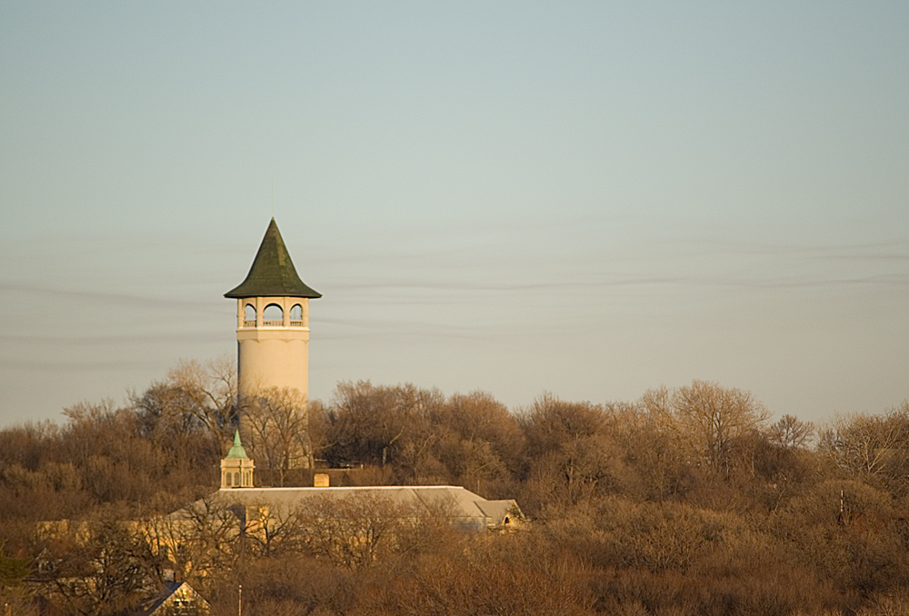
A water tower commonly known as the "Witch's Hat" stands just a few blocks away in Minneapolis's Prospect Park neighborhood.
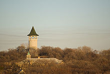 The "Witch's Hat" water tower in Prospect Park. This landmark is situated only a few blocks from where Minneapolis and Saint Paul meet.
In 1890, the first interurban streetcar link between Minneapolis and Saint Paul used University Avenue and Washington Avenue in Minneapolis. History is being repeated, as the Green Line light rail is under construction which will connect the two downtowns as well as the University of Minnesota following a similar route.
University Avenue carries Ramsey County Road 34 in Saint Paul, and Hennepin County Road 36 in Minneapolis to the junction with Interstate 35W. West and north of Central Avenue, University Avenue carries Minnesota State Highway 47 to the junction with U.S. Route 10, after which it carries Anoka County Road 51.
References
- ^ a b Millett, Larry (2007). AIA Guide to the Twin Cities: The Essential Source on the Architecture of Minneapolis and St. Paul. Minnesota Historical Society Press, p. 502, 505. ISBN 0-87351-540-4
- ^ a b c Empson, Donald L. (2006). The Street Where You Live: A Guide to the Place Names of Saint Paul. University of Minnesota Press. ISBN 0-8166-4729-1 ISBN 978-0-8166-4729-3.
Categories:- Streets in Saint Paul, Minnesota
- Streets in Minneapolis, Minnesota
- Minneapolis–Saint Paul
- U.S. Route 12
- U.S. Route 52

Wikimedia Foundation. 2010.