- Cosumnes River Preserve
-
Cosumnes River Preserve IUCN Category Ia (Strict Nature Reserve)
Location Sacramento County, California Nearest city Sacramento, California Coordinates 38°15′56″N 121°26′21″W / 38.26556°N 121.43917°WCoordinates: 38°15′56″N 121°26′21″W / 38.26556°N 121.43917°W Area 46,000 acres (190 km2) Established 1987 Governing body Joint management-The Nature Conservancy, Bureau of Land Management, Ducks Unlimited, Department of Fish and Game, Department of Water Resources, Sacramento County Department of Parks and Recreation, and the state Wildlife Conservation Board. The Cosumnes River Preserve is a nature preserve of 46,000 acres (190 km2) located 20 miles (30 km) south of Sacramento, in the US state of California. The preserve protects a Central Valley remnant that once contained one of the largest expanses of oak tree savanna, riparian oak forest and wetland habitat in North America.[1] Agricultural development has changed the landscape from groves of oaks and tule marshes to productive farmlands.[2]
Contents
The Cosumnes River is the last remaining free-flowing river in California's Central Valley, with the preserve located on the river's lower reach where it joins the Sacramento-San Joaquin Delta tidelands. The area supports a diverse range of plant and animal life, including three species of oak as well as rare plants like the endemic northern California black walnut (Juglans californica var. hindsii).[3] Notable features include the sandhill crane fall migration and the Tall Forest in Wood Duck Slough. More than 250 bird species, more than 40 fish species, and some 230 plant species have been identified here.
Located on the bird migration route, the Pacific Flyway, the preserve is designated an Important Bird Area by the American Bird Conservancy and National Audubon Society. Several rare birds, such as the Tri-colored Blackbird and the Greater Sandhill Crane, have been identified. Many bird species that have been extirpated from most of the Central Valley are returning to the area.[4]
The preserve is between two growing urban centers, Sacramento in the north, and Stockton to the south, which threaten to constrict the protected areas to a narrow corridor extending from the Sierra foothills to the Sacramento River Delta.
The National Park Service has been protecting the area since 1976 when the agency added the Cosumnes River environment to the National Natural Landmark Program as the Cosumnes River Riparian Woodlands. This program conserves examples of the country's natural history and is the only natural areas program of national scope that identifies and recognizes the best representations of biological and geological features in both public and private ownership.[5]
History of the preserve
The fast-disappearing valley oak (Quercus lobata) tree of California's Central Valley prompted The Nature Conservancy, a nonprofit conservation organization, to find and protect these trees from the rapid urban growth in the 1980s. After surveying the entire valley, the best stands were found on the lower Cosumnes River and a preserve of 800 acres (3.2 km2) was established in 1987. With further study, scientists better understood the river-oak forest relationship; the "swamp oak" is another name for the valley oak because it thrives on deep, alluvial soils (which also makes good farmland) that the river deposits with seasonal flooding. The Conservancy realized that it needed a larger, broader view that included the river, floodplains, the whole watershed. As a result, in 1993, the conservancy moved beyond its hallmark of outright land purchases and into cooperative agreements with farmers, water-and flood control agencies, and shared in management responsibility with federal, state and local land agencies toward the goal of protecting a watershed of 1,200 square miles (3,100 km2) in size.
Some partners in the cooperative agreement include: US Bureau of Land Management, California Department of Water Resources, California State Lands Commission, Sacramento County Department of Regional Parks, California Department of Fish and Game, Wildlife Conservation Board, Ducks Unlimited, Inc. and private landowners.
In 1998, the Howard Ranch, located within the watershed area, was put up for sale. The ranch contains important wetlands, including vernal pools, and the conservancy purchased the property of 13,000 acres (53 km2) property using a combination of grants and loans. The loans included funds from the federal Clean Water Act's State Revolving Fund. This was the first time these funds had been used to purchase and protect wetlands.[6]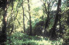 Cosumnes River riparian woodland
Currently, the preserve is more than 46,000 acres (190 km2) with educational and scientific studies being conducted in one of the largest conservation efforts begun on a watershed-sized scale. Collectively known as the Cosumnes River Project, it is a broad-based work to restore and protect the integrity of the river and associated landscapes including Central Valley habitats and wildlife.
River and forest relationship
The Cosumnes River has no major dams on its course of 80 miles (130 km) and floods after heavy rains bringing in sediments that provide nutrients for the vegetation, as well as recharging groundwater levels. In addition, removal of the man-made levees allows more innudation of floodwaters and is what ecologist Rich Reiner terms " natural process restoration".[7]
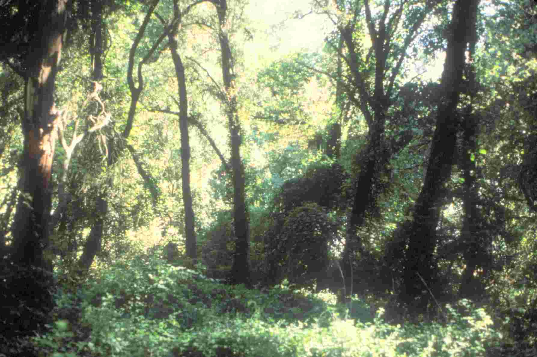
Notable trees in the preserve include valley oak and blue oak. The valley oak was once common in central California, forming large groves along rivers and streams. In grasslands, they form open savannas along with blue oaks.[8] The valley oak is the largest of the native California oak trees and can live to be 600 years old.[9] With a vertical root system as deep as 80 feet, it can reach groundwater levels.[9] The blue oak tolerates dry soil and can have a root system 30 feet deep. It has a distinctive blue tint in the green leaf color that can best be seen when compared to another nearby oak of a different type. The blue oak can live to be 400 years old[10] and provides critical winter range for deer and other wildlife.[10] The oaks provide several hundred pounds of nuts yearly, and at least 35 mammals and around 100 birds include oak acorns in their diet. Especially mule deer and western gray squirrel, who rely so much on the acorn crop that a poorly-producing year can limit their populations.[11]
Threats to the trees include land-clearing, rodents and exotic grasses. The non-native grasses are more aggressive and produce more seed than the native perennials, which attracts seed-eaters like Botta's Pocket Gopher that also feed on acorns and oak seedlings.[12] Restoration includes breaching the levees, allowing floodwaters to scour out the non-native grasses, reduce rodent populations and deposit sediment. With the buildup of sand and sediments in the flooded areas, studies have shown an increase growth of cottonwoods and willows, which in turn trap more sediments during the next flood cycles.[13]
The vegetation of oak, willow, alder, elderberry, cattails, and many other plants provide food, shelter and nesting sites for a wide range of wildlife, including migrating birds on the Pacific Flyway. The river is part of a dynamic balance of natural processes that sustain the plant and animal life that depend upon it.
"Every time a levee is repaired, the river is prevented from establishing a healthy floodplain, and every time river water is stored in a reservoir, the flow pulses essential for ecologic processes are eliminated."
-Philip B. Williams, Ph.D., Reno, NV. August, 2001 (from his speech River Engineering Versus River Restoration given at a ASCE conference)[14]Public access and education
The Cosumnes River Preserve Visitor Center is the hub for all activities concerning the preserve. Educational workshops, field trips and activity packets for teachers and students are provided through the visitor center.
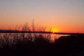
Recreation uses include wildlife-viewing, paddling, photography, nature study and limited fishing. The launch site for paddling is near the visitor center and a self-guided trip brochure with map is available. Tidal influence from the ocean is evident here with water levels changing several feet each day, exposing mudflats and sandbars. There are several named sloughs both east and west of the visitor center. Wood Duck Slough is the easternmost slough and has views of the Tall Forest, with large valley oaks overhanging the water and providing deep shade. "The scene is reminiscent of Bogart and Hepburn on the African Queen", writes author Charlie Pike in his book, Paddling Northern California.[15]
Hiking trails include short "walks" that showcase wetland plants and animals, to longer trails, such as the 7 miles (11 km) roundtrip Howard Ranch trail that has vernal pools, riparian habitat and views of oak woodland and the Sierra Nevada Mountains.
There is also a driving tour which allows visitors to see the scope of the conservation project, showing properties that are closed to the public.
See also
List of National Natural Landmarks in California
References
- ^ Cosumnes River Preserve history.
- ^ McKinney, John. "Visions of the Great Central Valley". California Parklands (California State Parks Foundation) (Fall 2008).
- ^ Calflora taxon report
- ^ "Important Bird Areas in California". Audubon-California. updated 2008. p. 2. http://ca.audubon.org/maps/pdf/Cosumnes_River_Watershed_Lower.pdf. Retrieved 2009-04-09.
- ^ "Cosumnes River Riparian Woodlands". National Natural Landmark Program. National Park Service. http://www.nature.nps.gov/nnl/Registry/USA_Map/States/California/NNL/CRRW/index.cfm. Retrieved 2009-04-10.
- ^ Reiner, Rich; Ramona Swenson (Fremontia, Jan 2000). "Saving Vernal Pools in the Cosumnes River Watershed". California Native Plant Society. p. 3. https://www.cnps.org/cnps/publications/fremontia/january_2000/5reiner.pdf. Retrieved 2009-04-03.
- ^ McKinney, John (2008). "A Mellifluous Roar". The Nature Conservancy. p. 5. http://www.cosumnes.org/about_crp/A%20Mellifluous%20Roar.pdf. Retrieved 2009-04-02.
- ^ Johnston, Verna California Forests and Woodlands, Univ. of Calif. Press 1994 p. 79
- ^ a b Stuart, John D. Trees and Shrubs of California Univ. of Calif, Press 2001 p.328
- ^ a b Stuart, John D. Trees and Shrubs of California Univ. of Calif. Press 2001 pp. 320-321
- ^ Johnston, Verna California Forests and Woodlands, Univ. of Calif. Press 1994 p. 87
- ^ Johnston, Verna California Forests and Woodlands, Univ. of Calif. Press 1994 p. 88
- ^ The Structure, Function and Management Implications of Fluvial Sedimentary Systems Fiona J. Dyer, Martin C. Thoms, Jon M. Olley, International Hydrological Programme, International Commission on Continental Erosion. Published by International Association of Hydrological Sciences, 2002 p. 90-Google Book Search results. accessed 04-03-2009
- ^ -Philip B. Williams,Ph.D., quoted from a keynote speech titled River Engineering Versus River Restoration p. 25
- ^ Pike, Charlie (2001). Paddling Northern California. Globe Piquet Press. p. 161. ISBN 1-56044-968-3.
External links
Categories:- IUCN Category Ia
- Nature reserves in California
- Wetlands of California
- Old growth forests
- Protected areas of Sacramento County, California
- National Natural Landmarks in California
- Sacramento-San Joaquin Delta
Wikimedia Foundation. 2010.