- Corydon Township, Warren County, Pennsylvania
-
Corydon Township Township Country United States State Pennsylvania County Warren Coordinates 41°47′0″N 79°1′0″W / 41.783333°N 79.016667°W Settled 1827 - Incorporated March 26, 1846 - Dissolved 1964 Timezone EST (UTC-4) - summer (DST) EDT (UTC-5) Area code 814  Former location of Corydon Township in modern-day Warren County
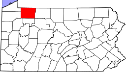 Location of Warren County in Pennsylvania
Corydon Township is a defunct township in Warren County, Pennsylvania in the United States. The township was merged in 1964 into Mead Township.
Contents
History
Historical populations Year Pop. 1850 228 1860 302 1870 411 1880 335 1890 527 1900 646 1910 402 1920 330 1930 327 1940 260 1950 263 1960 206 Source: United States Census Bureau Warren County was formed on March 12, 1800 out of Allegheny County, with the original township of Brokenstraw being formed in that October from everything in the county west of the Allegheny River and Conewango Creek; Conewango Township was formed in March 1808 and consisted of the unincorporated eastern half of Warren County.[1] On March 26, 1846, a portion of Corydon Township in McKean County was set off for Warren County.[2][3]
Construction of the Kinzua Dam caused the resulting Allegheny Reservoir to submerge the majority of the communities in Corydon Township. The township was merged into Mead Township in 1964.[4]
Geography
Corydon Township was located on a strip of land in the exterme northeastern corner of Warren County, and was bounded Cattaraugus County, New York on the north; McKean County on the east and south; and the Allegheny River on the west.[5]
References
Sources
- Schenck, J.S.; Rann, R.S., eds (1887). History of Warren County, Pennsylvania. Syracuse, New York: D. Mason & Co. http://www.archive.org/details/historyofwarrenc00sche. Retrieved June 4, 2011.
- Hottenstein, JoAnne; Welch, Sibyl (1965). "Warren County" (PDF). Incorporation dates of Pennsylvania municipalities. Harrisburg: Bureau of Municipal Affairs, Pennsylvania Department of Internal Affairs. http://www.phmc.state.pa.us/bah/dam/counties/pdfs/Warren.pdf. Retrieved June 4, 2011.
Municipalities and communities of Warren County, Pennsylvania County seat: Warren City 
Boroughs Bear Lake | Clarendon | Sugar Grove | Tidioute | Youngsville
Townships Brokenstraw | Cherry Grove | Columbus | Conewango | Deerfield | Eldred | Elk | Farmington | Freehold | Glade | Limestone | Mead | Pine Grove | Pittsfield | Pleasant | Sheffield | Southwest | Spring Creek | Sugar Grove | Triumph | Watson
CDPs Unincorporated
communitiesAkeley | Lander | Russell | Torpedo
Categories:- 1964 disestablishments
- Former municipalities in Pennsylvania
- Populated places established in 1827
- Townships in Warren County, Pennsylvania


Wikimedia Foundation. 2010.