- Conococha Lake
-
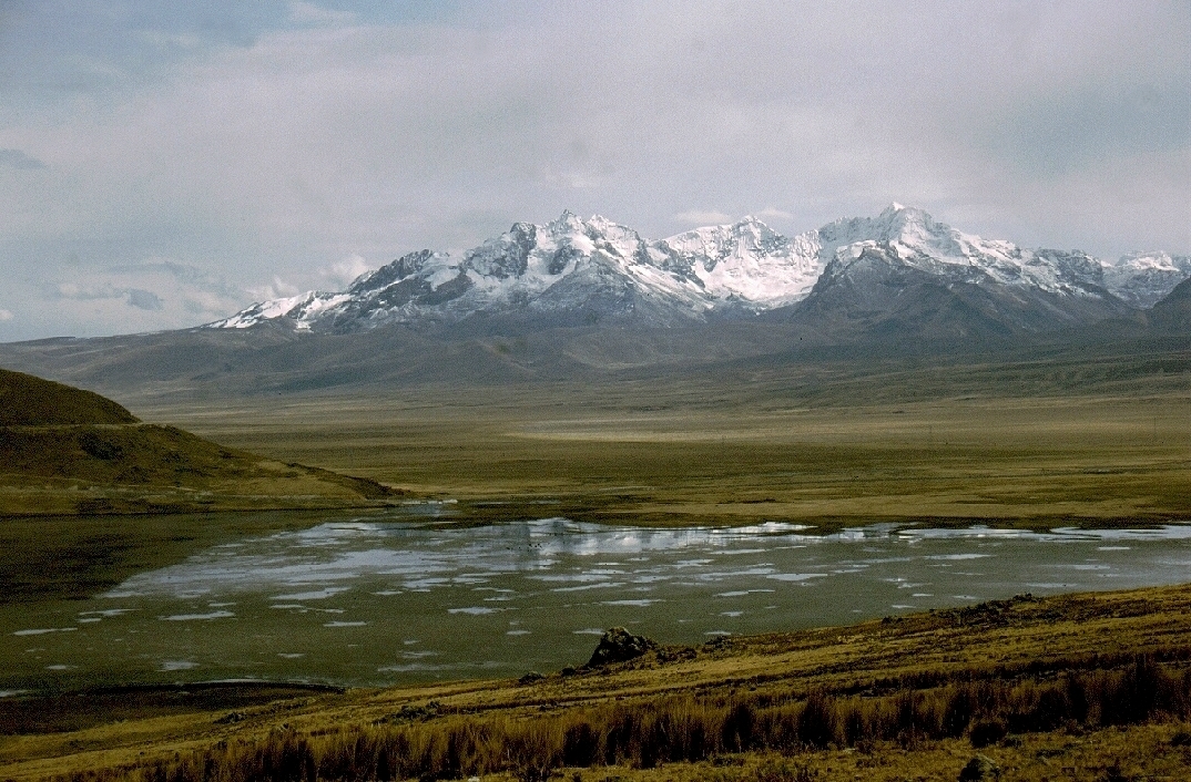
Laguna Conococha 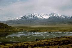
Location Ancash Region Coordinates 10°07′40″S 77°17′02″W / 10.12778°S 77.28389°WCoordinates: 10°07′40″S 77°17′02″W / 10.12778°S 77.28389°W Basin countries Peru Surface elevation 4,050 m Laguna Conococha is a lake in the Andes-Cordillera of South America in north-western Peru.
Laguna Conococha (Quechua "coñi cocha" = hot waters) is situated in the Ancash Region at an altitude of 4,050 m above sea level and at 10°07′40″S 77°17′02″W / 10.12778°S 77.28389°W on the road from Callejón de Huaylas to Chiquián.
The lake is seen as the headwaters of Río Santa which from here runs 200 km in a northerly direction, between Cordillera Negra and the snowcapped Cordillera Blanca.
Laguna Conococha is fed by small streams from the Cordillera Negra in the west and the Cordillera Blanca in the east. The main tributary of the lake is Rio Tuco which has its source in Laguna Tuco (9°56′40″S 77°11′44″W / 9.94444°S 77.19556°W) circa 5,000 m above sea level at one of the glacier tongues of Nevado de Tuco.
The village of Conococha is located on the western shore of the lake, where connecting roads to Lima, Pativilca, Huaraz and Chiquián are crossing.
Despite of the extreme altitude the lake is rich in fish, among others salmon and trout are found are. In 1996, a new species of the frog genus Telmatobius was discovered in the lake which is distinct from any other Peruvian species, as was reported by the scientists Antonio W. Salas und Ulrich Sinsch on behalf of Museo de Historia Natural, Lima.
The regional copper and zinc mining company Antamina has been accused of lowering waters levels of Laguna Conococha and thus affecting plant and animal species, and of contaminating the region with toxic mineral residues.
Categories:- Lakes of Peru
- Ancash Region
Wikimedia Foundation. 2010.