- Coldwater River (Algoma District)
-
Coldwater River River Country Canada Province Ontario Region Northeastern Ontario District Algoma Part Algoma, Unorganized, North Part of Great Lakes Basin Tributaries - right June Creek Source Black Lake - location Barager Township - elevation 370 m (1,214 ft) - coordinates 47°35′59″N 84°42′20″W / 47.59972°N 84.70556°W Mouth Lake Superior - location Giles Township - elevation 180 m (591 ft) - coordinates 47°28′05″N 84°47′17″W / 47.46806°N 84.78806°W 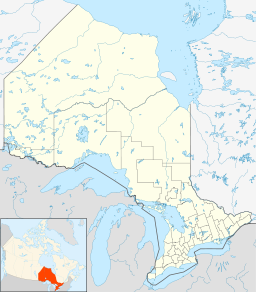
 Location of the mouth of the Coldwater River in Ontario.For other rivers named Coldwater River, see Coldwater River (disambiguation).
The Coldwater River is a river in the Unorganized North Part of Algoma District in Northeastern Ontario, Canada.[1] It is in the Great Lakes Basin, is a tributary of Lake Superior, and its entire course lies within Lake Superior Provincial Park.[2]
Course
The Coldwater River beings at Black Lake, in geographic Barager Township,[3] and travels south through geographic Broome Township,[4], and the southeast corner of geographic Brimbacombe Township[5] before flowing into geographic Giles Township,[6]where it takes in the right tributary June Creek, passes under Ontario Highway 17, and reaches its mouth at Lake Superior.
Tributaries
- June Creek
References
- ^ "Coldwater River". Geographical Names Data Base. Natural Resources Canada. http://geonames.nrcan.gc.ca/search/unique_e.php?id=FASDH&output=xml. Retrieved 2011-11-05.
- ^ "Park map". Lake Superior Provincial Park. MHS Webteam & Larrett Designs. http://www.lakesuperiorpark.ca/index.php?option=com_content&view=article&catid=13:quick-park-information&id=100:park-map. Retrieved 2011-11-04.
- ^ "Barager" (PDF). Geology Ontario - Historic Claim Maps. Ontario Ministry of Northern Development, Mines and Forestry. http://www.geologyontario.mndmf.gov.on.ca/website/historic_claim_maps/B/Barager.pdf. Retrieved 2011-11-05.
- ^ "Broome" (PDF). Geology Ontario - Historic Claim Maps. Ontario Ministry of Northern Development, Mines and Forestry. http://www.geologyontario.mndmf.gov.on.ca/website/historic_claim_maps/B/Broome.pdf. Retrieved 2011-11-05.
- ^ "Brimbacombe" (PDF). Geology Ontario - Historic Claim Maps. Ontario Ministry of Northern Development, Mines and Forestry. http://www.geologyontario.mndmf.gov.on.ca/website/historic_claim_maps/B/Brimacombe.pdf. Retrieved 2011-11-05.
- ^ "Giles" (PDF). Geology Ontario - Historic Claim Maps. Ontario Ministry of Northern Development, Mines and Forestry. http://www.geologyontario.mndmf.gov.on.ca/website/historic_claim_maps/G/Giles.pdf. Retrieved 2011-11-05.
Categories:- Rivers of Ontario
- Geography of Algoma District, Ontario
- Tributaries of Lake Superior
- Northern Ontario geography stubs

Wikimedia Foundation. 2010.