- Cockpit Country
-
Cockpit Country — Geographical Region — 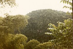
 Cockpit Country
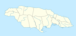
Coordinates: 18°17′43″N 77°41′43″W / 18.2952094°N 77.6953125°W Country Jamaica Parish Trelawny Named for Topology reminiscent of the shape of cock fighting dens. Time zone EST (UTC-5) Cockpit Country is an area in Jamaica which provided a natural defensive area used by Maroons to establish communities outside the control of Spanish or British colonialists.
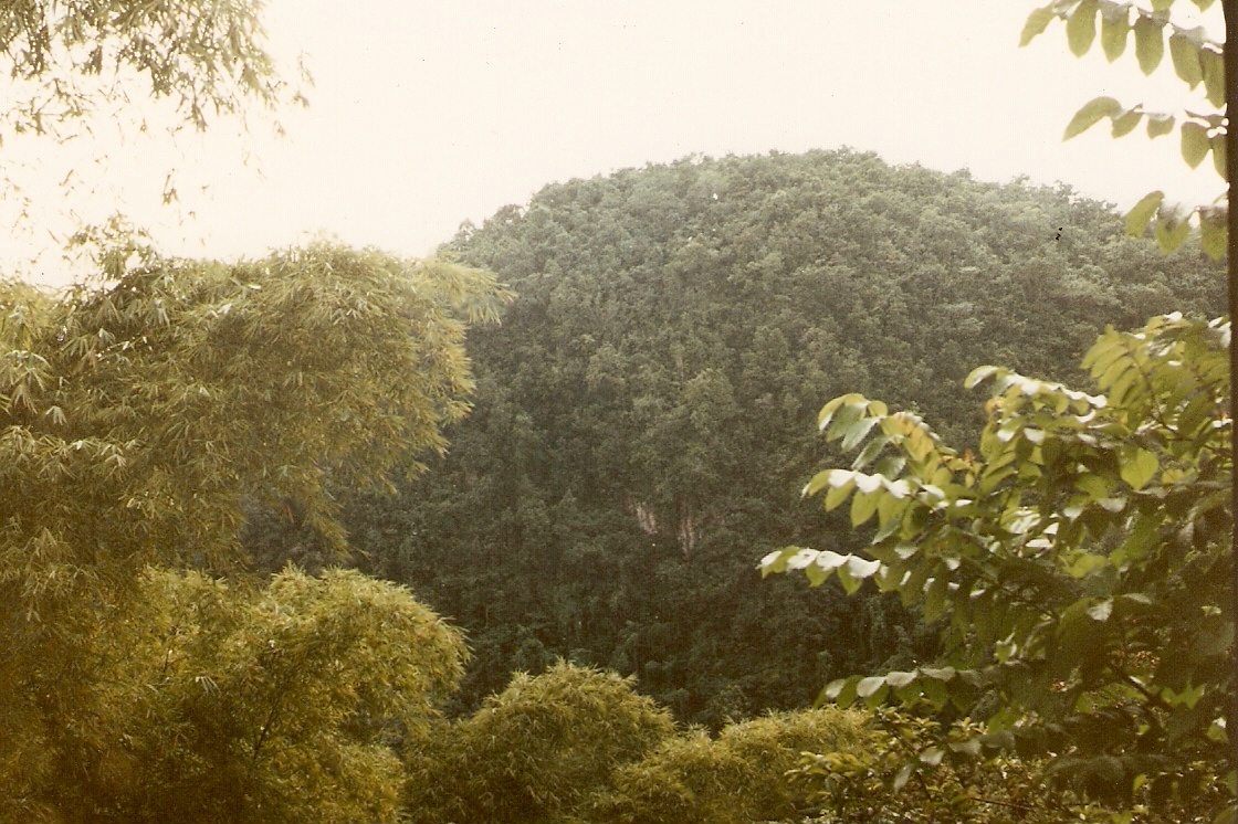
Cockpit Country is pockmarked with steep-sided hollows, as much as 120 metres (390 ft) deep in places, which are separated by conical hills and ridges.
On the north, the main defining feature is the fault-based "Escarpment", a long ridge that extends from Flagstaff in the west, through Windsor in the centre, to Campbells and the start of the Barbecue Bottom Road (B10). The Barbecue Bottom Road, which runs north-south, high along the side of a deep, fault-based valley in the east, is the only drivable route across the Cockpit Country. However, there are two old, historical trails that cross further west, the Troy Trail, and the Quick Step Trail, both of which are seldom used as of 2006 and difficult to find.
In the southwest, near Quick Step, is the district known as the "Land of Look Behind," so named because Spanish horsemen venturing into this region of hostile runaway slaves were said to have ridden two to a mount, one rider facing to the rear to keep a precautionary watch.
Where the ridges between sinkholes in the plateau area have dissolved, flat-bottomed basins or valleys have been formed that are filled with terra rosa soils, some of the most productive on the island. The largest basin is the Vale of Clarendon, 80 kilometres (50 mi) long and 32 kilometres (20 mi) wide. Queen of Spains Valley, Nassau Valley, and Cave Valley were formed by the same process.
Contents
Environment
The Cockpit Country is Jamaica's largest remaining contiguous rainforest. In 1979 an unpublished paper proposed the possibility of a National Park[1] In 1994 the geographer Alan Eyre[2] proposed that the Cockpit Country be zoned a World Heritage Site. A petition for protection of the area was submitted to Prime Minister Bruce Golding in 2006.
References
See also
External links
Coordinates: 18°17′43″N 77°41′43″W / 18.2952094°N 77.6953125°W
Geography of Jamaica  History of Jamaica
Subdivisions Settlements Landforms Bays and covesOrange Bay · XtabiAlligator Pond · Billys Bay · Bluefields Beach · Boston Beach · Calabash Bay · Doctor's Cave Beach Club · Font Hill Beach · Frenchmans Bay · Frenchman's Cove · Great Pedro Bay · Gut River · Hellshire Beach · Long Bay · Negril · Ocean View Beach · Treasure Beach · Whitehouse Beach · Winifred BeachJamaican Caves Organisation · Bad Hole · Belmont · Carambie · Coffee River · Drip · Dunn's Hole · Gourie · Green Grottos · Hutchinson's Hole · Jackson's Bay · Morgans Pond Hole · Mouth Maze · Oxford · Smokey Hole · Thatchfield Great · Windsor Great · XtabiHarboursHeadlandsMountainsRiversAlligator Hole · Annotto · Back · Black · Broad · Buff Bay · Cabarita · Cane · Cave · Coleburns Gully · Dry · Dunn · Ferry · Flint (Hanover) · Flint (St Mary) · Great · Green Island · Guava · Gut · Hectors · Hope · Llandovery · Lucea East · Lucea West · Martha Brae · Milk · Montego · Morant · Morgans · Negril (North · South) · Negro · New Savannah · One Eye · Oracabessa · Orange · Plantain Garden · Port Maria · Rio Bueno · Rio Cobre · Rio Doro · Rio Grande · Rio Magno · Rio Minho · Rio Nuevo · Rio Pedro · Roaring · Salt · Smith · Spanish · Stony · Sweet · Swift · Thicket · Wag Water · White · YS · YallahsOtherCockpit CountryExtreme points Natural disasters Earthquakes1692 (Port Royal) · 1907 (Kingston)Tropical stormsGildaTropical depressionsFauna Animals · Birds · FishFlora Maps List of maps of JamaicaCategories:- Jamaican Maroons
- Trelawny Parish
- Jamaica geography stubs
- African diaspora stubs

Wikimedia Foundation. 2010.