- Oxford Cave, Jamaica
-
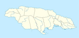
Oxford Cave, Jamaica Location 18°12′25″N 77°37′33″W / 18.2070126°N 77.6259613°WCoordinates: 18°12′25″N 77°37′33″W / 18.2070126°N 77.6259613°W[1] Depth N/A[1] Length 765 metres (2,510 ft)[1] Number of entrances 1[1] Oxford Cave is a cave in Manchester Parish in west-central Jamaica. It is 765 metres long and at 290 metres altitude.[1] The cave entrance is close by a main road and because of its accessibility has suffered much graffiti, vandalism and litter.[1] It is a roost for a great many bats, but these are under threat from the number of anti-social human visitors, many there to collect bat guano to use as farm fertiliser, others for bashments.[1]
See also
External links
References
- ^ a b c d e f g Stewart, R S (2006-06-06). "Oxford Cave - Field Notes". Jamaican Caves Organisation. http://www.jamaicancaves.org/oxford_060606.htm. Retrieved 2009-09-15.
 Caves of JamaicaBad Hole · Belmont · Carambie · Coffee River · Drip · Dunn's Hole · Gourie · Green Grottos · Hutchinson's Hole · Jackson's Bay · Long Mile · Morgans Pond Hole · Mouth Maze · Oxford · Smokey Hole · Swansea · Thatchfield Great · Windsor Great · XtabiCategories:
- Caves of Jamaica
- Manchester Parish
- Bat roosts of Jamaica
- Jamaica geography stubs
Wikimedia Foundation. 2010.

