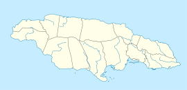
- Mouth Maze Cave
-
Mouth Maze Cave Location 18°18′30″N 77°34′29″W / 18.3084°N 77.5748°WCoordinates: 18°18′30″N 77°34′29″W / 18.3084°N 77.5748°W[1] Depth 10 metres (33 ft)[2] Length 3,118 metres (10,230 ft)[2] Number of entrances 2[1] List of entrances Main18°18′29″N 77°34′26″W / 18.308°N 77.574°W
Lighthole18°18′32″N 77°34′34″W / 18.309°N 77.576°WHazards Flood risk. Labyrinth. Mouth Maze Cave is a large, labyrinthine river cave in Trelawny, Jamaica. It is the only exit of the Mouth River from a small valley which, during intense rainfall, becomes flooded as the flow backs up.[1] Because of this it can only safely be visited in very dry periods.[1]
Contents
Natural history
The cave contains many invertebrates including, post hurricane Ivan, a termite nest.[1]
See also
External links
References
- ^ a b c d e Stewart, R S (2007-02-16). "Mouth Maze Cave - Field Notes". Jamaican Caves Organisation. http://www.jamaicancaves.org/mouth_maze_050330.htm. Retrieved 2008-07-25.
- ^ a b Fincham, Alan G (1997). Jamaica Underground (2nd ed. ed.). ISBN 976-640-036-9. http://www.jamaicancaves.org/Register_K_N.htm.
 Caves of JamaicaBad Hole · Belmont · Carambie · Coffee River · Drip · Dunn's Hole · Gourie · Green Grottos · Hutchinson's Hole · Jackson's Bay · Long Mile · Morgans Pond Hole · Mouth Maze · Oxford · Smokey Hole · Swansea · Thatchfield Great · Windsor Great · Xtabi
Jamaican Caves Organisation Categories:- Caves of Jamaica
- Trelawny Parish
- Jamaica geography stubs
Wikimedia Foundation. 2010.

