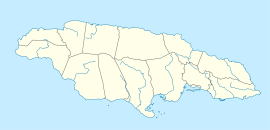
- Morgans Pond Hole
-
Morgans Pond Hole Location 18°08′00″N 77°28′31″W / 18.1334539°N 77.4752426°WCoordinates: 18°08′00″N 77°28′31″W / 18.1334539°N 77.4752426°W[1] Depth 186 metres (610 ft)[1] Length 165 metres (541 ft)[1] Number of entrances 1[1] At 186 metres (610 ft), Morgans Pond Hole in Manchester Parish, Jamaica is the second deepest known cave in the island.[2]
See also
External links
- Map.
- Aerial view.
- Photos:
- Caving in Jamaica.
- Morgans Pond Hole Field Notes.
References
- ^ a b c d Stewart, R S (2007-02-16). "Morgans Pond Hole - Field Notes". Jamaican Caves Organisation. http://www.jamaicancaves.org/morgans_pond_080725.htm. Retrieved 2008-07-25.
- ^ van Rentergem, Guy. "Why Jamaica". Guy van Rentergem. http://users.skynet.be/sky33676/why.html. Retrieved 2009-09-16.
 Caves of JamaicaBad Hole · Belmont · Carambie · Coffee River · Drip · Dunn's Hole · Gourie · Green Grottos · Hutchinson's Hole · Jackson's Bay · Long Mile · Morgans Pond Hole · Mouth Maze · Oxford · Smokey Hole · Swansea · Thatchfield Great · Windsor Great · XtabiCategories:
- Caves of Jamaica
- Manchester Parish
- Jamaica geography stubs
Wikimedia Foundation. 2010.

