- Cloverton, Minnesota
-
Cloverton, Minnesota — Unincorporated community — 
 Cloverton, Minnesota
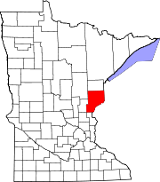
Coordinates: 46°10′05″N 92°19′11″W / 46.16806°N 92.31972°WCoordinates: 46°10′05″N 92°19′11″W / 46.16806°N 92.31972°W Country United States State Minnesota County Pine Township New Dosey Elevation 1,093 ft (333 m) Population – Total 60 Time zone Central (CST) (UTC-6) – Summer (DST) CDT (UTC-5) Area code(s) 320 GNIS feature ID 641361[1] Cloverton is an unincorporated community in Pine County, Minnesota, United States. Cloverton is located in New Dosey Township near the Wisconsin state line, 26 miles (42 km) east of Sandstone. According to the Minnesota Department of Transportation, Cloverton has an estimated population of 60.[2] Cloverton was named for wild clover in the area or for the Red Clover Land Company, a major landowner in the township in 1916. The Soo Line Railroad opened in the community in 1911. A post office operated in Cloverton from 1912 until 1972.[3]
References
- ^ U.S. Geological Survey Geographic Names Information System: Cloverton, Minnesota
- ^ Minnesota Department of Transportation (2010). Dakota County, Minnesota (Map). http://www.dot.state.mn.us/maps/cadd/county/pine2.pdf. Retrieved 2011-08-11.
- ^ "Cloverton". Minnesota Historical Society. http://mnplaces.mnhs.org/upham/city.cfm?PlaceNameID=583&BookCodeID=74&County=58&SendingPage=Results.cfm. Retrieved 12 August 2011.
Municipalities and communities of Pine County, Minnesota Cities Askov | Brook Park | Bruno | Denham | Finlayson | Henriette | Hinckley | Kerrick | Pine City | Rock Creek | Rutledge | Sandstone | Sturgeon Lake | Willow River
Townships Arlone | Arna | Barry | Birch Creek | Bremen | Brook Park | Bruno | Chengwatana | Clover | Crosby | Danforth | Dell Grove | Finlayson | Fleming | Hinckley | Kerrick | Kettle River | Mission Creek | Munch | New Dosey | Nickerson | Norman | Ogema | Park | Partridge | Pine City | Pine Lake | Pokegama | Royalton | Sandstone | Sturgeon Lake | Wilma | Windemere
Unincorporated
communitiesBeroun | Chengwatana | Cloverdale | Cloverton | Duquette | Friesland | Groningen | Lake Lena | Nickerson | Pokegama | Wareham | West Rock
Indian
reservationCategories:- Populated places in Pine County, Minnesota
- Unincorporated communities in Minnesota
- Minnesota geography stubs


Wikimedia Foundation. 2010.