- Rutledge, Minnesota
Infobox Settlement
official_name = Rutledge, Minnesota
settlement_type =City
nickname =
motto = "The Lonely Pine"
mapsize = 250px
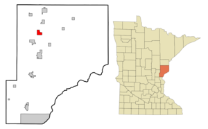
map_caption = Location of Rutledge, Minnesota
mapsize1 =
map_caption1 =subdivision_type = Country
subdivision_name =United States
subdivision_type1 = State
subdivision_name1 =Minnesota
subdivision_type2 = County
subdivision_name2 = Pinegovernment_footnotes =
government_type =
leader_title =
leader_name =
leader_title1 =
leader_name1 =
established_title =
established_date =unit_pref = Imperial
area_footnotes =area_magnitude =
area_total_km2 = 7.8
area_land_km2 = 7.6
area_water_km2 = 0.2
area_total_sq_mi = 3.0
area_land_sq_mi = 2.9
area_water_sq_mi = 0.1population_as_of = 2000
population_footnotes =
population_total = 196
population_density_km2 = 25.7
population_density_sq_mi = 66.5timezone = Central (CST)
utc_offset = -6
timezone_DST = CDT
utc_offset_DST = -5
elevation_footnotes =
elevation_m = 314
elevation_ft = 1030
latd = 46 |latm = 15 |lats = 30 |latNS = N
longd = 92 |longm = 51 |longs = 50 |longEW = Wpostal_code_type =
ZIP code
postal_code = 55795 (North of Pine River) 55735 (South of Pine River)
area_code = 218 (North of Pine River) 320 (South of Pine River)
blank_name = FIPS code
blank_info = 27-56518GR|2
blank1_name = GNIS feature ID
blank1_info = 0650434GR|3
website =
footnotes =Rutledge is a city in Pine County,
Minnesota ,United States , at the confluence of the Kettle and Pine Rivers. The population was 196 at the 2000 census.
County 61 serves as a main route in the community.The Willard Munger Bicycle/Snowmobile Trail passes through Rutledge.History
Long before it ever became an incorporated village, a group of Native Indians lived along the banks of the Kettle River from where the community is today to a point about 5 miles downstream. The Government Road between St. Paul, MN and Superior, WI came through that area in the 1860's. A bridge was constructed across the Kettle River at what was called the Rock Dam. On the south side of the river a station was built. There stagecoachs stopped to change horses and allow passengers to get out and stretch their legs and have a lunch. It was at this location where the first Europeans settled. In 1870 the Lake Superior and Mississippi Railroad was completed in this region. A depot was built about two and one half miles upstream from the Rock Dam. The depot was named Kettle River Station. The community began to grow near the railroad station. On February 14, 1893 an election was held at the school house to decide if the settlement should be incorporated as a village. A total of 22 votes were cast, 19 favoring incorportaion. The Village of Rutledge was named after a local lumberman Edward Rutledge who had built several mills in the area. James D. McCormack served as the first Mayor.
Geography
According to the
United States Census Bureau , the city has a total area of 3.0square mile s (7.8km² ), of which, 3.0 square miles (7.6 km²) of it is land and 0.1 square miles (0.2 km²) of it (2.32%) is water.Demographics
As of the
census GR|2 of 2000, there were 196 people, 78 households, and 56 families residing in the city. Thepopulation density was 66.5 people per square mile (25.7/km²). There were 110 housing units at an average density of 37.3/sq mi (14.4/km²). The racial makeup of the city was 96.94% White, 1.53% Native American, 1.53% from other races. Hispanic or Latino of any race were 1.53% of the population.There were 78 households out of which 30.8% had children under the age of 18 living with them, 60.3% were married couples living together, 9.0% had a female householder with no husband present, and 28.2% were non-families. 20.5% of all households were made up of individuals and 10.3% had someone living alone who was 65 years of age or older. The average household size was 2.51 and the average family size was 2.95.
In the city the population was spread out with 24.5% under the age of 18, 6.6% from 18 to 24, 32.7% from 25 to 44, 26.0% from 45 to 64, and 10.2% who were 65 years of age or older. The median age was 35 years. For every 100 females there were 100.0 males. For every 100 females age 18 and over, there were 100.0 males.
The median income for a household in the city was $33,750, and the median income for a family was $47,083. Males had a median income of $25,250 versus $21,667 for females. The
per capita income for the city was $19,040. About 15.3% of families and 19.6% of the population were below thepoverty line , including 37.5% of those under the age of eighteen and none of those sixty five or over.References
History Section from a Bicentennial (1976) Article by Todd Liljedahl "Used with Permission"

Wikimedia Foundation. 2010.