- Willow River, Minnesota
Infobox Settlement
official_name = Willow River, Minnesota
settlement_type =City
nickname =
motto =
imagesize =
image_caption =
image_
imagesize =
image_caption =
image_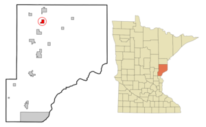
mapsize = 250px
map_caption = Location of Willow River, Minnesota
mapsize1 =
map_caption1 =subdivision_type = Country
subdivision_name =United States
subdivision_type1 = State
subdivision_name1 =Minnesota
subdivision_type2 = County
subdivision_name2 = Pinegovernment_footnotes =
government_type =
leader_title =
leader_name =
leader_title1 =
leader_name1 =
established_title =
established_date =unit_pref = Imperial
area_footnotes =area_magnitude =
area_total_km2 = 4.5
area_land_km2 = 4.1
area_water_km2 = 0.4
area_total_sq_mi = 1.7
area_land_sq_mi = 1.6
area_water_sq_mi = 0.2population_as_of = 2000
population_footnotes =
population_total = 309
population_density_km2 = 75.9
population_density_sq_mi = 196.7timezone = Central (CST)
utc_offset = -6
timezone_DST = CDT
utc_offset_DST = -5
elevation_footnotes =
elevation_m = 317
elevation_ft = 1040
latd = 46 |latm = 19 |lats = 13 |latNS = N
longd = 92 |longm = 50 |longs = 11 |longEW = Wpostal_code_type =
ZIP code
postal_code = 55795
area_code = 218
blank_name = FIPS code
blank_info = 27-70492GR|2
blank1_name = GNIS feature ID
blank1_info = 0654204GR|3
website =
footnotes =Willow River is a city in Pine County,
Minnesota ,United States , at the confluence of the Kettle and Willow Rivers. The population was 309 at the 2000 census.Interstate 35 , County Road 43, and County 61 (Cross Street) are three of the main routes in the community.Geography
According to the
United States Census Bureau , the city has a total area of 1.7square mile s (4.5km² ), of which, 1.6 square miles (4.1 km²) of it is land and 0.2 square miles (0.4 km²) of it (8.72%) is water.Demographics
As of the
census GR|2 of 2000, there were 309 people, 129 households, and 70 families residing in the city. Thepopulation density was 196.7 people per square mile (76.0/km²). There were 155 housing units at an average density of 98.7/sq mi (38.1/km²). The racial makeup of the city was 92.88% White, 4.53% Native American, 0.97% from other races, and 1.62% from two or more races. Hispanic or Latino of any race were 1.94% of the population.There were 129 households out of which 31.0% had children under the age of 18 living with them, 41.1% were married couples living together, 10.1% had a female householder with no husband present, and 45.7% were non-families. 39.5% of all households were made up of individuals and 20.9% had someone living alone who was 65 years of age or older. The average household size was 2.40 and the average family size was 3.37.
In the city the population was spread out with 28.5% under the age of 18, 12.0% from 18 to 24, 24.9% from 25 to 44, 19.7% from 45 to 64, and 14.9% who were 65 years of age or older. The median age was 34 years. For every 100 females there were 98.1 males. For every 100 females age 18 and over, there were 92.2 males.
The median income for a household in the city was $25,938, and the median income for a family was $44,167. Males had a median income of $37,656 versus $25,417 for females. The
per capita income for the city was $16,620. About 16.1% of families and 16.9% of the population were below thepoverty line , including 21.3% of those under the age of eighteen and 18.6% of those sixty five or over.Historic Places
*
John Doboszenski Farmstead
*Willow River Rutabaga Warehouse and Processing Plant Notable residents
*
Ernie Nevers , Football Hall of FamerReferences
Wikimedia Foundation. 2010.