- Citânia de Briteiros
-
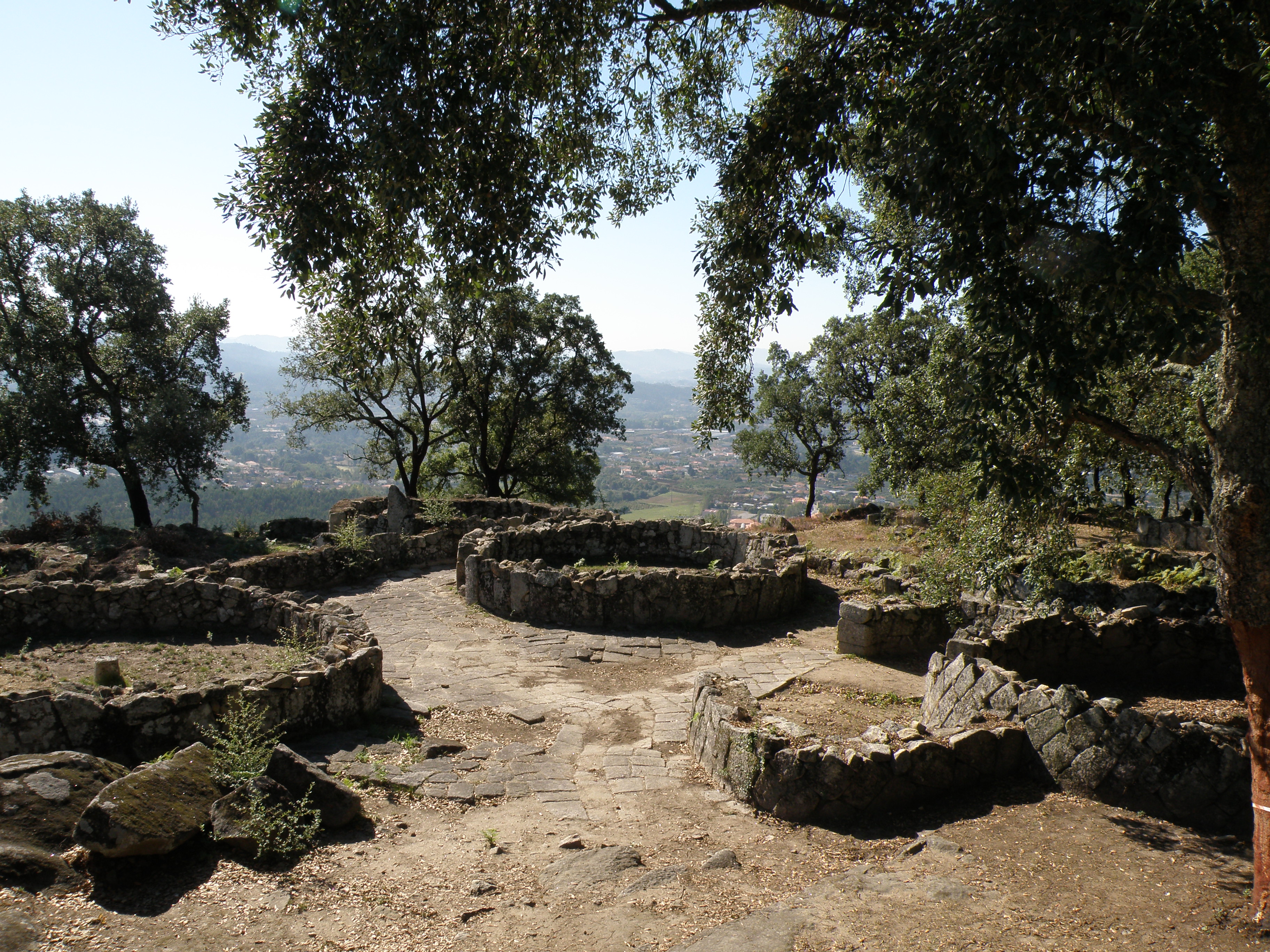
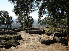 View of the Citânia de Briteiros, showing house ruins and stone paving
The Citânia de Briteiros is an archaeological site of Castro culture in the north-western Iberian Peninsula, significant for its size, urbanism, and architecture. Although primarily known for its remains of an Iron Age proto-urban hill fort (or oppidum), excavations at the site have revealed evidence of sequential settlements extending from the Bronze Age to the Middle Ages.[1]
Contents
Location and environment
The site is situated on a small promontory called Monte de São Romão near the Ave river, in the Norte region of Portugal, between the freguesias of Salvador de Briteiros and Donim, about 15 kilometers north-west of Guimarães. The location provides an extensive view over the navigable Ave river and its valley, and over an early north-south trade and communication path between the Douro and Minho river valleys. The moderate elevation of the site, the temperate and humid climate, and the nearby river give the hill and the surrounding area varied and rich natural resources for exploitation, from fruits of the woods to fishing to grazing.[2]
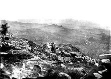 Citânia de Briteiros during an 1877 archaeological campaign
Research history
The site has been studied extensively since 1874, when the Portuguese archaeologist Francisco Martins Sarmento began annual excavation campaigns while helping to develop methods of archaeological research and preservation in Portugal; Sarmento's campaigns led to the discovery of much of the ruins of the acropolis (the highest portion of the settlement), and he reconstructed a pair of dwellings on the site from his research. Continuing discoveries during the first decades of work led Martins Sarmento to purchase the land on which the settlement lay. The land and Martins Sarmento's research materials were bequeathed to the Martins Sarmento Society; from the 1930s through the 1960s, new excavations were carried out by the Society, supervised by Mário Cardozo, which led to the discovery of large parts of the settlement on the eastern slope and additional portions of the acropolis. Further surveys were made in the 1970s (in the north-eastern section), and in 2002, 2005 and 2006.[1]
As research methods developed over the 19th and 20th centuries, the successive excavations at the Briteiros site adapted to evolving concepts, and gaps remain in the scientific knowledge of the site. In 2004 a project was initiated under the responsibility of Minho University with the collaboration of the Martins Sarmento Society to integrate the past studies and improve the conservation of the site.[1]
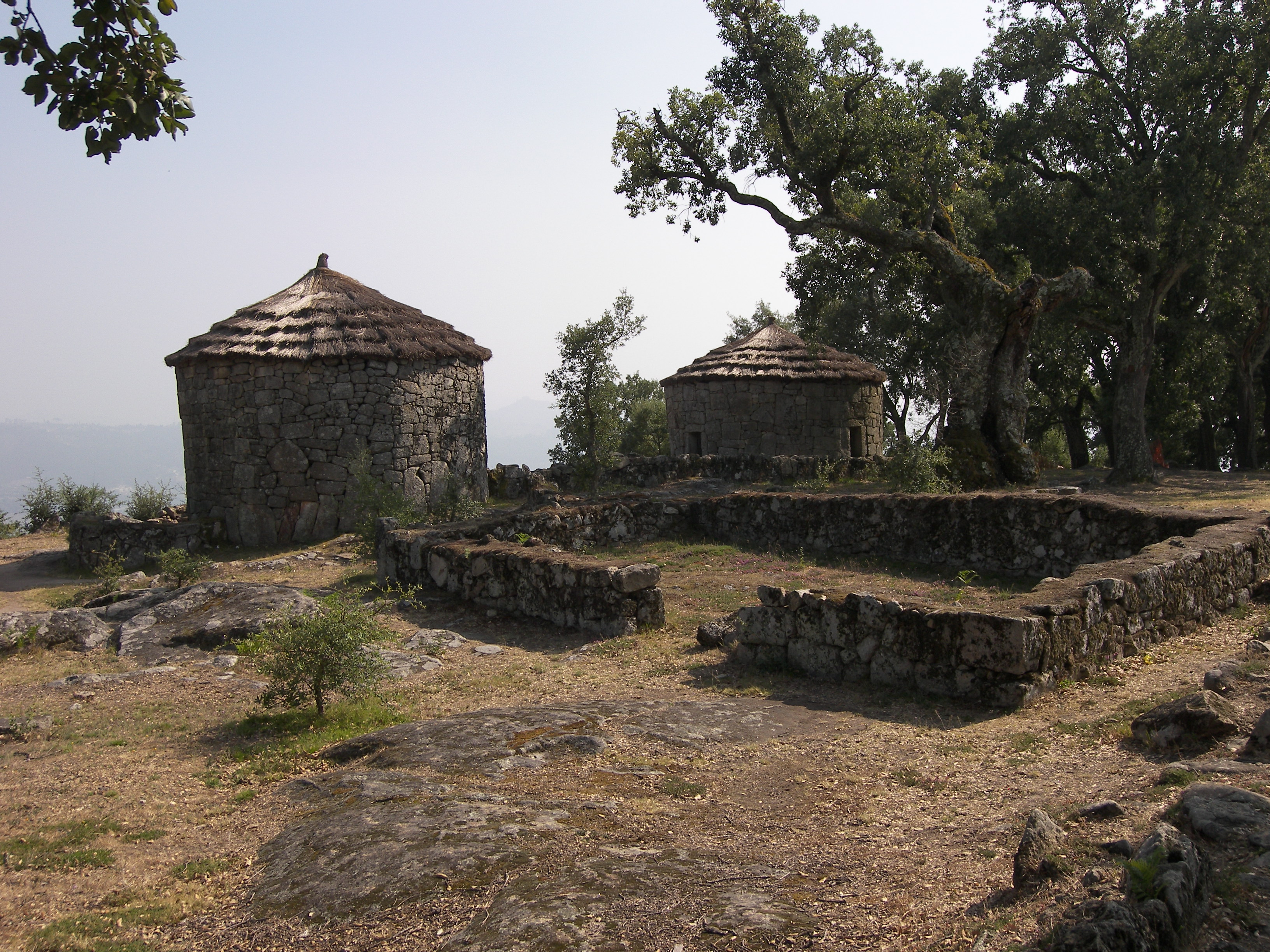
 Castro houses reconstructed by Martins Sarmento at the Citânia de Briteiros
The site was classified and protected by IPPAR as a Portuguese National Monument in 1910.[3]
Settlement history
Notes by Martins Sarmento and from recent explorations show that the Monte de São Romão was a favored location for rock art engravings of the Atlantic Bronze Age,[1] in the beginning of the first millennium BCE;[2] it is not known when or why this first group left.
Numerous early engraved rock surfaces were destroyed when many boulders were cut to build the ramparts and family compounds as the Castro settlement grew. Little is known of the beginnings of the Castro occupation, as no structures from the late Bronze Age have been found. Pottery from the early Iron Age has been found, when the settlement would already have been fortified. The majority of the ruins visible today have been dated from the second Iron Age, especially the last two centuries BCE.[1] This period was the peak of occupation of the site, by Celtiberians.
Expansion of the Roman Empire into the region has left evidence in the oppidum at Briteiros, in the form of coins (those of Augustus and Tiberius are the most numerous found, with smaller numbers of coins of the Republic, and the Flavians and the Antonines) ranging from the 1st century BCE to the 2nd century CE. A small number of amphorae and red pottery pieces have been found, and there is some evidence of Romanization in the architecture of the alleys and buildings of the eastern slope, but overall the visible impact of Roman occupiers is not strong.[1]
The reduced number of later coin and pottery finds suggests that occupation of the oppidum was declining from the 1st century CE, resulting in the 2nd century with very few people living within the ramparts. Evidence shows that there was a transitory reoccupation in the High Middle Ages, which included the building of a medieval chapel and graveyard on the acropolis.[1]
Characteristics of the Castro settlement
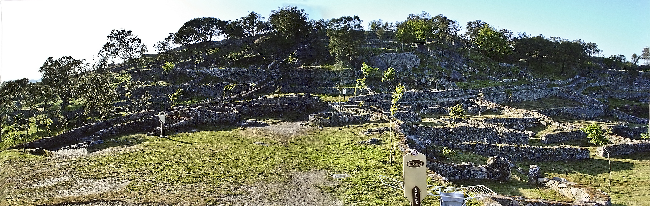
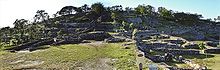 Panorama of the hill of the Citânia de Briteiros, view from the south
The visible ruins of the walled village or hill fort cover an area of about 24 hectares. The Briteiros site is called a citânia or cividade (from Latin civitas, city), due to its large size and city-like structure; other examples from the region and period include the Citânia de Sanfins and Cividade de Terroso.
The defensive system includes three lines of ramparts, with a partial fourth line to the north and a pair of moats. The preserved walls measure one to three meters thick and less than two meters high; a portion of wall restored by Martins Sarmento measures almost four meters high. The walls were built using irregular dry stone masonry methods, edged on both sides. The innermost rampart was partially absorbed into the urban development by being incorporated as a support wall for several family compounds. Gates were cut through each of the ramparts to provide passage; some of the gate openings still have hollows where vertically-moving palisades were placed. Ramps and stairs providing access to the top of the third rampart are evident.[1]
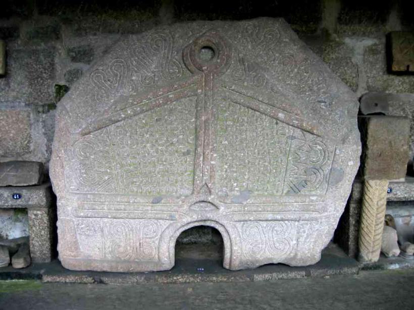
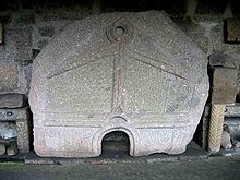 The Pedra Formosa from the baths of the Citânia de Briteiros
The known urban area of the settlement includes the acropolis, at the highest elevation, surrounded by the first rampart, and covering an area of about 7 hectares. Around 100 family dwelling compounds were found in this area, grouped into small blocks, with the blocks divided by several streets;[1] Briteiros is unusual among castros in having its streets arranged in a rough grid pattern.[4] The ramparts and main roads form the most visible aspects of the urban organization for public use, but other community elements exist: conduits which carried water from a spring on the hill, fountains, at least two public bath structures, and a large meeting or council house.[1] One bath ruin, an accidental find during road work in the 1930s, is one of the best-preserved constructions of its kind in northern Portugal and Galicia,[2] and includes a decorative monolith of almost 3 meters square, called the Pedra Formosa (the "handsome stone", thought once to have formed part of a burial chamber[4]).
Each of the family compounds, delimited by masonry walls, provided living and working space for a large family. Most compounds included one to three circular stone houses, some of them large and with an atrium, where the nuclear family lived; other structures within the compound housed other family members, served as stables, or stored agricultural tools, food, and rain or spring water.
Daily tasks and crafts were performed in the stone-paved courtyard of the compound, which formed the center of family life in the citânia.[2] Assuming around 6 people per family unit, a population of the acropolis of around 625 people has been estimated,[2] but estimates may reach as many as 1500 for the entire settlement when excavations are made of the eastern and south-western extremities.
See also
References
- ^ a b c d e f g h i j Sande Lemos, Francisco & Correida da Cruz, Gonçalo: Citânia de Briteiros: The Proto-Historic Settlement. Sociedade Martins Sarmento (2007), ISBN 978-972-8078-87-4
- ^ a b c d e Sande Lemos, Francisco: Citânia de Briteiros: Visitor's Guide. Sociedade Martins Sarmento (2007)
- ^ Instituto Português do Património Arquitectónico (IPPAR) classification of the site (in Portuguese)
- ^ a b MacKendrick, Paul: The Iberian Stones Speak: Archaeology in Spain and Portugal. New York, Funk and Wagnalls (1969)
External links
- Citânia de Briteiros: virtual visit (in English and Portuguese)
Categories:- Castro culture
- Prehistoric sites in Portugal
- Archaeological sites in Portugal
- Former populated places in Portugal

Wikimedia Foundation. 2010.