- Chon Daen District
-
Chon Daen
ชนแดน— Amphoe — Amphoe location in Phetchabun Province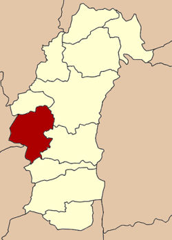
Coordinates: 16°11′21″N 100°51′35″E / 16.18917°N 100.85972°ECoordinates: 16°11′21″N 100°51′35″E / 16.18917°N 100.85972°E Country  Thailand
Province Phetchabun Seat Tambon Muban Amphoe established Area - Total 1,137.0 km2 (439 sq mi) Population (2000) - Total 86,086 - Density 75.7/km2 (196.1/sq mi) Time zone THA (UTC+7) Postal code 67150 Geocode 6702 Chon Daen (Thai: ชนแดน) is a district (Amphoe) in the western part of Phetchabun Province, northern Thailand.
History
Chon Daen minor district (King Amphoe) was created in 1917. It was officially upgraded to a full district in 1956.
Geography
Neighboring districts are (from the north clockwise) Wang Pong, Mueang Phetchabun, Nong Phai and Bueng Sam Phan of Phetchabun Province, Nong Bua of Nakhon Sawan Province, and Dong Charoen and Tap Khlo of Phichit Province.
Administration
The district is subdivided into 9 subdistricts (tambon), which are further subdivided into 125 villages (muban). There are three townships (thesaban tambon) - Chon Daen covers parts of tambon Chon Daen, Dong Khui parts of tambon Dong Khui and Takut Rai, and Tha Kham covers parts of tambon Tha Kham. There are further 9 Tambon administrative organizations.
1. Chon Daen ชนแดน 2. Dong Khui ดงขุย 3. Tha Kham ท่าข้าม 4. Phutthabat พุทธบาท 5. Lat Khae ลาดแค 6. Ban Kluai บ้านกล้วย 8. Sap Phutsa ซับพุทรา 9. Takut Rai ตะกุดไร 10. Sala Lai ศาลาลาย Mueang Phetchabun · Chon Daen · Lom Sak · Lom Kao · Wichian Buri · Si Thep · Nong Phai · Bueng Sam Phan · Nam Nao · Wang Pong · Khao Kho
Categories:- Amphoe of Phetchabun
- Northern Thailand geography stubs

Wikimedia Foundation. 2010.