- Changuinola District
-
Changuinola District — District — El Empalme, Bocas del Toro Location of the district capital in Panama
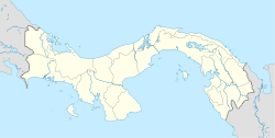
 Changuinola District
Coordinates: 09°25′48″N 82°31′12″W / 9.43°N 82.52°WCoordinates: 09°25′48″N 82°31′12″W / 9.43°N 82.52°W Country  Panama
Province Bocas del Toro Province Capital Changuinola Area - Total 1,542.5 sq mi (3,995 km2) Population (2000) - Total 71,922 Time zone ETZ (UTC-5) Changuinola District is a district (distrito) of Bocas del Toro Province in Panama. The population according to the 2000 census was 71,922.[1] The district covers a total area of 3,995 km². The capital lies at the city of Changuinola.[1] Major industries include tourism and agriculture.
Administrative divisions
The district is divided administratively into the following corregimientos:
Changuinola, Almirante, Guabito, Teribe, Valle del Risco, El Empalme and Las Tablas
Climate
Changuinola has a coastal location with a tropical climate. The area does not have a predictable dry season. The driest times are late August to mid-October, February, and March.[2] Changuinola is humid. Thundershowers and heavy rain are common.[3] Normal temperatures are consistent all year (Hi: 80°-84°F, low: 71°-75°F).[2] Due to its low latitude, sunrise is around 6 AM, and sunset is around 6 PM local time. These times vary slightly during the year. Weather data is collected at Captain Manuel Nino International Airport in Changuinola.[2]
Climate data for Changuinola, Panama Month Jan Feb Mar Apr May Jun Jul Aug Sep Oct Nov Dec Year Average high °F (°C) 80
(27)80
(27)82
(28)83
(28)83
(28)83
(28)82
(28)82
(28)84
(29)83
(28)81
(27)80
(27)82
(27.7)Average low °F (°C) 71
(22)71
(22)72
(22)73
(23)75
(24)75
(24)74
(23)74
(23)75
(24)75
(24)73
(23)72
(22)73.3
(23.0)Precipitation inches (mm) 12.56
(319)7.90
(200.7)7.61
(193.3)11.30
(287)11.08
(281.4)10.87
(276.1)16.06
(407.9)11.37
(288.8)6.42
(163.1)7.80
(198.1)14.45
(367)15.81
(401.6)133.23
(3,384)Source: Weather Underground [2] References
- ^ a b "Districts of Panama". Statoids. http://www.statoids.com/ypa.html. Retrieved April 10, 2009.
- ^ a b c d "Changuinola, Panama". Weather Underground. http://www.wunderground.com/NORMS/DisplayIntlNORMS.asp?CityCode=78767&Units=english. Retrieved 2009-05-29.
- ^ Frommer's Panama (2E, 2009), ISBN 9780470371831.
Capital: Bocas del ToroBocas del Toro District 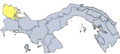
Changuinola District Chiriquí Grande District  Districts of Panama
Bocas del Toro Province Chiriquí Province Alanje District · Barú District · Boquerón District · Boquete District · Bugaba District · David District · Dolega District · Gualaca District · Remedios District · Renacimiento District · San Félix District · San Lorenzo District · Tolé DistrictCoclé Province Aguadulce District · Antón District · La Pintada District · Natá District · Olá District · Penonomé DistrictColón Province Darién Province Chepigana District · Pinogana DistrictHerrera Province Chitré District · Las Minas District · Los Pozos District · Ocú District · Parita District · Pesé District · Santa María DistrictLos Santos Province Guararé District · Las Tablas District · Los Santos District · Macaracas District · Pedasí District · Pocrí District · Tonosí DistrictPanamá Province Arraiján District · Balboa District · Capira District · Chame District · Chepo District · Chimán District · La Chorrera District · Panamá District · San Carlos District · San Miguelito District · Taboga DistrictVeraguas Province Atalaya District · Calobre District · Cañazas District · La Mesa District · Las Palmas District · Montijo District · Río de Jesús District · San Francisco District · Santa Fé District · Santiago District, Veraguas · Soná District · Mariato DistrictCategories:


Wikimedia Foundation. 2010.