- Cerro Pan de Azúcar
-
Cerro Pan de Azúcar 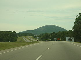
The hill viewed from a roadElevation 423 m (1,388 ft) Translation Sugar Loaf Hill (Spanish) Pronunciation Spanish: [ˈsero ˈpan de aˈsukar] Location Piriápolis, Maldonado Department,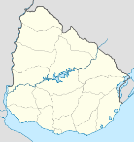
 Cerro Pan de Azúcar
 Uruguay
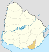
Range Cuchilla Grande Coordinates 34°48′33″S 55°15′31″W / 34.80917°S 55.25861°WCoordinates: 34°48′33″S 55°15′31″W / 34.80917°S 55.25861°W Geology Type Hill (granite, gneiss) Age of rock Precambrian Climbing Easiest route Hike Cerro Pan de Azúcar is a hill and the third highest point of Uruguay, with an altitude of 423 metres (1,387.8 ft).
Contents
Location and features
It is located southwest of Maldonado Department, in the municipality of Piriápolis, in a range of hills named Cuchilla Grande.
At the eastern feet of the hill and partly on its side, is the Reserva de Flora y Fauna del Pan de Azúcar, a nature reserve and zoo.[1] On its summit, there is a cross made of cement, with a height of 35 metres (114.8 feet), visible from a wide distance. The cross is visitable inside with a spiral staircase leading to the horizontal part of the cross, which offers view of the area through small openings.
History
In 1890 Don Francisco Piria, founder of the resort of Piriápolis, had bought a big streach of land including the Cerro Pan de Azúcar and streaching all the way to the beach. The hill was rich in granite and by his decision one of its slopes became a quarry which provided solid granite rocks for the construction of the seaside resort, and which gave work to more than 500 workers.
In 1933 the famous sculptor Juan Zorrilla de San Martín together with father Engels Walters constructed a 35 meter cross on its top. In 1980 a nature consevation and breeding center for animals threatened by extincion was founded on its east side.
Images
 Cerro Pan de Azúcar seen from the Nature Reserve.
 The Nature Reserve seen from the hill.
See also
References
External links
- (Spanish) Municipio de Maldonado
- (Spanish) Cerro Pan de Azucar - Eco-Park
 Maldonado Department of UruguayCapital: Maldonado
Towns and
villagesAiguá • Balneario Buenos Aires • Barrio Hipódromo • Barrio Los Aromos • Cerro Pelado • El Tesoro • Garzón, Uruguay • Gerona • Gregorio Aznárez • Hipódromo • La Sonrisa • Maldonado • Pan De Azúcar • Pinares - Las Delicias • Piriápolis • Playa Grande • Punta Del Este • San Carlos • San Rafael - El Placer • Villa Delia
Sights Arboretum Lussich • Casapueblo • Cerro Pan de Azúcar • Monumento al Ahogado • Punta Ballena
Categories:- Uruguay geography stubs
- Hills of Uruguay
- Maldonado Department
- National parks and nature reserves of Uruguay


Wikimedia Foundation. 2010.