- Cerro de las Ánimas
-
Cerro de las Ánimas Piriápolis, Maldonado Department,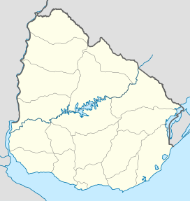
 Cerro de las Ánimas
 Uruguay
Elevation 501 m (1,644 ft) Translation Hill of the Souls (Spanish) Pronunciation Spanish: [ˈsero ðelaˈsanimas] Location Range Sierra de las Ánimas (part of Cuchilla Grande) Coordinates 34°45′07.38″S 55°19′10.54″W / 34.75205°S 55.3195944°WCoordinates: 34°45′07.38″S 55°19′10.54″W / 34.75205°S 55.3195944°W Geology Type Hill Age of rock Precambrian Climbing Easiest route Hike Cerro de las Ánimas ("Hill of the Souls", formerly known as Mirador Nacional) is a peak and the second highest point of Uruguay, with an altitude of 501 metres (1,643.7 ft).
Contents
Location and features
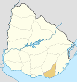
It is located southwest of Maldonado Department, in the municipality of Piriápolis, in a range of hills named Sierra de las Ánimas.
Changing height calculations
Until 1973, this hill was considered the highest point of Uruguay. However, in that year, a group of scientists of the Servicio Geográfico Militar (Military Geographic Service) changed the measure of the Cerro Catedral, currently considered the highest point of the country, with an altitude of 513.66 metres (1,685.24 feet).
See also
External links
- (Spanish) Paseo Sierra de las Ánimas.
 Maldonado Department of UruguayCapital: Maldonado
Towns and
villagesAiguá • Balneario Buenos Aires • Barrio Hipódromo • Barrio Los Aromos • Cerro Pelado • El Tesoro • Garzón, Uruguay • Gerona • Gregorio Aznárez • Hipódromo • La Sonrisa • Maldonado • Pan De Azúcar • Pinares - Las Delicias • Piriápolis • Playa Grande • Punta Del Este • San Carlos • San Rafael - El Placer • Villa Delia
Sights Arboretum Lussich • Casapueblo • Cerro Pan de Azúcar • Monumento al Ahogado • Punta Ballena
Categories:- Uruguay geography stubs
- Hills of Uruguay
- Maldonado Department


Wikimedia Foundation. 2010.