- 2007 Alum Rock earthquake
-
2007 Alum Rock earthquake Date October 30, 2007 Magnitude 5.6 Mw Depth 5.7 miles (9 km) Epicenter 37°25′55″N 121°46′34″W / 37.432°N 121.776°WCoordinates: 37°25′55″N 121°46′34″W / 37.432°N 121.776°W Countries or regions  United States
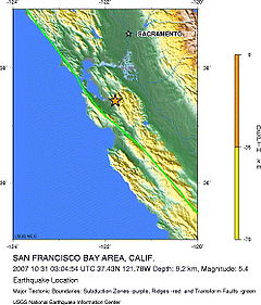
Casualties none The 2007 Alum Rock earthquake occurred on October 30, 2007 at approximately 8:04 p.m. PDT (October 31, 3:04 a.m. UTC)[1] in Alum Rock Park in San Jose, California. It measured 5.6 on the moment magnitude scale and had a depth of 5.7 miles (9.2 km).[2]
The Alum Rock earthquake was the largest in the San Francisco Bay Area since the 1989 Loma Prieta earthquake, which measured 6.9 on the moment magnitude scale. Ground shaking from the Alum Rock quake reached San Francisco and Oakland and other points further north.
ElarmS, an earthquake early warning system, accurately predicted the quake seconds before it struck, correctly estimating the quake's magnitude to within 0.5 magnitude units using only three to four seconds worth of data. Scientists with the California Integrated Seismic Network hope to refine the system to provide a 10-second warning in a similar quake to residents of Oakland and San Francisco.[3]
Contents
Geology
The quake originated on the Calaveras Fault. 60,000 felt reports existed far beyond Santa Rosa. The earthquake ruptured an area of the fault for a length of about 5 km (3.1 mi) beginning at the hypocenter and extending southeast. No surface trace of the earthquake along the fault.[4]
Damage
The earthquake caused minor damage, such as knocking things off of shelves, but caused no casualties. The shaking was felt as far north as Eugene, Oregon. Some parts of the area felt the rupture for up to 15 seconds. David Oppenheimer, a seismologist at the United States Geological Survey (USGS), said that although the quake was felt as a strong jolt over a wide region, it was more significant because it caused stress changes in the Calaveras Fault and the nearby Hayward Fault.[5]
See also
- Earthquakes in California
- List of earthquakes in the United States
References
- ^ "The Alum Rock Earthquake of October 30, 2007, 08:04 pm PDT". Berkeley Seismological Laboratory. http://seismo.berkeley.edu/~peggy/AlumRock.htm. Retrieved 2008-10-10.
- ^ Associated Press (2007-10-31). "Moderate quake rattles Bay Area". CNN. Archived from the original on September 17, 2008. http://web.archive.org/web/20080917054918/http://www.cnn.com/2007/US/10/30/california.quake/index.html. Retrieved 2008-10-10.
- ^ Early warning system predicted shaking from Oct. 30 quake, PhysOrg.com, December 11, 2007. Retrieved October 16, 2008.
- ^ "Magnitude 5.6 - SAN FRANCISCO BAY AREA, CALIFORNIA". USGS. 2008-09-23. http://earthquake.usgs.gov/eqcenter/eqinthenews/2007/nc40204628/#summary. Retrieved 2008-10-10.
- ^ Perlman, David (2007-10-31). "Quake raises danger of more action on volatile Hayward Fault". San Francisco Chronicle. http://www.sfgate.com/cgi-bin/article.cgi?f=/c/a/2007/10/31/MNCAT3RA1.DTL. Retrieved 2008-10-10.
Significant California earthquakes Very Large
(7.0 or greater)1857 Fort Tejon (7.9) · 1872 Lone Pine (7.8) · 1906 San Francisco (7.8) · 1952 Kern County (7.3) · 1992 Cape Mendocino (7.2) · 1992 Landers (7.3) · 1999 Hector Mine (7.1) · 2010 Baja California (7.2)
Large
(6.0-6.9)1868 Hayward (6.8) · 1933 Long Beach (6.4) · 1971 San Fernando (6.6) · 1983 Coalinga (6.5) · 1984 Morgan Hill (6.2) · 1986 Chalfant Valley (6.2) · 1989 Loma Prieta (6.9) · 1992 Big Bear (6.4) · 1994 Northridge (6.7) · 2003 San Simeon (6.5) · 2004 Parkfield (6.0) · 2010 Eureka (6.5)
Moderate
(less than 6.0)1987 Whittier Narrows (5.9) · 2007 Alum Rock (5.6) · 2008 Chino Hills (5.4)
← Earthquakes in 2007 → - 2007–08 Nazko (<4.0)
- Alum Rock (5.6, Oct 30)
- Ağrı (5.0, Jan 21)
- Aisén Fjord (6.7, Apr 21)
- Andreanof Islands (7.2, Dec 19)
- Tocopilla (7.7, Nov 14)
- Chūetsu offshore (6.6, Jul 16)
- Gisborne (6.8, Dec 20)
- Guatemala (6.7, Jun 13)
- Iberian Peninsula (6.1, Feb 12)
- Kent (4.3, Apr 28)
- Kuril Islands (8.1, Jan 13)
- Laos (6.1, May 16)
- Martinique (7.4, Nov 29)
- Noto (6.9, Mar 25)
- Peru†‡ (8.0, Aug 15)
- Solomon Islands† (8.1, Apr 2)
- 1st Sumatra† (6.4, Mar 6)
- 2nd Sumatra (8.5, Sep 12)
- Mariana Islands (7.2, Oct 31)
- Tonga (7.9, Dec 9)
- Puchuncaví (6.7, Dec 15)
† indicates earthquake resulting at least 30 deaths
‡ indicates the deadliest earthquake of the yearCategories:- Earthquakes in California
- 2007 earthquakes
- 2007 natural disasters in the United States
Wikimedia Foundation. 2010.

