- 2007 Noto earthquake
-
Coordinates: 37°16′N 136°36′E / 37.267°N 136.6°E
2007 Noto earthquake 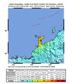
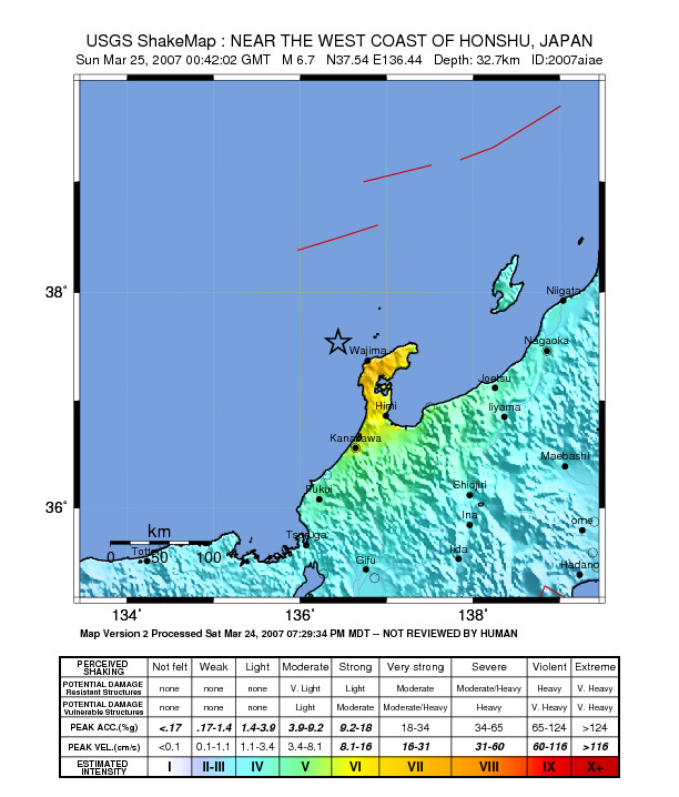
Date March 25, 2007 Magnitude 6.9 Mw Countries or regions Japan Peak acceleration 1.33 g (vector sum) Casualties 1 dead, 170 injured At 9:42 a.m. on March 25, 2007, the Noto Peninsula Earthquake (能登半島地震 Noto hantō jishin), a magnitude 6.9 earthquake, struck the Hokuriku region of Japan, near the Noto Peninsula. The earthquake shook the city of Nanao and the town of Anamizu with a seismic intensity of 6+ on Japan's shindo scale. One death, in the city of Wajima, and at least 214 injuries have been reported. A tsunami advisory was immediately made for the Kaga coast and Noto coast, and a 10-20 cm wave hit shore about 30 minutes later. [1]
The Japan Meteorological Agency placed the earthquake at 37.3°N, 136.5°E, at a depth of 50 km. It estimated the magnitude at 7.1, but later revised its estimate to 6.9. The earthquake had a maximum three-component vector sum peak ground acceleration of 1,304 cm/s2 (1.33 g).[2]
Japanese broadcaster NHK reported an aftershock as strong as magnitude 5.3 at 6:11 p.m. [3]
See also
References
- ^ "Hokuriku quake kills one, injures 170". The Japan Times. 2007-03-26. http://search.japantimes.co.jp/cgi-bin/nn20070326a1.html.
- ^ Masumi Yamada, Sun-Cheon Park, Jim Mori (January/February 2008). "The 2007 Noto Peninsula, Japan, Earthquake (Mw 6.7): Damage to Wooden Structures". Seismological Research Letters Volume 79, Number 1. http://www.eqh.dpri.kyoto-u.ac.jp/~masumi/etc/yamada2008SRL.pdf. Retrieved 22 March 2011.
- ^ "Aftershock hits as quake injury toll reaches 170". AP via News Limited. 2007-03-26. http://www.news.com.au/story/0,10117,21446505-401,00.html.[dead link]
Sources
- "Strong quake off Japan kills 1, injures scores". AP via CNN. 2007-03-25. http://www.cnn.com/2007/WORLD/asiapcf/03/25/quake.japan.ap/index.html.
- Japan Meteorological Agency (Japanese)
- "Earthquakes rock Pacific nations". BBC. 2007-03-25. http://news.bbc.co.uk/2/hi/asia-pacific/6492473.stm.
- "6.9 Magnitude Earthquake Kills 1, Injures 170 in Japan". AP via Fox. 2007-03-25. http://www.foxnews.com/story/0,2933,260942,00.html.
- Hamada, Masanori; Ömer Aydan, Akio Sakamoto (2007-04). "A Quick Report on Noto Peninsula Earthquake on March 25, 2007" (PDF). Japan Society of Civil Engineers. http://www.jsce-int.org/disaster_report/noto_report.pdf. Retrieved 2008-05-07.
← Earthquakes in 2007 → 2007–08 Nazko (<4.0) · Alum Rock (5.6, Oct 30) · Ağrı (5.0, Jan 21) · Aisén Fjord (6.7, Apr 21) · Andreanof Islands (7.2, Dec 19) · Tocopilla (7.7, Nov 14) · Chūetsu offshore (6.6, Jul 16) · Gisborne (6.8, Dec 20) · Guatemala (6.7, Jun 13) · Iberian Peninsula (6.1, Feb 12) · Kent (4.3, Apr 28) · Kuril Islands (8.1, Jan 13) · Laos (6.1, May 16) · Martinique (7.4, Nov 29) · Noto (6.9, Mar 25) · Peru†‡ (8.0, Aug 15) · Solomon Islands† (8.1, Apr 2) · 1st Sumatra† (6.4, Mar 6) · 2nd Sumatra (8.5, Sep 12) · Mariana Islands (7.2, Oct 31) · Tonga (7.9, Dec 9) · Puchuncaví (6.7, Dec 15)
† indicates earthquake resulting at least 30 deaths
‡ indicates the deadliest earthquake of the yearCategories:- Chūbu region
- Earthquakes in Japan
- 2007 earthquakes
- 2007 in Japan
- Hokuriku region
- Japanese history stubs
- Earthquake stubs
Wikimedia Foundation. 2010.