- Clinton County Airport
-
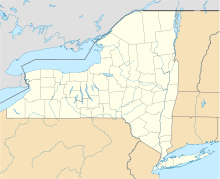
Clinton County Airport IATA: PLB – ICAO: KPLB – FAA LID: PLB Location of airport in New York Summary Airport type Public Owner Clinton County Serves City of Plattsburgh, New York Location Town of Plattsburgh, New York Elevation AMSL 371 ft / 113 m Coordinates 44°41′15″N 073°31′28″W / 44.6875°N 73.52444°W Runways Direction Length Surface ft m 1/19 5,000 1,524 Asphalt 14/32 5,000 1,524 Asphalt Statistics (2006) Aircraft operations 14,150 Based aircraft 30 Source: Federal Aviation Administration[1] Clinton County Airport (IATA: PLB, ICAO: KPLB, FAA LID: PLB) is a former county-owned public-use airport in Clinton County, New York, United States. It is located three nautical miles (6 km) west of the central business district of the city of Plattsburgh.[1] It served Plattsburgh and the western side of Lake Champlain.
Clinton County transitioned to using the nearby Plattsburgh International Airport (44°39′03″N 073°28′05″W / 44.65083°N 73.46806°W) as the primary airport for the region on June 18, 2007, and Clinton County Airport is now officially closed to itinerant aircraft, though it's still used for paradrops, and a few aircraft are still based there.
As per Federal Aviation Administration records, the airport had 1,712 passenger boardings (enplanements) in calendar year 2004 and 1,747 enplanements in 2005.[2] According to the FAA's National Plan of Integrated Airport Systems for 2007–2011, Clinton County was categorized as a general aviation airport because the commercial service category required at least 2,500 passenger boardings per year.[3]
Facilities and aircraft
Clinton County Airport covers an area of 990 acres (400 ha) at an elevation of 371 feet (113 m) above mean sea level.[1] It has two runways; the primary instrument runway is runway 1-19. An instrument landing system is installed on the north-facing runway 1. Runway 1 is also equipped with a medium intensity approach lighting system. A VOR is located on the field and provides a non-precision instrument approach to runway 19. Both runway 1-19 and runway 14-32 are 5000 feet in length and 100 feet wide (1,524 x 30 m). The landing threshold to runway 19 is displaced 635 feet for landing due to trees north of the airport. A third runway oriented east-west existed during the 1980s, but it was abandoned.
For the 12-month period ending October 24, 2006, the airport had 14,150 aircraft operations, an average of 38 per day: 78% general aviation and 22% air taxi. At that time there were 30 aircraft based at this airport: 83% single-engine, 13% multi-engine and 3% jet.[1]
References
- ^ a b c d FAA Airport Master Record for PLB (Form 5010 PDF). Federal Aviation Administration. Effective 29 July 2010.
- ^ FAA Passenger Boarding and All-Cargo Data: 2005
- ^ FAA National Plan of Integrated Airport Systems: 2007-2011
External links
- Clinton County Airport at Clinton County website
- Clinton County (PLB)PDF airport diagram from New York State DOT
- Aerial image as of 7 May 1995 from USGS The National Map
- Resources for this airport:
- AirNav airport information for KPLB
- ASN accident history for PLB
- FlightAware airport information and live flight tracker
- NOAA/NWS latest weather observations
- SkyVector aeronautical chart, Terminal Procedures for KPLB
Categories:- Airports in New York
- Transportation in Clinton County, New York
Wikimedia Foundation. 2010.

