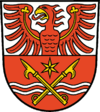
- Märkisch-Oderland
-
Märkisch-Oderland — District — 
Country  Germany
State Brandenburg Capital Seelow Area – Total 2,127.7 km2 (821.5 sq mi) Population (31 December 2010)[1] – Total 190,502 – Density 89.5/km2 (231.9/sq mi) Time zone CET (UTC+1) – Summer (DST) CEST (UTC+2) Vehicle registration MOL Website maerkisch-oderland.de Märkisch-Oderland is a Landkreis (district) in the eastern part of Brandenburg, Germany. Neighboring are (from the north clockwise) the district Barnim, the country Poland, the district-free city Frankfurt (Oder), the district Oder-Spree and the Bundesland Berlin. The administrative seat is Seelow but the largest town is Strausberg.
Contents
Geography
The district extends from the outskirts of Berlin in the west to the Oder river and the Polish border in the east. It includes a swampy area along the Oder known as the Oderbruch, about 60 km in length and 17 km in width. The Oderbruch was partially drained and populated in the 18th century. The rest of the district is mainly agricultural land.
History
The district dates back to the district Lebus and the district Oberbarnim, which were both created in 1816. The district Lebus dates back to the Land Lebus, the region around the town of Lebus. In 1863 Seelow became the seat of the administration of the district Lebus, and in 1950 the district was renamed to Kreis Seelow. In 1952 the districts were split into three parts, the districts Bad Freienwalde, Seelow and Strausberg. In 1993 the three parts were merged together to form the current district - the new name refers to Northmarch lands at the Oder river.
Coat of arms
Towns and municipalities
Amt-free towns Ämter
Amt-free municipalities- Fredersdorf-Vogelsdorf
- Hoppegarten
- Letschin
- Neuenhagen bei Berlin
- Petershagen-Eggersdorf
- Rüdersdorf bei Berlin
1. Barnim-Oderbruch
[seat: Wriezen]3. Golzow
4. Lebus
7. Seelow-Land
[seat: Seelow]1seat of the Amt; 2town References
- ^ "Bevölkerung im Land Brandenburg am am 30. Dezember 2010 nach amtsfreien Gemeinden, Ämtern und Gemeinden. Gebietsstand: 31.12.2010" (in German). Amt für Statistik Berlin-Brandenburg. 31 December 2010. http://www.statistik-berlin-brandenburg.de//Publikationen/OTab/2011/OT_A01-04-00_124_201012_BB.pdf.
External links
- Official website (German)
- History and infos (German)
Urban districts Rural districts Barnim · Dahme-Spreewald · Elbe-Elster · Havelland · Märkisch-Oderland · Oberhavel · Oberspreewald-Lausitz · Oder-Spree · Ostprignitz-Ruppin · Potsdam-Mittelmark · Prignitz · Spree-Neiße · Teltow-Fläming · UckermarkCategories:- Districts of Brandenburg
- Märkisch-Oderland
Wikimedia Foundation. 2010.

