- Oberspreewald-Lausitz
-
Oberspreewald-Lausitz — District — 
Country  Germany
State Brandenburg Capital Senftenberg Area - Total 1,216.6 km2 (469.7 sq mi) Population (31 December 2010)[1] - Total 121,679 - Density 100/km2 (259/sq mi) Time zone CET (UTC+1) - Summer (DST) CEST (UTC+2) Vehicle registration OSL Website http://www.osl-online.de Oberspreewald-Lausitz is a Kreis (district) in the southern part of Brandenburg, Germany. Neighboring districts are (from the north clockwise) Dahme-Spreewald, Spree-Neiße, the districts Kamenz and Riesa-Großenhain in Saxony, and the district Elbe-Elster.
Contents
Geography
The Spree river runs through the district; along its banks there is the Spreewald, a wooded area and habitat of several rare animals. The district is part of the historic region of Lusatia.
History
The district was formed in 1993 by merging the previous districts Calau and Senftenberg and small part of the district Bad Liebenwerda.
Coat of arms
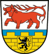
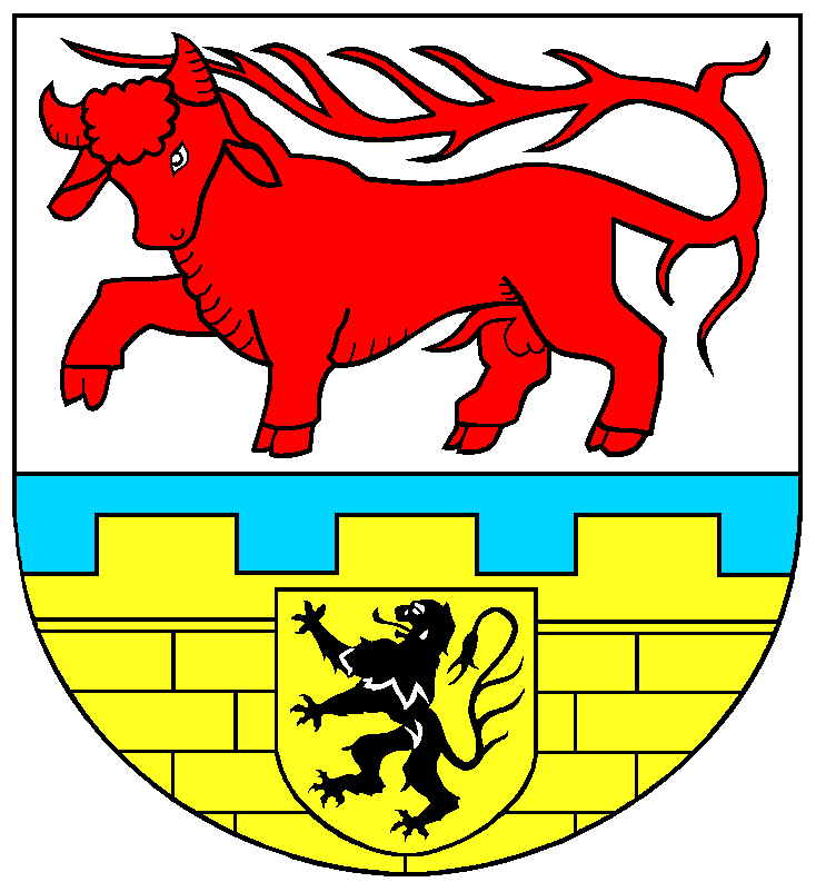
The coat of arms shows a red bull as the symbol of the Lower Lusatia region, representing the former district Calau. The city wall in the bottom part is an old symbol of the Upper Lusatia region, and also represents the former district Senftenberg. The shield with a lion is the symbol of the county of Meißen, representing the municipalities of the former district Bad Liebenwerda which were included into the district. Towns and municipalities
Amt-free towns Ämter
Amt-free municipalities1. Altdöbern
2. Ortrand
3. Ruhland
1seat of the Amt; 2town References
- ^ "Bevölkerung im Land Brandenburg am am 30. Dezember 2010 nach amtsfreien Gemeinden, Ämtern und Gemeinden. Gebietsstand: 31.12.2010" (in German). Amt für Statistik Berlin-Brandenburg. 31 December 2010. http://www.statistik-berlin-brandenburg.de//Publikationen/OTab/2011/OT_A01-04-00_124_201012_BB.pdf.
External links
 Media related to Oberspreewald-Lausitz at Wikimedia Commons
- Official website (German)
Urban districts Rural districts Barnim · Dahme-Spreewald · Elbe-Elster · Havelland · Märkisch-Oderland · Oberhavel · Oberspreewald-Lausitz · Oder-Spree · Ostprignitz-Ruppin · Potsdam-Mittelmark · Prignitz · Spree-Neiße · Teltow-Fläming · UckermarkCategories:- Districts of Brandenburg
- Oberspreewald-Lausitz
Wikimedia Foundation. 2010.