- Rezovo
on the bloc’s new border |publisher=BNR
Radio Bulgaria |date=2007-01-03 |accessdate=2008-09-02 Note that the entirety ofCyprus and various Greek islands, including a part ofRhodes , are located further southeast.] The village is located 11kilometre s south ofSinemorets , 17 km fromAhtopol and 36 km from Lozenets. As the Rezovo River constitutes the border between Bulgaria and theEurope an part ofTurkey , Rezovo directly overlooks the Turkish bank of the river and the Turkish village of Beğendik, inDemirköy district,Kırklareli Province .Researchers have attempted to link the village's name to that of
Rhesus of Thrace , a Thracian king of the "Iliad ", and although the existence of an ancient settlement at the place of the modern village has been proven (with the oldest artifacts dating to the 4th century BC), it is hard to establish any connection with Rhesus' personality. In ancient times, the area was subject to large-scale metallurgical activity, with the largest ancient deposit ofslag in Bulgaria. It is believed that themedieval fortress of "Castrition" lay on Cape Kastrich north of modern Rezovo.Today's village was first mentioned in Ottoman registers as "Rezvi", a village of 41 Christian families. In the 18th century, it was noted as "Büyük Rezve" ("Big Rezve") and marked as a
sea port on Ottoman maps. According toAustria n Wenzel von Bronjar and other 18th-century western travellers, the river mouth at that place had a goodwharf suitable as a storm and winter shelter. Rezovo has changed its location slightly several times: its oldest known location is the same as today's, at the coast. However, the locals were forced to move inland because of persistent raids by Caucasian Lazpirate s, settling during the 19th century in the "Kladarsko Bardo" area 10 kilometres to the west, also along the Rezovo River. By 1900, that "Old Rezovo" had 70–80 houses and anEastern Orthodox church of SaintElijah the Forerunner. The seaside land was not completely abandoned, as it was used as apasture because of the favourable climate.In 1903, the residents of Rezovo took an active part in the Bulgarian
Ilinden-Preobrazhenie Uprising , seeking unification with their compatriots in thePrincipality of Bulgaria . However, the revolt was crushed by the Ottoman authorities and most of Old Rezovo was burned to the ground. The surviving locals settled on the coast, approximately where the oldest known incarnation of the village had been. The Church of Saints Constantine and Helena was built in 1906. After theBalkan Wars of 1912–1913, Rezovo became part of theKingdom of Bulgaria and a limited number of Bulgarian refugees (25 families) from other parts ofEastern Thrace that remained under Ottoman rule settled in the village. According toLyubomir Miletich 's demographic survey of the Ottoman province ofEdirne in "The Destruction of Thracian Bulgarians in 1913 ", published in 1918, before the wars Rezovo (Рѣзово) was a village in the district of Vassiliko inhabited by 70 Bulgarian Exarchist families. [cite book|last=Милетичъ|first=Любомир|title=Разорението на тракийскитѣ българи презъ 1913 година|publisher=Българска академия на науките|location=София|date=1918|pages=p. 294|chapter=Статистиченъ прѣгледъ на българското население въ Одринския виляетъ|url=http://promacedonia.com/bmark/lm_tr/index.html|accessdate=2008-09-06|language=Bulgarian|chapterurl=http://promacedonia.com/bmark/lm_tr/lm_tr_pril_1.htm]After the wars, the main occupation of the locals was
charcoal production andlogging , with someagriculture , cattle breeding andfishing . Wood and charcoal were exported by means of the wooden pier in the Rezovo River. The population has gradually declined, however, but today Rezovo is a popular beach resort and a spot frequented by tourists because of its southeasternmost location. Until recently, it was part of the border zone and visitors were required to be checked by Border Police officials. As Bulgaria joined the European Union on1 January 2007 , Rezovo became the contiguous EU's southeasternmost point. On2 January 2007 , municipal mayor Petko Arnaudov hoisted theflag of Europe in the village, along with the national and municipal flags, and the street starting from the Bulgarian border sign was renamed the Europe Alley. [cite news |url=http://far.bourgas.org/more_news.php?id=3114 |title=Европейският флаг се развя в най-югоизточната точка на съюза |last=Инджов |first=Александър |date=2007-01-03 |language=Bulgarian |publisher=Черноморски фар |accessdate=2008-09-06 ]Honour
Rezovski Creek onLivingston Island in theSouth Shetland Islands ,Antarctica is named after Rezovo.Gallery

villa with a castle-like tower
John the Baptist  village sign demonstrating the "
-ovo " placename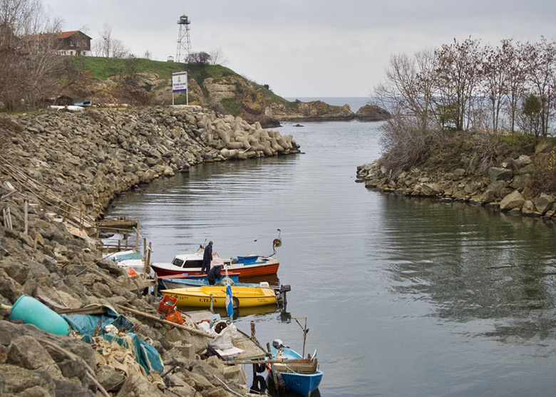
The_mouth_of_the_Rezovo_River:_Bulgarian_bank_to_the_left,_Turkish_bank_to_the_rightReferences
*
*
* оазис в края на България |publisher=Стандарт |date=2003-10-03 |last=Генов |first=Николай |accessdate=2008-09-01External links
* [http://www.evgenidinev.com/mt/mt-search.cgi?tag=%D1%81%D0%B5%D0%BB%D0%BE%20%D0%A0%D0%B5%D0%B7%D0%BE%D0%B2%D0%BE&blog_id=9 Evgeni Dinev's photo gallery of Rezovo]
* [http://gallery.slovar.org.uk/categories.php?cat_id=84 Slovar's photo gallery of Rezovo]
Wikimedia Foundation. 2010.